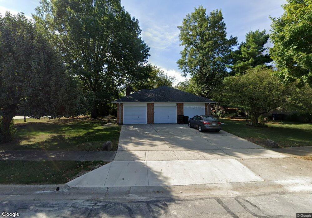
1265 Colston Dr Westerville, OH 43081
Estimated Value: $420,264 - $513,000
3
Beds
2
Baths
2,256
Sq Ft
$207/Sq Ft
Est. Value
About This Home
This home is located at 1265 Colston Dr, Westerville, OH 43081 and is currently estimated at $466,816, approximately $206 per square foot. 1265 Colston Dr is a home located in Franklin County with nearby schools including Mcvay Elementary School, Walnut Springs Middle School, and Westerville-North High School.
Ownership History
Date
Name
Owned For
Owner Type
Purchase Details
Closed on
Sep 7, 2023
Sold by
Mccandless George Douglas
Bought by
George Douglas Mccandless Living Trust and Mccandless
Current Estimated Value
Purchase Details
Closed on
Aug 23, 2023
Sold by
Mccandless George Douglas
Bought by
George Douglas Mccandless Living Trust and Mccandless
Purchase Details
Closed on
May 5, 1997
Sold by
Mccandless George D and Mcandless Linda D
Bought by
The City Of Westerville
Purchase Details
Closed on
Oct 22, 1990
Bought by
Mccandless George D
Purchase Details
Closed on
May 1, 1987
Create a Home Valuation Report for This Property
The Home Valuation Report is an in-depth analysis detailing your home's value as well as a comparison with similar homes in the area
Home Values in the Area
Average Home Value in this Area
Purchase History
| Date | Buyer | Sale Price | Title Company |
|---|---|---|---|
| George Douglas Mccandless Living Trust | -- | None Listed On Document | |
| George Douglas Mccandless Living Trust | -- | None Listed On Document | |
| The City Of Westerville | -- | -- | |
| Mccandless George D | $125,000 | -- | |
| -- | -- | -- |
Source: Public Records
Tax History Compared to Growth
Tax History
| Year | Tax Paid | Tax Assessment Tax Assessment Total Assessment is a certain percentage of the fair market value that is determined by local assessors to be the total taxable value of land and additions on the property. | Land | Improvement |
|---|---|---|---|---|
| 2024 | $6,067 | $116,560 | $23,630 | $92,930 |
| 2023 | $5,974 | $116,560 | $23,630 | $92,930 |
| 2022 | $4,590 | $71,750 | $24,150 | $47,600 |
| 2021 | $4,628 | $71,750 | $24,150 | $47,600 |
| 2020 | $4,615 | $71,750 | $24,150 | $47,600 |
| 2019 | $4,889 | $71,750 | $24,150 | $47,600 |
| 2018 | $5,126 | $90,410 | $28,390 | $62,020 |
| 2017 | $5,201 | $90,410 | $28,390 | $62,020 |
| 2016 | $4,170 | $58,490 | $17,150 | $41,340 |
| 2015 | $4,039 | $58,490 | $17,150 | $41,340 |
| 2014 | $4,042 | $58,490 | $17,150 | $41,340 |
| 2013 | $1,906 | $55,720 | $16,345 | $39,375 |
Source: Public Records
Map
Nearby Homes
- 806 Watten Ln
- 5769 Burntwood Way
- 6506 Purplefinch Ct
- 4432 Scissortail Loop
- 4765 Smoketalk Ln Unit 1
- 6352 Hibiscus Ct
- 4758 Crazy Horse Ln Unit 2
- 4755 Crazy Horse Ln Unit 6
- 4786 Crazy Horse Ln Unit 2
- 4816 Crazy Horse Ln Unit 4
- 6360 Thrasher Loop
- 737 Autumn Branch Rd
- 750 Autumn Branch Rd
- 4892 Clearfork Ln Unit 8
- 4981 Smoketalk Ln
- 4936 Wintersong Ln Unit 4
- 4775 Powderhorn Ln Unit 3
- 4781 Powderhorn Ln Unit bldg 5
- 4883 Powderhorn Ln Unit 3
- 4968 Wintersong Ln Unit 10
- 1257 Colston Dr
- 1249 Colston Dr
- 1268 Colston Dr
- 1260-1262 Colston Dr
- 1260 Colston Dr Unit 262
- 1241 Colston Dr
- 1244 Colston Dr
- 1252 Colston Dr Unit 254
- 1190 S Sunbury Rd
- 1179 S Sunbury Rd
- 1242 Colston Dr Unit 244
- 1210 S Sunbury Rd
- 1233 Colston Dr
- 1180 S Sunbury Rd
- 1234 Colston Dr Unit 236
- 1245 S Sunbury Rd Unit 2
- 1225 Colston Dr
- 1226 Colston Dr Unit 228
- 1226 Norway Ln
- 1213 Colston Dr