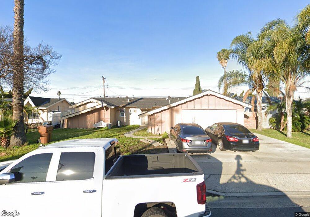
12653 West St Garden Grove, CA 92840
Estimated Value: $915,194 - $1,069,000
4
Beds
4
Baths
1,351
Sq Ft
$728/Sq Ft
Est. Value
About This Home
This home is located at 12653 West St, Garden Grove, CA 92840 and is currently estimated at $984,049, approximately $728 per square foot. 12653 West St is a home located in Orange County with nearby schools including Crosby Elementary School, Izaak Walton Intermediate School, and Garden Grove High School.
Ownership History
Date
Name
Owned For
Owner Type
Purchase Details
Closed on
Apr 2, 2019
Sold by
The Real Estate Brokers
Bought by
Bui Phat and Luong Mai
Current Estimated Value
Home Financials for this Owner
Home Financials are based on the most recent Mortgage that was taken out on this home.
Original Mortgage
$350,000
Interest Rate
4.1%
Mortgage Type
New Conventional
Create a Home Valuation Report for This Property
The Home Valuation Report is an in-depth analysis detailing your home's value as well as a comparison with similar homes in the area
Home Values in the Area
Average Home Value in this Area
Purchase History
| Date | Buyer | Sale Price | Title Company |
|---|---|---|---|
| Bui Phat | $525,000 | Fidelity Natl Ttl Orange Cnt |
Source: Public Records
Mortgage History
| Date | Status | Borrower | Loan Amount |
|---|---|---|---|
| Previous Owner | Bui Phat | $350,000 |
Source: Public Records
Tax History Compared to Growth
Tax History
| Year | Tax Paid | Tax Assessment Tax Assessment Total Assessment is a certain percentage of the fair market value that is determined by local assessors to be the total taxable value of land and additions on the property. | Land | Improvement |
|---|---|---|---|---|
| 2025 | $7,734 | $623,904 | $522,424 | $101,480 |
| 2024 | $7,734 | $611,671 | $512,180 | $99,491 |
| 2023 | $7,595 | $599,678 | $502,137 | $97,541 |
| 2022 | $7,428 | $587,920 | $492,291 | $95,629 |
| 2021 | $7,613 | $576,393 | $482,639 | $93,754 |
| 2020 | $6,818 | $535,500 | $477,690 | $57,810 |
| 2019 | $1,364 | $79,963 | $36,378 | $43,585 |
| 2018 | $1,404 | $78,396 | $35,665 | $42,731 |
| 2017 | $1,393 | $76,859 | $34,965 | $41,894 |
| 2016 | $1,268 | $75,352 | $34,279 | $41,073 |
| 2015 | $1,251 | $74,221 | $33,764 | $40,457 |
| 2014 | $1,224 | $72,768 | $33,103 | $39,665 |
Source: Public Records
Map
Nearby Homes
- 12727 West St
- 12861 West St Unit 157
- 12861 West St Unit 100
- 12222 Emrys Ave
- 12851 Newhope St
- 12970 Newhope St
- 13052 Rockinghorse Rd
- 11841 Shetland Rd
- 12246 Nadine Cir
- 13111 Rainbow St
- 12905 Palm St
- 12272 9th St
- 12842 Palm St Unit 108
- 12842 Palm St Unit 204
- 12842 Palm St Unit 301
- 12850 Palm St Unit 6
- 12691 Sweetbriar Dr
- 12621 Sweetbriar Dr
- 405 13181 Lampson
- 11731 Rose Dr
- 12667 West St
- 12637 West St
- 12658 Morgan Ln
- 12646 Morgan Ln
- 12679 West St
- 12672 Morgan Ln
- 12626 Morgan Ln
- 12606 Morgan Ln
- 12681 West St Unit 131
- 12001 College Ave
- 12632 West St
- 12686 Morgan Ln
- 12615 West St
- 12691 West St
- 12652 West St
- 12011 College Ave
- 12698 Morgan Ln
- 12655 Morgan Ln
- 12002 Emrys Ave
- 12662 West St