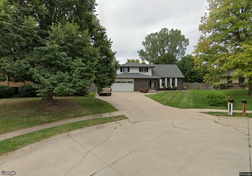
12655 Woodsdale Cir Omaha, NE 68137
Millard Highlands NeighborhoodEstimated Value: $327,000 - $393,000
4
Beds
3
Baths
1,990
Sq Ft
$178/Sq Ft
Est. Value
About This Home
This home is located at 12655 Woodsdale Cir, Omaha, NE 68137 and is currently estimated at $354,162, approximately $177 per square foot. 12655 Woodsdale Cir is a home located in Douglas County with nearby schools including Sandoz Elementary School, Millard South High School, and Millard Central Middle School.
Create a Home Valuation Report for This Property
The Home Valuation Report is an in-depth analysis detailing your home's value as well as a comparison with similar homes in the area
Home Values in the Area
Average Home Value in this Area
Tax History Compared to Growth
Tax History
| Year | Tax Paid | Tax Assessment Tax Assessment Total Assessment is a certain percentage of the fair market value that is determined by local assessors to be the total taxable value of land and additions on the property. | Land | Improvement |
|---|---|---|---|---|
| 2025 | $4,438 | $269,500 | $30,400 | $239,100 |
| 2024 | $5,365 | $269,500 | $30,400 | $239,100 |
| 2023 | $5,365 | $269,500 | $30,400 | $239,100 |
| 2022 | $4,859 | $229,900 | $30,400 | $199,500 |
| 2021 | $4,834 | $229,900 | $30,400 | $199,500 |
| 2020 | $4,272 | $201,500 | $30,400 | $171,100 |
| 2019 | $4,285 | $201,500 | $30,400 | $171,100 |
| 2018 | $3,913 | $181,500 | $30,400 | $151,100 |
| 2017 | $3,763 | $177,300 | $30,400 | $146,900 |
| 2016 | $3,516 | $165,500 | $24,800 | $140,700 |
| 2015 | $3,355 | $154,700 | $23,200 | $131,500 |
| 2014 | $3,355 | $154,700 | $23,200 | $131,500 |
Source: Public Records
Map
Nearby Homes
- 12805 Southdale Dr
- 12814 Sky Park Dr
- 6625 S 129th St
- 12826 Emiline St
- 12830 Emiline St
- 7009 S 129th St
- 21404 Morning View Dr
- 21446 Morning View Dr
- 21445 Morning View Dr
- 13116 Southdale Cir
- 12609 Lillian St
- 13117 Edna St
- 6048 Oak Hills Dr
- 13326 Adams St
- 6041 Oak Hills Dr Unit 3
- 6012 Oakcrest Plaza Unit 16
- 13205 Lillian St
- 13415 Josephine St
- 6729 S 135th Ave
- 13418 Olive St
- 12656 Woodsdale Cir
- 12720 Southdale Dr
- 12645 Woodsdale Cir
- 12640 Southdale Dr
- 12730 Southdale Dr
- 6645 Brookridge Dr
- 6635 Brookridge Dr
- 12630 Southdale Dr
- 12644 Woodsdale Cir
- 6625 Brookridge Dr
- 12635 Woodsdale Cir
- 6715 Brookridge Dr
- 12620 Southdale Dr
- 6615 Brookridge Dr
- 12725 Southdale Dr
- 12715 Southdale Dr
- 12624 Woodsdale Cir
- 12625 Woodsdale Cir
- 12715 Sky Park Dr
- 12635 Southdale Dr