Estimated Value: $1,851,000 - $2,222,000
4
Beds
4
Baths
3,991
Sq Ft
$493/Sq Ft
Est. Value
About This Home
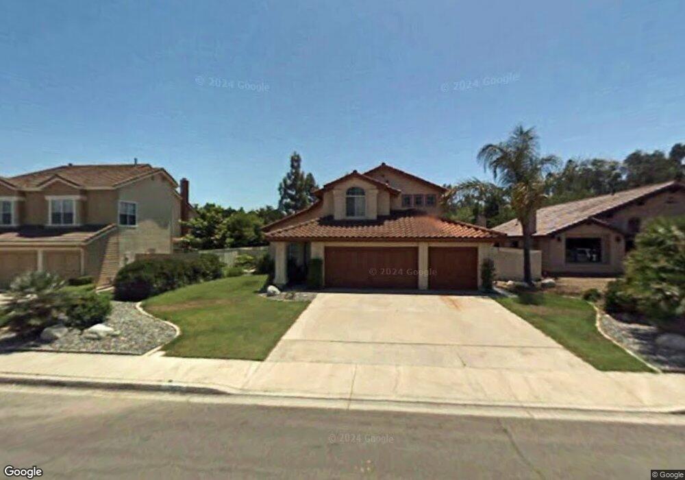
This home is located at 12657 Rockrose Ct, Poway, CA 92064 and is currently estimated at $1,968,145, approximately $493 per square foot. 12657 Rockrose Ct is a home located in San Diego County with nearby schools including Midland Elementary, Twin Peaks Middle, and Poway High.
Ownership History
Date
Name
Owned For
Owner Type
Purchase Details
Closed on
Aug 2, 1993
Sold by
Heckmann Scott M and Heckmann Beth A
Bought by
Ting Oswald A and Ting Jenny W
Current Estimated Value
Home Financials for this Owner
Home Financials are based on the most recent Mortgage that was taken out on this home.
Original Mortgage
$220,000
Interest Rate
7.16%
Purchase Details
Closed on
Feb 28, 1990
Create a Home Valuation Report for This Property
The Home Valuation Report is an in-depth analysis detailing your home's value as well as a comparison with similar homes in the area
Home Values in the Area
Average Home Value in this Area
Purchase History
| Date | Buyer | Sale Price | Title Company |
|---|---|---|---|
| Ting Oswald A | $330,000 | North American Title | |
| -- | $366,900 | -- |
Source: Public Records
Mortgage History
| Date | Status | Borrower | Loan Amount |
|---|---|---|---|
| Closed | Ting Oswald A | $220,000 |
Source: Public Records
Tax History
| Year | Tax Paid | Tax Assessment Tax Assessment Total Assessment is a certain percentage of the fair market value that is determined by local assessors to be the total taxable value of land and additions on the property. | Land | Improvement |
|---|---|---|---|---|
| 2025 | $7,673 | $685,544 | $169,955 | $515,589 |
| 2024 | $7,673 | $672,103 | $166,623 | $505,480 |
| 2023 | $7,512 | $658,925 | $163,356 | $495,569 |
| 2022 | $7,389 | $646,005 | $160,153 | $485,852 |
| 2021 | $7,293 | $633,339 | $157,013 | $476,326 |
| 2020 | $7,197 | $626,846 | $155,404 | $471,442 |
| 2019 | $7,013 | $614,556 | $152,357 | $462,199 |
| 2018 | $6,819 | $602,507 | $149,370 | $453,137 |
| 2017 | $172 | $590,694 | $146,442 | $444,252 |
| 2016 | $6,506 | $579,113 | $143,571 | $435,542 |
| 2015 | $6,411 | $570,415 | $141,415 | $429,000 |
| 2014 | $6,262 | $559,242 | $138,645 | $420,597 |
Source: Public Records
Map
Nearby Homes
- 13641 Carriage Rd
- 13622 Utopia Rd
- 12885 Rockwell Ct
- 14109 Arbolitos Dr
- 12939 Cree Ct
- 12851 Papago Dr
- 13824 Powers Rd
- 12739 Papago Dr
- 13650 Mulberry Tree Ct Unit 167
- 13442 Mountainside Dr
- 12614 Orohaven Ln
- 12875 Carriage Heights Way Unit 12875
- 14120 Kendra Way
- 12719 Robison Blvd Unit 18
- 13619 Sycamore Tree Ln
- 12311 Witt Rd
- 13056 Poway Rd
- 14240 Kendra Way
- 14334 Sandown Ct
- 1/2 Poway Rd
- 12653 Rockrose Ct
- 12661 Rockrose Ct
- 12656 Butterwood Ct
- 12665 Rockrose Ct
- 12649 Rockrose Ct
- 12660 Butterwood Ct
- 12664 Butterwood Ct
- 12662 Rockrose Ct
- 12658 Rockrose Ct
- 12666 Rockrose Ct
- 12652 Butterwood Ct
- 12654 Rockrose Ct
- 12645 Rockrose Ct
- 13998 Hickory St
- 12670 Rockrose Ct
- 13994 Hickory St
- 13990 Hickory St
- 14002 Hickory St
- 12642 Rockrose Ct
- 12648 Butterwood Ct
Your Personal Tour Guide
Ask me questions while you tour the home.