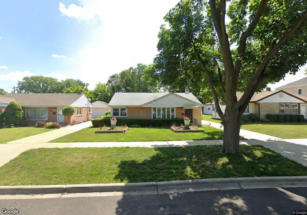
1267 Earl Ave Des Plaines, IL 60018
Estimated Value: $314,000 - $370,000
3
Beds
1
Bath
995
Sq Ft
$337/Sq Ft
Est. Value
About This Home
This home is located at 1267 Earl Ave, Des Plaines, IL 60018 and is currently estimated at $335,768, approximately $337 per square foot. 1267 Earl Ave is a home located in Cook County with nearby schools including Forest Elementary School, Algonquin Middle School, and Maine West High School.
Create a Home Valuation Report for This Property
The Home Valuation Report is an in-depth analysis detailing your home's value as well as a comparison with similar homes in the area
Home Values in the Area
Average Home Value in this Area
Tax History Compared to Growth
Tax History
| Year | Tax Paid | Tax Assessment Tax Assessment Total Assessment is a certain percentage of the fair market value that is determined by local assessors to be the total taxable value of land and additions on the property. | Land | Improvement |
|---|---|---|---|---|
| 2024 | $4,795 | $24,156 | $5,363 | $18,793 |
| 2023 | $4,631 | $24,156 | $5,363 | $18,793 |
| 2022 | $4,631 | $24,156 | $5,363 | $18,793 |
| 2021 | $5,164 | $20,129 | $4,468 | $15,661 |
| 2020 | $5,145 | $20,129 | $4,468 | $15,661 |
| 2019 | $5,164 | $22,617 | $4,468 | $18,149 |
| 2018 | $4,612 | $18,857 | $3,932 | $14,925 |
| 2017 | $4,548 | $18,857 | $3,932 | $14,925 |
| 2016 | $4,546 | $18,857 | $3,932 | $14,925 |
| 2015 | $4,846 | $18,654 | $3,396 | $15,258 |
| 2014 | $4,760 | $18,654 | $3,396 | $15,258 |
| 2013 | $4,624 | $18,654 | $3,396 | $15,258 |
Source: Public Records
Map
Nearby Homes
- 1394 Carol Ln
- 1157 W Grant Dr
- 1056 E Villa Dr
- 1205 S Wolf Rd
- 991 Wicke Ave
- 773 E Lincoln Ave
- 1050 E Oakton St
- 807 Fairmont Ct
- 911 E Villa Dr
- 858 E Grant Dr
- 505 Forest Ave
- 881 E Thacker St
- 886 E Thacker St
- 906 Alfini Dr
- 714 E Thacker St
- 915 Graceland Ave Unit 1E
- 1596 Oxford Rd
- 520 E Thacker St
- 1380 Oakwood Ave Unit 306
- 1365 Ashland Ave Unit 302