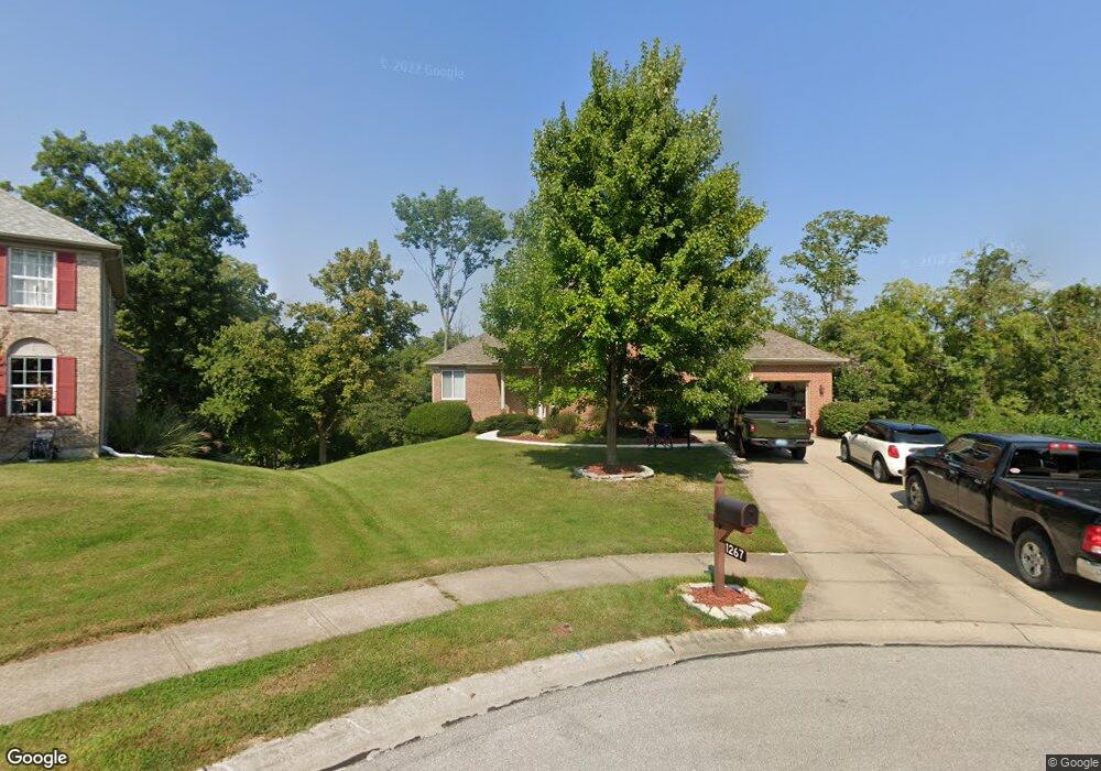
1267 Kentland Ct Hebron, KY 41048
Estimated Value: $469,648 - $560,000
4
Beds
4
Baths
2,827
Sq Ft
$176/Sq Ft
Est. Value
About This Home
This home is located at 1267 Kentland Ct, Hebron, KY 41048 and is currently estimated at $497,912, approximately $176 per square foot. 1267 Kentland Ct is a home located in Boone County with nearby schools including Thornwilde Elementary School, Conner Middle School, and Conner High School.
Ownership History
Date
Name
Owned For
Owner Type
Purchase Details
Closed on
Jun 20, 2005
Sold by
Green Paul F and Green Angie T
Bought by
Osborne Charles D and Osborne Donna M
Current Estimated Value
Home Financials for this Owner
Home Financials are based on the most recent Mortgage that was taken out on this home.
Original Mortgage
$100,000
Outstanding Balance
$74,927
Interest Rate
5.66%
Mortgage Type
Credit Line Revolving
Estimated Equity
$422,985
Purchase Details
Closed on
Sep 18, 1996
Sold by
Bold Homes Inc
Bought by
Green Paul F and Green Angie T
Home Financials for this Owner
Home Financials are based on the most recent Mortgage that was taken out on this home.
Original Mortgage
$156,465
Interest Rate
7.63%
Mortgage Type
New Conventional
Purchase Details
Closed on
Apr 25, 1996
Sold by
Drees Co
Bought by
Bold Homes Inc
Create a Home Valuation Report for This Property
The Home Valuation Report is an in-depth analysis detailing your home's value as well as a comparison with similar homes in the area
Home Values in the Area
Average Home Value in this Area
Purchase History
| Date | Buyer | Sale Price | Title Company |
|---|---|---|---|
| Osborne Charles D | $325,000 | Kentucky Land Title Agency | |
| Green Paul F | $195,587 | -- | |
| Bold Homes Inc | $33,500 | -- |
Source: Public Records
Mortgage History
| Date | Status | Borrower | Loan Amount |
|---|---|---|---|
| Open | Osborne Charles D | $100,000 | |
| Previous Owner | Green Paul F | $156,465 |
Source: Public Records
Tax History Compared to Growth
Tax History
| Year | Tax Paid | Tax Assessment Tax Assessment Total Assessment is a certain percentage of the fair market value that is determined by local assessors to be the total taxable value of land and additions on the property. | Land | Improvement |
|---|---|---|---|---|
| 2024 | $3,753 | $354,200 | $50,000 | $304,200 |
| 2023 | $3,546 | $325,000 | $40,000 | $285,000 |
| 2022 | $3,486 | $325,000 | $40,000 | $285,000 |
| 2021 | $3,556 | $325,000 | $40,000 | $285,000 |
| 2020 | $3,545 | $325,000 | $40,000 | $285,000 |
| 2019 | $3,573 | $325,000 | $40,000 | $285,000 |
| 2018 | $3,592 | $325,000 | $40,000 | $285,000 |
| 2017 | $3,543 | $325,000 | $40,000 | $285,000 |
| 2015 | $3,517 | $325,000 | $40,000 | $285,000 |
| 2013 | -- | $325,000 | $40,000 | $285,000 |
Source: Public Records
Map
Nearby Homes
- 1975 Wedgewood Ln
- 1033 Bloomfield Ct
- 2013 Wyndemere Ct
- 1012 Meadowbrook Ct
- 2050 Treetop Ln
- 1079 Glenhurst Ct
- 2453 Rivers Pointe Dr
- 2449 Rivers Pointe Dr
- 2020 Windsong Way
- 1560 Brenden Ct
- 1 Rivers Pointe Dr
- 1748 Ledgestone Way
- 2429 Rivers Pointe Dr
- 1529 Brenden Ct
- Crestwood Plan at Rivers Pointe Estates
- Sebastian Plan at Rivers Pointe Estates
- Aldridge Plan at Rivers Pointe Estates
- Bennett Plan at Rivers Pointe Estates
- Ash Lawn Plan at Rivers Pointe Estates
- Brennan Plan at Rivers Pointe Estates
- 1261 Kentland Ct
- 1266 Kentland Ct
- 1266 Kentl Court
- 1255 Kentland Ct
- 1260 Kentland Ct
- 1254 Kentland Ct
- 1249 Kentland Ct
- 1248 Kentland Ct
- 1243 Kentland Ct
- 1249 Strathmore Ct
- 1255 Strathmore Ct
- 1243 Strathmore Ct
- 1236 Kentland Ct
- 1237 Kentland Ct
- 1237 Strathmore Ct
- 1230 Kentland Ct
- 1231 Kentland Ct
- 2021 Wedgewood Ln
- 1267 Strathmore Ct
- 1242 Strathmore Ct