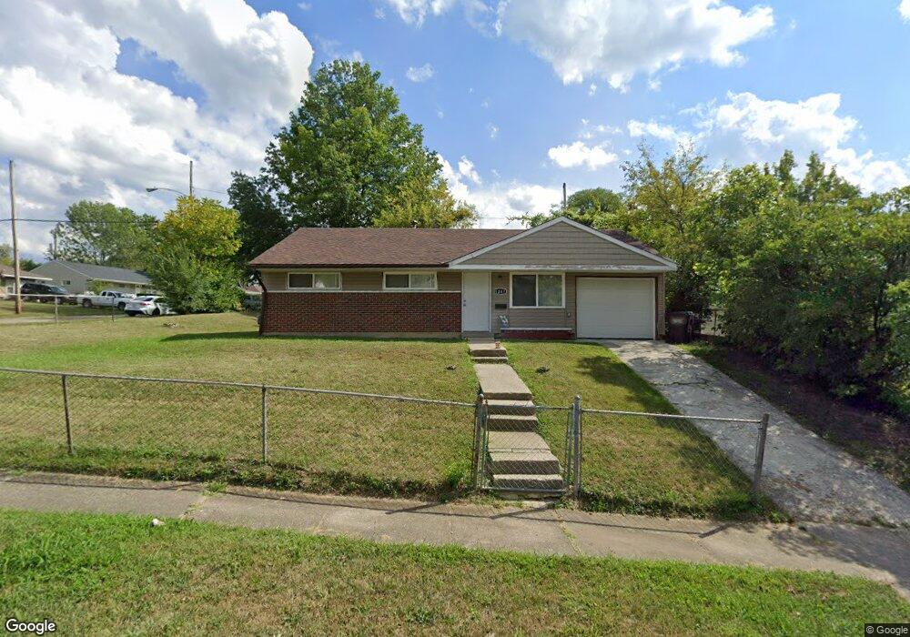
1267 Madeleine Cir Cincinnati, OH 45231
Finneytown NeighborhoodEstimated Value: $127,000 - $164,000
3
Beds
1
Bath
918
Sq Ft
$162/Sq Ft
Est. Value
About This Home
This home is located at 1267 Madeleine Cir, Cincinnati, OH 45231 and is currently estimated at $148,317, approximately $161 per square foot. 1267 Madeleine Cir is a home located in Hamilton County with nearby schools including Mt Healthy High School and John Paul II Catholic School.
Ownership History
Date
Name
Owned For
Owner Type
Purchase Details
Closed on
Feb 12, 2019
Sold by
Reynolds Brian
Bought by
Rrt Development 7 Llc
Current Estimated Value
Purchase Details
Closed on
Jul 18, 2018
Sold by
Fyall Eddie and Fyall Frances
Bought by
Raynolds Brian
Create a Home Valuation Report for This Property
The Home Valuation Report is an in-depth analysis detailing your home's value as well as a comparison with similar homes in the area
Home Values in the Area
Average Home Value in this Area
Purchase History
| Date | Buyer | Sale Price | Title Company |
|---|---|---|---|
| Rrt Development 7 Llc | $10,200 | None Available | |
| Raynolds Brian | $5,000 | None Available |
Source: Public Records
Tax History
| Year | Tax Paid | Tax Assessment Tax Assessment Total Assessment is a certain percentage of the fair market value that is determined by local assessors to be the total taxable value of land and additions on the property. | Land | Improvement |
|---|---|---|---|---|
| 2025 | $1,774 | $29,516 | $4,823 | $24,693 |
| 2024 | $1,809 | $29,516 | $4,823 | $24,693 |
| 2023 | $1,689 | $29,516 | $4,823 | $24,693 |
| 2022 | $1,085 | $13,612 | $4,774 | $8,838 |
| 2021 | $1,080 | $13,612 | $4,774 | $8,838 |
| 2020 | $1,066 | $13,612 | $4,774 | $8,838 |
| 2019 | $1,063 | $12,604 | $4,421 | $8,183 |
| 2018 | $1,068 | $12,604 | $4,421 | $8,183 |
| 2017 | $1,030 | $12,604 | $4,421 | $8,183 |
| 2016 | $1,394 | $16,668 | $4,771 | $11,897 |
| 2015 | $1,382 | $16,668 | $4,771 | $11,897 |
| 2014 | $1,374 | $16,668 | $4,771 | $11,897 |
| 2013 | $1,414 | $17,546 | $5,023 | $12,523 |
Source: Public Records
Map
Nearby Homes
- 1285 Landis Ln
- 1125 Murkett Ct
- 8609 Balboa Dr
- 1116 Madeleine Cir
- 1101 Meadowind Ct
- 1144 Hempstead Dr
- 7227 Bernard Ave
- 8693 Mockingbird Ln
- 1123 Compton Rd
- 8663 Mockingbird Ln
- 1115 Compton Rd
- 1461 Kinney Ave
- 8829 Mockingbird Ln
- 1052 Vacationland Dr
- 8491 Daly Rd
- 1202 Ashmore Ct
- 1481 Saint Clair Ave
- 7508 Elizabeth St
- 1476 Foxwood Dr
- 1500 Madison Ave
- 1275 Madeleine Cir
- 8843 Grenada Dr
- 1283 Madeleine Cir
- 8835 Grenada Dr
- 1259 Madeleine Cir
- 8848 Grenada Dr
- 1287 Madeleine Cir
- 1268 Madeleine Cir
- 8827 Grenada Dr
- 1272 Madeleine Cir
- 1264 Madeleine Cir
- 1276 Madeleine Cir
- 8832 Grenada Dr
- 1260 Madeleine Cir
- 1280 Madeleine Cir
- 1291 Madeleine Cir
- 1256 Madeleine Cir
- 8819 Grenada Dr
- 1253 Madeleine Cir
- 1284 Madeleine Cir
Your Personal Tour Guide
Ask me questions while you tour the home.