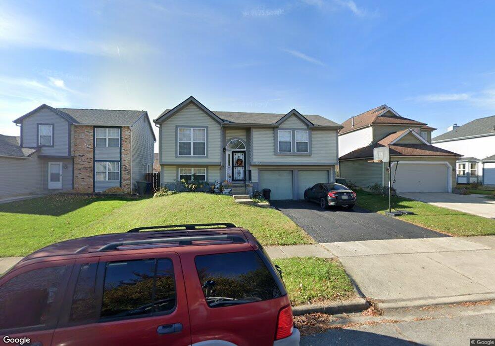
1267 Pinnacle Dr Columbus, OH 43204
Brookshire NeighborhoodEstimated Value: $240,000 - $270,000
3
Beds
2
Baths
1,476
Sq Ft
$171/Sq Ft
Est. Value
About This Home
This home is located at 1267 Pinnacle Dr, Columbus, OH 43204 and is currently estimated at $251,762, approximately $170 per square foot. 1267 Pinnacle Dr is a home located in Franklin County with nearby schools including West Franklin Elementary School, Franklin Woods Intermediate School, and Finland Middle School.
Ownership History
Date
Name
Owned For
Owner Type
Purchase Details
Closed on
Mar 3, 2003
Sold by
Spoto Mark E
Bought by
Lemus Walter R and Lemus Deysi M
Current Estimated Value
Home Financials for this Owner
Home Financials are based on the most recent Mortgage that was taken out on this home.
Original Mortgage
$101,000
Outstanding Balance
$42,242
Interest Rate
6%
Mortgage Type
Purchase Money Mortgage
Estimated Equity
$209,520
Purchase Details
Closed on
May 25, 2001
Sold by
Yeisley Thomas A and Yeisley Marsha K
Bought by
Spoto Mark E
Home Financials for this Owner
Home Financials are based on the most recent Mortgage that was taken out on this home.
Original Mortgage
$108,300
Interest Rate
7.18%
Mortgage Type
Purchase Money Mortgage
Purchase Details
Closed on
Dec 1, 1992
Bought by
Yeisley Thomas A
Create a Home Valuation Report for This Property
The Home Valuation Report is an in-depth analysis detailing your home's value as well as a comparison with similar homes in the area
Home Values in the Area
Average Home Value in this Area
Purchase History
| Date | Buyer | Sale Price | Title Company |
|---|---|---|---|
| Lemus Walter R | $111,000 | -- | |
| Spoto Mark E | $110,000 | Lawyers Title | |
| Yeisley Thomas A | $75,100 | -- |
Source: Public Records
Mortgage History
| Date | Status | Borrower | Loan Amount |
|---|---|---|---|
| Open | Lemus Walter R | $101,000 | |
| Previous Owner | Spoto Mark E | $108,300 |
Source: Public Records
Tax History
| Year | Tax Paid | Tax Assessment Tax Assessment Total Assessment is a certain percentage of the fair market value that is determined by local assessors to be the total taxable value of land and additions on the property. | Land | Improvement |
|---|---|---|---|---|
| 2025 | $2,612 | $71,650 | $21,110 | $50,540 |
| 2024 | $2,612 | $71,650 | $21,110 | $50,540 |
| 2023 | $2,566 | $71,645 | $21,105 | $50,540 |
| 2022 | $2,270 | $46,520 | $7,980 | $38,540 |
| 2021 | $2,316 | $46,520 | $7,980 | $38,540 |
| 2020 | $2,303 | $46,520 | $7,980 | $38,540 |
| 2019 | $2,178 | $38,820 | $6,650 | $32,170 |
| 2018 | $2,133 | $38,820 | $6,650 | $32,170 |
| 2017 | $2,128 | $38,820 | $6,650 | $32,170 |
| 2016 | $2,099 | $34,690 | $6,340 | $28,350 |
| 2015 | $2,099 | $34,690 | $6,340 | $28,350 |
| 2014 | $2,101 | $34,690 | $6,340 | $28,350 |
| 2013 | $1,157 | $38,535 | $7,035 | $31,500 |
Source: Public Records
Map
Nearby Homes
- 3438 High Creek Dr
- 3664-3670 Mccarley Dr S
- 3318 Miriam Dr S
- 3551 Glorious Rd
- 1341 S Hague Ave
- 1605 Greenville Rd
- 840 Mark Place
- 1657 Ripplebrook Rd
- 814 Miriam Dr W
- 1641 Greenville Rd
- 1490 Demorest Rd
- 1380 Sunflower Dr
- 3826 Clime Rd
- 3029 Rosedale Ave
- 2929 Briggs Rd
- 2937 Rundell Dr
- 781 Stephen Dr W
- 894 Binns Blvd
- 3721 Briggs Rd Unit 723
- 1168 Racine Ave
- 1261 Pinnacle Dr
- 1273 Pinnacle Dr
- 1279 Pinnacle Dr
- 1255 Pinnacle Dr
- 1262 Treehaven Ln
- 1254 Treehaven Ln
- 1268 Treehaven Ln
- 1249 Pinnacle Dr
- 1285 Pinnacle Dr
- 1274 Treehaven Ln
- 1264 Pinnacle Dr
- 1270 Pinnacle Dr
- 1256 Pinnacle Dr
- 1242 Treehaven Ln
- 3478 Treehaven Ln
- 1276 Pinnacle Dr
- 1280 Treehaven Ln
- 1250 Pinnacle Dr
- 1243 Pinnacle Dr
- 1291 Pinnacle Dr
Your Personal Tour Guide
Ask me questions while you tour the home.