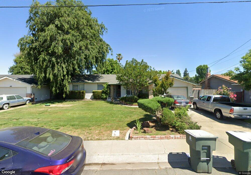
1267 Starlite Ln Yuba City, CA 95991
Estimated Value: $366,000 - $440,277
3
Beds
2
Baths
1,774
Sq Ft
$234/Sq Ft
Est. Value
About This Home
This home is located at 1267 Starlite Ln, Yuba City, CA 95991 and is currently estimated at $414,319, approximately $233 per square foot. 1267 Starlite Ln is a home located in Sutter County with nearby schools including Lincrest Elementary School, Yuba City High School, and St. Isidore Catholic School.
Ownership History
Date
Name
Owned For
Owner Type
Purchase Details
Closed on
Jan 25, 2024
Sold by
Lebeau Michele
Bought by
Michele Lebeau Revocable Trust and Lebeau
Current Estimated Value
Purchase Details
Closed on
Sep 22, 2020
Sold by
Schrot Robert G
Bought by
Schrot Robert G and Lebeau Michele
Create a Home Valuation Report for This Property
The Home Valuation Report is an in-depth analysis detailing your home's value as well as a comparison with similar homes in the area
Home Values in the Area
Average Home Value in this Area
Purchase History
| Date | Buyer | Sale Price | Title Company |
|---|---|---|---|
| Michele Lebeau Revocable Trust | -- | None Listed On Document | |
| Schrot Robert G | -- | None Listed On Document |
Source: Public Records
Tax History Compared to Growth
Tax History
| Year | Tax Paid | Tax Assessment Tax Assessment Total Assessment is a certain percentage of the fair market value that is determined by local assessors to be the total taxable value of land and additions on the property. | Land | Improvement |
|---|---|---|---|---|
| 2025 | $5,063 | $457,776 | $98,838 | $358,938 |
| 2024 | $5,063 | $448,800 | $96,900 | $351,900 |
| 2023 | $5,063 | $100,885 | $15,275 | $85,610 |
| 2022 | $1,114 | $98,908 | $14,976 | $83,932 |
| 2021 | $1,102 | $97,041 | $14,724 | $82,317 |
| 2020 | $1,082 | $96,045 | $14,573 | $81,472 |
| 2019 | $1,059 | $94,162 | $14,287 | $79,875 |
| 2018 | $1,042 | $92,315 | $14,007 | $78,308 |
| 2017 | $1,016 | $90,506 | $13,732 | $76,774 |
| 2016 | $995 | $88,731 | $13,463 | $75,268 |
| 2015 | $978 | $87,399 | $13,261 | $74,138 |
| 2014 | $967 | $85,686 | $13,001 | $72,685 |
Source: Public Records
Map
Nearby Homes
- 1358 Starlite Ln
- 1200 Starlite Ln
- 1380 Starlite Ln
- 1031 Celestial Way
- 0 Victoria Ct
- 1325 Delone Dr
- 1159 Mayette Ct
- 925 Starlite Ln
- 1255 Lincoln Rd Unit 29
- 988 Carolina Ave
- 3013 Railroad Ave
- 1563 Del Lago
- 1224 Highland Ave
- 1744 Franquette Dr
- 750 Lincoln Rd Unit 82
- 1181 Robert Dr
- 2193 Gerald Ct
- 862 Murray Ct
- 1474 Smith Rd
- 564 Queensbury Way
- 1289 Starlite Ln
- 1208 Randolph Dr
- 1204 Randolph Dr
- 1212 Randolph Dr
- 1272 Starlite Ln
- 1223 Starlite Ln
- 1303 Starlite Ln
- 1244 Starlite Ln
- 1216 Randolph Dr
- 1200 Randolph Dr
- 1315 Starlite Ln
- 1222 Starlite Ln
- 1201 Starlite Ln
- 1337 Starlite Ln
- 1207 Randolph Dr
- 1211 Randolph Dr
- 1220 Randolph Dr
- 1196 Randolph Dr
- 1171 Galaxy Dr