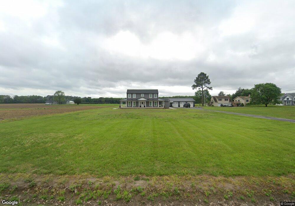
1267 Tuxward Rd Hartly, DE 19953
Estimated Value: $332,000 - $482,000
3
Beds
2
Baths
1,960
Sq Ft
$196/Sq Ft
Est. Value
About This Home
This home is located at 1267 Tuxward Rd, Hartly, DE 19953 and is currently estimated at $384,469, approximately $196 per square foot. 1267 Tuxward Rd is a home located in Kent County with nearby schools including Hartly Elementary School, William Henry Middle School, and Central Middle School.
Ownership History
Date
Name
Owned For
Owner Type
Purchase Details
Closed on
Jun 15, 2022
Sold by
Twilley Paul J
Bought by
Lloyd Christopher R and Dean Bailey L
Current Estimated Value
Home Financials for this Owner
Home Financials are based on the most recent Mortgage that was taken out on this home.
Original Mortgage
$280,000
Outstanding Balance
$265,999
Interest Rate
5.09%
Mortgage Type
New Conventional
Estimated Equity
$118,470
Create a Home Valuation Report for This Property
The Home Valuation Report is an in-depth analysis detailing your home's value as well as a comparison with similar homes in the area
Home Values in the Area
Average Home Value in this Area
Purchase History
| Date | Buyer | Sale Price | Title Company |
|---|---|---|---|
| Lloyd Christopher R | $175,000 | Benson Bonnie M | |
| Lloyd Christopher R | $175,000 | Benson Bonnie M |
Source: Public Records
Mortgage History
| Date | Status | Borrower | Loan Amount |
|---|---|---|---|
| Open | Lloyd Christopher R | $280,000 | |
| Closed | Lloyd Christopher R | $280,000 |
Source: Public Records
Tax History Compared to Growth
Tax History
| Year | Tax Paid | Tax Assessment Tax Assessment Total Assessment is a certain percentage of the fair market value that is determined by local assessors to be the total taxable value of land and additions on the property. | Land | Improvement |
|---|---|---|---|---|
| 2025 | $2,166 | $377,400 | $81,400 | $296,000 |
| 2024 | $2,166 | $377,400 | $81,400 | $296,000 |
| 2023 | $1,494 | $50,100 | $8,800 | $41,300 |
| 2022 | $1,440 | $50,100 | $8,800 | $41,300 |
| 2021 | $992 | $50,100 | $8,800 | $41,300 |
| 2020 | $945 | $50,100 | $8,800 | $41,300 |
| 2019 | $873 | $50,100 | $8,800 | $41,300 |
| 2018 | $764 | $50,100 | $8,800 | $41,300 |
| 2017 | $744 | $50,100 | $0 | $0 |
| 2016 | $696 | $50,100 | $0 | $0 |
| 2015 | $1,148 | $50,100 | $0 | $0 |
| 2014 | $1,151 | $50,100 | $0 | $0 |
Source: Public Records
Map
Nearby Homes
- 105 Downes Dr
- 486 Road 183
- Lot 20 Tower
- TBD Halltown Rd Unit 3
- 392 Judith Rd
- 436 Halltown Rd
- 5120 Halltown Rd
- 310 Main St
- 4640 Mahan Corner Rd
- 5380 Halltown Rd
- 855 Brittney Ln
- 844 Big Ditch Rd
- 0 Crystal Rd
- 27279 Jenny Hye Ln
- 233 Hartly Rd
- 461 Hartly Rd
- 37 Rehak Dr
- 233 Main St
- 1051 Hartly Rd
- 0 Main St
- 1285 Tuxward Rd
- 1318 Tuxward Rd
- 1181 Tuxward Rd
- 1325 Tuxward Rd
- 0 Bryants Corner Rd
- 0 Bryants Corner Rd Unit 1003963261
- 1 Bryants Corner Rd
- 1389 Tuxward Rd
- 142 Bryants Corner Rd
- 92 Bryants Corner Rd
- 19 Bryants Corner Rd
- 107 Bryants Corner Rd
- 67 Bryants Corner Rd
- 164 Bryants Corner Rd
- 139 Bryants Corner Rd
- 204 Bryants Corner Rd
- 181 Bryants Corner Rd
- 1563 Tuxward Rd
- 240 Bryants Corner Rd
- 109 Holly Island Rd