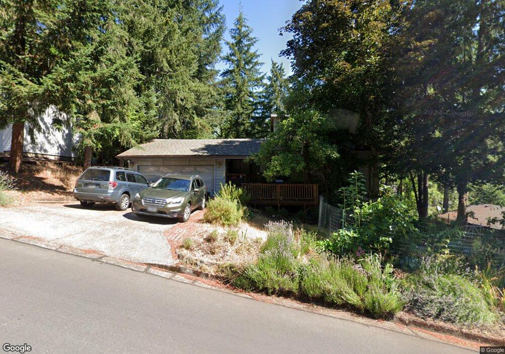
1268 Brookside Dr Eugene, OR 97405
Crest Drive NeighborhoodEstimated Value: $545,000 - $580,000
3
Beds
2
Baths
1,181
Sq Ft
$472/Sq Ft
Est. Value
About This Home
This home is located at 1268 Brookside Dr, Eugene, OR 97405 and is currently estimated at $557,172, approximately $471 per square foot. 1268 Brookside Dr is a home located in Lane County with nearby schools including Edgewood Community Elementary School, Spencer Butte Middle School, and South Eugene High School.
Ownership History
Date
Name
Owned For
Owner Type
Purchase Details
Closed on
Apr 12, 2023
Sold by
Johnson Mark
Bought by
Johnson Mark and Johnson Alison
Current Estimated Value
Home Financials for this Owner
Home Financials are based on the most recent Mortgage that was taken out on this home.
Original Mortgage
$260,000
Outstanding Balance
$252,302
Interest Rate
6.65%
Mortgage Type
New Conventional
Estimated Equity
$304,870
Purchase Details
Closed on
Apr 26, 2016
Sold by
Montez Peter
Bought by
Johnson Mark and Johnson Alison
Home Financials for this Owner
Home Financials are based on the most recent Mortgage that was taken out on this home.
Original Mortgage
$225,000
Interest Rate
3.73%
Mortgage Type
Seller Take Back
Purchase Details
Closed on
Mar 14, 2006
Sold by
Noble David R and Noble Monica M
Bought by
Montez Peter
Home Financials for this Owner
Home Financials are based on the most recent Mortgage that was taken out on this home.
Original Mortgage
$119,518
Interest Rate
6.19%
Mortgage Type
Seller Take Back
Create a Home Valuation Report for This Property
The Home Valuation Report is an in-depth analysis detailing your home's value as well as a comparison with similar homes in the area
Home Values in the Area
Average Home Value in this Area
Purchase History
| Date | Buyer | Sale Price | Title Company |
|---|---|---|---|
| Johnson Mark | -- | Western Title | |
| Johnson Mark | $240,000 | Multiple | |
| Montez Peter | $119,518 | Fidelity National Title Insu |
Source: Public Records
Mortgage History
| Date | Status | Borrower | Loan Amount |
|---|---|---|---|
| Open | Johnson Mark | $260,000 | |
| Previous Owner | Johnson Mark | $225,000 | |
| Previous Owner | Montez Peter | $119,518 |
Source: Public Records
Tax History
| Year | Tax Paid | Tax Assessment Tax Assessment Total Assessment is a certain percentage of the fair market value that is determined by local assessors to be the total taxable value of land and additions on the property. | Land | Improvement |
|---|---|---|---|---|
| 2025 | $5,865 | $301,039 | -- | -- |
| 2024 | $5,792 | $292,271 | -- | -- |
| 2023 | $5,792 | $283,759 | $0 | $0 |
| 2022 | $5,426 | $275,495 | $0 | $0 |
| 2021 | $5,097 | $267,471 | $0 | $0 |
| 2020 | $5,115 | $259,681 | $0 | $0 |
| 2019 | $4,940 | $252,118 | $0 | $0 |
| 2018 | $4,650 | $237,646 | $0 | $0 |
| 2017 | $4,442 | $237,646 | $0 | $0 |
| 2016 | $4,255 | $230,724 | $0 | $0 |
| 2015 | $4,129 | $224,004 | $0 | $0 |
| 2014 | $4,079 | $217,480 | $0 | $0 |
Source: Public Records
Map
Nearby Homes
- 0 Pine View Ct Unit 758820410
- 806 Sundance St
- 3854 Monroe St
- 278 Rockridge Ct
- 320 Dellwood Dr
- 21 Westbrook Way
- 17 Westbrook Way
- 4040 Southpointe Dr
- 653 Brookside Dr
- 36 Westbrook Way
- 453 Dellwood Dr
- 357 W 37th Ave
- 3593 Lawrence St
- 422 Stonewood Dr Unit 422
- 152 Treehill Loop Unit 152
- 151 Treehill Loop Unit 151
- 418 Stonewood Dr Unit 418
- 126 Treehill Loop Unit 126
- 143 Treehill Loop Unit 143
- 170 E 40th Ave
- 4210 Brae Burn Dr
- 1226 Brookside Dr
- 1251 Brookside Dr
- 1283 Brookside Dr
- 1212 Brookside Dr
- 4190 Brae Burn Dr
- 4186 Normandy Way
- 1205 Brookside Dr
- 4170 Normandy Way
- 4310 Inwood Ln
- 4320 Inwood Ln
- 1192 Brookside Dr
- 4207 Brae Burn Dr
- 4235 Brae Burn Dr
- 4340 Inwood Ln
- 4273 Brae Burn Dr
- 4158 Normandy Way
- 4183 Brae Burn Dr
- 4197 Normandy Way
- 1188 Brookside Dr
Your Personal Tour Guide
Ask me questions while you tour the home.