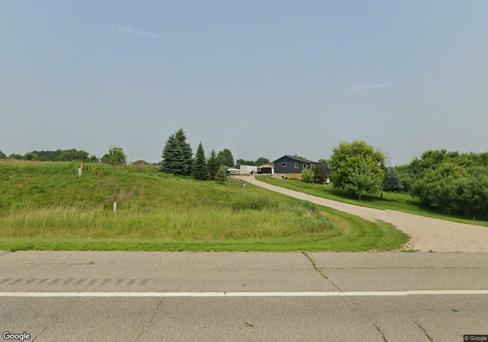
12682 U S 12 Atwater, MN 56209
Estimated Value: $155,000 - $318,000
2
Beds
2
Baths
1,404
Sq Ft
$174/Sq Ft
Est. Value
About This Home
This home is located at 12682 U S 12, Atwater, MN 56209 and is currently estimated at $243,945, approximately $173 per square foot. 12682 U S 12 is a home located in Kandiyohi County with nearby schools including ACGC Elementary School, ACGC Elementary Grades 5 & 6, and A.C.G.C. Secondary.
Ownership History
Date
Name
Owned For
Owner Type
Purchase Details
Closed on
Aug 5, 2016
Sold by
Barber Corey M and Barber Michael D
Bought by
Barber Corey M
Current Estimated Value
Purchase Details
Closed on
Nov 11, 2015
Sold by
Barber Michael D and Barber Collen M
Bought by
Barber Corey M and Barber Michael D
Purchase Details
Closed on
Mar 4, 2014
Sold by
Minnesota Housing Finance Agy
Bought by
Barber Michael D and Barber Colleen M
Purchase Details
Closed on
Feb 1, 2008
Sold by
Us Bank National Association Nd
Bought by
Manselle Gregory P and Leyendecker Rebecca S
Home Financials for this Owner
Home Financials are based on the most recent Mortgage that was taken out on this home.
Original Mortgage
$85,680
Interest Rate
6.2%
Mortgage Type
New Conventional
Purchase Details
Closed on
Mar 20, 2007
Sold by
Lukason John P
Bought by
Us Bank National Association Nd
Create a Home Valuation Report for This Property
The Home Valuation Report is an in-depth analysis detailing your home's value as well as a comparison with similar homes in the area
Home Values in the Area
Average Home Value in this Area
Purchase History
| Date | Buyer | Sale Price | Title Company |
|---|---|---|---|
| Barber Corey M | -- | Quality Title | |
| Barber Corey M | -- | Quality Title | |
| Barber Michael D | $50,500 | -- | |
| Manselle Gregory P | $83,000 | None Available | |
| Us Bank National Association Nd | -- | None Available |
Source: Public Records
Mortgage History
| Date | Status | Borrower | Loan Amount |
|---|---|---|---|
| Previous Owner | Manselle Gregory P | $85,680 |
Source: Public Records
Tax History Compared to Growth
Tax History
| Year | Tax Paid | Tax Assessment Tax Assessment Total Assessment is a certain percentage of the fair market value that is determined by local assessors to be the total taxable value of land and additions on the property. | Land | Improvement |
|---|---|---|---|---|
| 2025 | $1,466 | $190,600 | $77,300 | $113,300 |
| 2024 | $1,442 | $180,400 | $67,100 | $113,300 |
| 2023 | $1,464 | $173,900 | $59,200 | $114,700 |
| 2022 | $1,248 | $161,200 | $55,200 | $106,000 |
| 2021 | $720 | $127,700 | $49,000 | $78,700 |
| 2020 | $680 | $83,600 | $48,700 | $34,900 |
| 2019 | $672 | $80,400 | $46,700 | $33,700 |
| 2018 | $630 | $79,500 | $46,700 | $32,800 |
| 2017 | $624 | $80,200 | $46,700 | $33,500 |
| 2016 | $642 | $519 | $0 | $0 |
| 2015 | -- | $0 | $0 | $0 |
| 2014 | -- | $0 | $0 | $0 |
Source: Public Records
Map
Nearby Homes
- 12505 15th Ave SE
- 14974 49th Ave NE
- #### 15th Ave SE
- 4645 Diamond Ln
- 4635 Diamond Ln
- 112 3rd St N
- 328 6th St
- 244 6th St N
- 232 7th St N
- 205 N 7th St
- 5762 165th St NE
- 906 Mcdermott Ave
- 5980 165th St NE
- 14685 Breezy Point Rd
- 503 7th St N
- 7883 15th Ave SE
- 6836 159th St NE
- 402 4th St S
- 205 Pleasant Ave W
- 410 2nd St N
- 12682 Highway 12 NE
- 12943 U S 12
- 13166 Highway 12 NE
- 1560 135th St NE
- 13670 Highway 12 NE
- 2200 135th St NE
- 0 120 St NE
- 1801 135th St NE
- 11920 Highway 12 NE
- 2460 135th St NE
- 638 135th St NE
- 2235 120th St NE
- 851 120th St NE
- 851 851 Ne 120 St
- 11680 Highway 12 NE
- TBD 135th St NE
- 11680 U S 12
- 12481 30th Ave NE