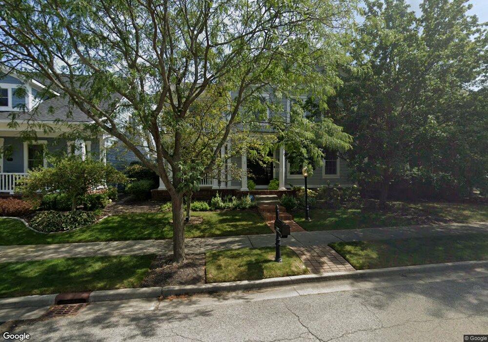
12687 Vanderhorst St Carmel, IN 46032
West Carmel NeighborhoodEstimated Value: $588,000 - $873,000
4
Beds
3
Baths
3,235
Sq Ft
$232/Sq Ft
Est. Value
About This Home
This home is located at 12687 Vanderhorst St, Carmel, IN 46032 and is currently estimated at $751,737, approximately $232 per square foot. 12687 Vanderhorst St is a home located in Hamilton County with nearby schools including West Clay Elementary, Creekside Middle School, and Carmel High School.
Ownership History
Date
Name
Owned For
Owner Type
Purchase Details
Closed on
Oct 17, 2007
Sold by
Rh Of Indiana Lp
Bought by
Coles Brian L and Coles Whitney M
Current Estimated Value
Home Financials for this Owner
Home Financials are based on the most recent Mortgage that was taken out on this home.
Original Mortgage
$321,028
Outstanding Balance
$202,927
Interest Rate
6.45%
Mortgage Type
Purchase Money Mortgage
Estimated Equity
$548,810
Purchase Details
Closed on
Jan 16, 2006
Sold by
Brenwick Tnd Communities Llc
Bought by
Rh Of Indiana Lp
Create a Home Valuation Report for This Property
The Home Valuation Report is an in-depth analysis detailing your home's value as well as a comparison with similar homes in the area
Home Values in the Area
Average Home Value in this Area
Purchase History
| Date | Buyer | Sale Price | Title Company |
|---|---|---|---|
| Coles Brian L | -- | Fat | |
| Rh Of Indiana Lp | -- | None Available |
Source: Public Records
Mortgage History
| Date | Status | Borrower | Loan Amount |
|---|---|---|---|
| Open | Coles Brian L | $321,028 |
Source: Public Records
Tax History Compared to Growth
Tax History
| Year | Tax Paid | Tax Assessment Tax Assessment Total Assessment is a certain percentage of the fair market value that is determined by local assessors to be the total taxable value of land and additions on the property. | Land | Improvement |
|---|---|---|---|---|
| 2024 | $5,275 | $480,100 | $145,800 | $334,300 |
| 2023 | $5,310 | $484,100 | $145,800 | $338,300 |
| 2022 | $5,180 | $454,800 | $125,400 | $329,400 |
| 2021 | $4,874 | $428,500 | $125,400 | $303,100 |
| 2020 | $4,776 | $423,000 | $125,400 | $297,600 |
| 2019 | $4,565 | $404,600 | $79,100 | $325,500 |
| 2018 | $4,560 | $408,200 | $79,100 | $329,100 |
| 2017 | $4,360 | $390,400 | $79,100 | $311,300 |
| 2016 | $4,171 | $379,300 | $79,100 | $300,200 |
| 2014 | $3,990 | $366,100 | $65,900 | $300,200 |
| 2013 | $3,990 | $369,300 | $65,900 | $303,400 |
Source: Public Records
Map
Nearby Homes
- 12711 Vanderhorst St
- 2454 Gwinnett St
- 2575 Buckland St
- 12697 Treaty Line St
- 12933 Horlbeck St
- 12934 Treaty Line St
- 2577 Filson St
- 2263 Glebe St
- 2578 Filson St
- 12755 Tradd St
- 12750 Moonseed Dr
- 12843 Tradd St Unit 2B
- 12870 Tradd St
- 12997 Moultrie St
- 12652 Apsley Ln
- 13018 Deerstyne Green St
- 12938 University Crescent Unit 2B
- 13054 Deerstyne Green St
- 2444 Laurel Lake Blvd
- 1902 Rhettsbury St
- 12675 Vanderhorst St
- 12691 Vanderhorst St
- 2480 Buckland St
- 2485 Gwinnett St
- 12699 Vanderhorst St
- 2468 Buckland St
- 2520 Woodley St
- 2473 Gwinnett St
- 2495 Buckland St
- 2517 Buckland St
- 2483 Buckland St
- 2532 Woodley St
- 2529 Buckland St
- 2456 Buckland St
- 2461 Gwinnett St
- 2541 Buckland St
- 2544 Woodley St
- 12705 Vanderhorst St
- 2523 Grafton St
- 2444 Buckland St