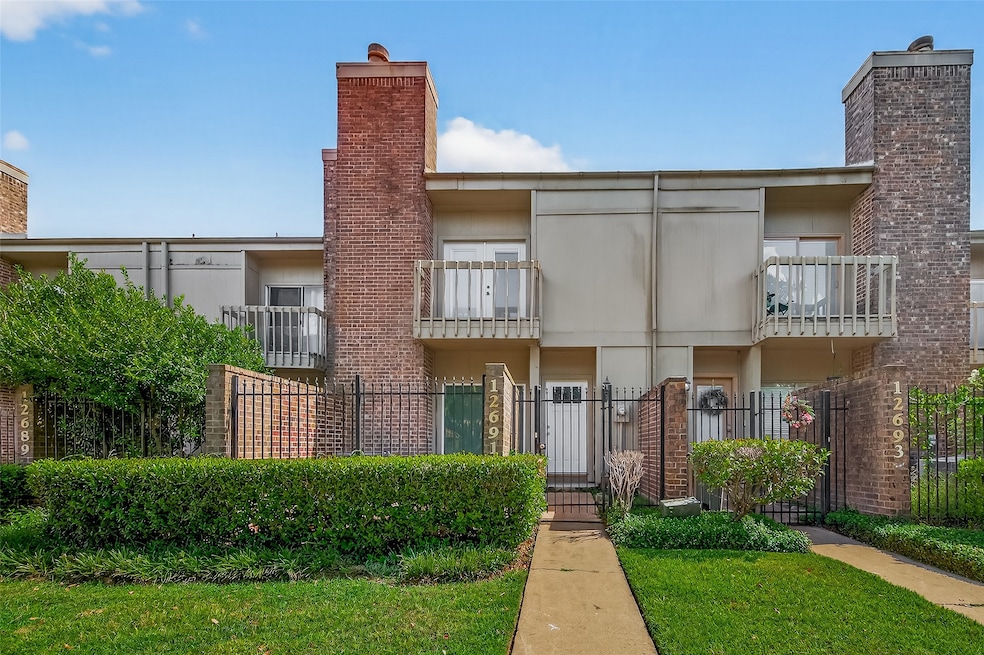

12691 Briar Patch Rd Unit 5 Houston, TX 77077
Energy Corridor NeighborhoodEstimated payment $1,800/month
Highlights
- 79,071 Sq Ft lot
- 1 Fireplace
- Double Vanity
- Traditional Architecture
- Community Pool
- Living Room
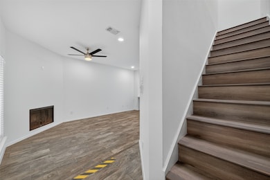
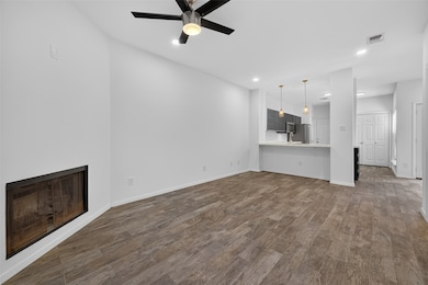
About This Home
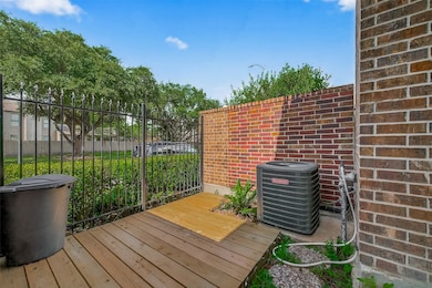
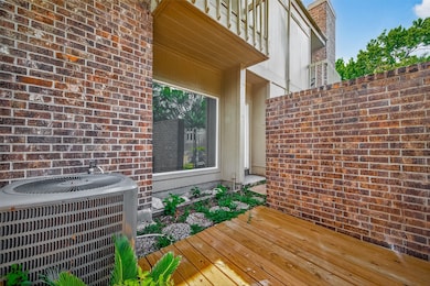
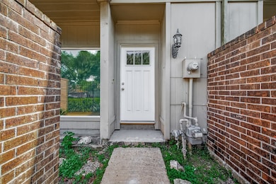
Rare find Gem! Beautifully renovated 2bdrm 2 1/2 bathrooms Townhome in Energy Corridor. Excellent location. *New roof and Deck 2025*

Townhouse Details
Home Type
- Townhome
Est. Annual Taxes
- $5,238
Year Built
- Built in 1980
Lot Details
- 1.82 Acre Lot
HOA Fees
- $230 Monthly HOA Fees
Home Design
- Traditional Architecture
- Brick Exterior Construction
- Slab Foundation
- Composition Roof
- Cement Siding
Interior Spaces
- 1,344 Sq Ft Home
- 2-Story Property
- 1 Fireplace
- Living Room
- Utility Room
Kitchen
- Microwave
- Dishwasher
Bedrooms and Bathrooms
- 2 Bedrooms
- En-Suite Primary Bedroom
- Double Vanity
Schools
- Daily Elementary School
- West Briar Middle School
- Westside High School
Utilities
- Central Heating and Cooling System
- Heating System Uses Gas
Community Details
Overview
- Association fees include common areas, trash
- Wildwood Civic/ Property Masters Association
- Wildwood Clstr Hms 01 Pt R/P U Subdivision
Recreation
- Community Pool
Map
Home Values in the Area
Average Home Value in this Area
Tax History
| Year | Tax Paid | Tax Assessment Tax Assessment Total Assessment is a certain percentage of the fair market value that is determined by local assessors to be the total taxable value of land and additions on the property. | Land | Improvement |
|---|---|---|---|---|
| 2025 | $5,238 | $251,068 | $60,000 | $191,068 |
| 2024 | $5,238 | $250,344 | $60,000 | $190,344 |
| 2023 | $5,238 | $282,714 | $60,000 | $222,714 |
| 2022 | $5,123 | $232,648 | $60,000 | $172,648 |
| 2021 | $4,719 | $202,461 | $53,400 | $149,061 |
| 2020 | $5,465 | $225,673 | $53,400 | $172,273 |
| 2019 | $5,624 | $222,240 | $55,800 | $166,440 |
| 2018 | $3,556 | $140,535 | $60,000 | $80,535 |
| 2017 | $4,197 | $166,000 | $60,000 | $106,000 |
| 2016 | $4,197 | $166,000 | $60,000 | $106,000 |
| 2015 | $2,519 | $151,403 | $60,000 | $91,403 |
| 2014 | $2,519 | $130,535 | $30,000 | $100,535 |
Property History
| Date | Event | Price | List to Sale | Price per Sq Ft |
|---|---|---|---|---|
| 10/29/2025 10/29/25 | Price Changed | $1,850 | -2.4% | $1 / Sq Ft |
| 10/11/2025 10/11/25 | For Rent | $1,895 | 0.0% | -- |
| 10/11/2025 10/11/25 | For Sale | $215,000 | -- | $160 / Sq Ft |
Purchase History
| Date | Type | Sale Price | Title Company |
|---|---|---|---|
| Warranty Deed | -- | Old Republic Natl Title Ins | |
| Warranty Deed | -- | Chicago Title | |
| Warranty Deed | -- | Chicago Title |
Mortgage History
| Date | Status | Loan Amount | Loan Type |
|---|---|---|---|
| Previous Owner | $77,600 | No Value Available | |
| Previous Owner | $56,800 | No Value Available |
Source: Houston Association of REALTORS®
MLS Number: 33112182
APN: 1075860110005
Disclaimer: Certain information contained herein is derived from information provided by parties other than Homes.com. All information provided is deemed reliable, but is not guaranteed to be accurate and should be independently verified.
![]() Copyright 2025, Houston REALTORS® Information Service, Inc.
Copyright 2025, Houston REALTORS® Information Service, Inc.
The information provided is exclusively for consumers’ personal, non-commercial use, and may not be used for any purpose other than to identify prospective properties consumers may be interested in purchasing.
Information is deemed reliable but not guaranteed.
- 1251 Trace Dr
- 12620 Briar Patch Rd
- 12636 Briar Patch Rd
- 902 Ashford Pkwy
- 12979 Kingsbridge Ln
- 12551 Honeywood Trail
- 1513 Beaconshire Rd
- 1502 Beaconshire Rd
- 12859 Kingsbridge Ln
- 12869 Kingsbridge Ln
- 12527 Honeywood Trail
- 1527 Ainsdale Dr
- 12929 Kingsbridge Ln
- 1533 Beaconshire Rd
- 14811 Bramblewood Dr
- 950 Moon Drop Ln
- 930 Moon Drop Ln
- 12800 Briar Forest Dr Unit 126
- 12800 Briar Forest Dr Unit 48
- 12523 Shepherds Ridge Dr
- 12660 Briar Patch Rd
- 12658 Briar Patch Dr
- 1335 Silverado Dr
- 1200 S Dairy Ashford St
- 1414 S Dairy Ashford Rd
- 12750 Briar Forest Dr
- 1493 Silverado Dr
- 12859 Kingsbridge Ln
- 1535 Beaconshire Rd
- 12929 Kingsbridge Ln
- 12906 Kingsbridge Ln
- 12800 Briar Forest Dr Unit 56
- 12800 Briar Forest Dr Unit 48
- 14602 Oak Bend Dr
- 12511 Shepherds Ridge Dr
- 12826 Westmere Dr
- 12846 Westmere Dr
- 12710 Westleigh Dr
- 12951 Briar Forest Dr
- 1520 Enclave Pkwy