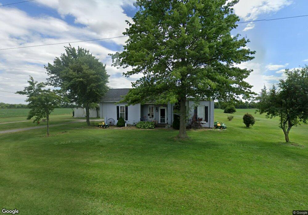
12695 County Road F Wauseon, OH 43567
Estimated Value: $157,077 - $255,000
3
Beds
1
Bath
1,328
Sq Ft
$162/Sq Ft
Est. Value
About This Home
This home is located at 12695 County Road F, Wauseon, OH 43567 and is currently estimated at $214,769, approximately $161 per square foot. 12695 County Road F is a home with nearby schools including Wauseon Primary School, Wauseon Elementary School, and Wauseon Middle School.
Ownership History
Date
Name
Owned For
Owner Type
Purchase Details
Closed on
Aug 3, 2015
Sold by
Goldsmith John P
Bought by
Roger B Ernst & Beverly A Ernst Living T
Current Estimated Value
Purchase Details
Closed on
Sep 10, 2008
Sold by
Goldsmith Johnny and Goldsmith John P
Bought by
Conners Sharon A
Purchase Details
Closed on
Jan 1, 1990
Bought by
Zeigler Terry
Create a Home Valuation Report for This Property
The Home Valuation Report is an in-depth analysis detailing your home's value as well as a comparison with similar homes in the area
Home Values in the Area
Average Home Value in this Area
Purchase History
| Date | Buyer | Sale Price | Title Company |
|---|---|---|---|
| Roger B Ernst & Beverly A Ernst Living T | $38,000 | Attorney | |
| Conners Sharon A | $34,900 | Attorney | |
| Zeigler Terry | -- | -- |
Source: Public Records
Tax History Compared to Growth
Tax History
| Year | Tax Paid | Tax Assessment Tax Assessment Total Assessment is a certain percentage of the fair market value that is determined by local assessors to be the total taxable value of land and additions on the property. | Land | Improvement |
|---|---|---|---|---|
| 2024 | $1,715 | $36,050 | $15,260 | $20,790 |
| 2023 | $1,640 | $36,050 | $15,260 | $20,790 |
| 2022 | $1,640 | $29,340 | $12,710 | $16,630 |
| 2021 | $1,748 | $29,340 | $12,710 | $16,630 |
| 2020 | $1,638 | $29,340 | $12,710 | $16,630 |
| 2019 | $1,546 | $27,970 | $11,170 | $16,800 |
| 2018 | $1,368 | $27,970 | $11,170 | $16,800 |
| 2017 | $1,335 | $27,970 | $11,170 | $16,800 |
| 2016 | $1,349 | $25,420 | $11,170 | $14,250 |
| 2015 | $1,229 | $25,420 | $11,170 | $14,250 |
| 2014 | $1,235 | $25,420 | $11,170 | $14,250 |
| 2013 | $997 | $18,910 | $9,910 | $9,000 |
Source: Public Records
Map
Nearby Homes
- 1090 Seneca Dr
- 1058 Seneca Dr
- 1066 Seneca Dr
- 1062 Seneca Dr
- Integrity 1830 Plan at Arrowhead Trails
- integrity 2280 Plan at Arrowhead Trails
- Integrity 2080 Plan at Arrowhead Trails
- 1209 Apache Dr
- 13242 Us Highway 20a
- 911 Doris Dr
- 13354 U S 20a
- 00 Glenwood
- 0 Glenwood Unit 6124946
- 801 N Shoop Ave
- 527 E Elm St
- 303 Eastwood St
- 351 E Walnut St
- 7373 County Road 12
- 217 Marshall St
- 139 Marshall St
- 12735 County Road F
- 12662 County Road F
- 12706 County Road F
- 12732 County Road F
- 12856 County Road F
- 6132 County Road 13
- 6031 County Road 13
- 5800 County Road 13
- 6085 County Road 13
- 12340 County Road F
- 6117 County Road 13
- 6232 County Road 13
- 13060 County Road F
- 6151 County Road 13
- 6181 County Road 13
- 13090 County Road F
- 12300 County Road F
- 12293 County Road F
- 6205 County Road 13
- 5751 County Road 13