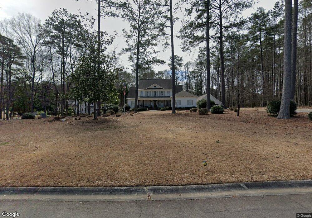
127 127 Maplewood Griffin, GA 30224
Spalding County NeighborhoodEstimated Value: $592,000 - $685,000
4
Beds
6
Baths
4,680
Sq Ft
$133/Sq Ft
Est. Value
About This Home
This home is located at 127 127 Maplewood, Griffin, GA 30224 and is currently estimated at $622,110, approximately $132 per square foot. 127 127 Maplewood is a home located in Spalding County with nearby schools including Crescent Road Elementary School, Rehoboth Road Middle School, and Spalding High School.
Ownership History
Date
Name
Owned For
Owner Type
Purchase Details
Closed on
Nov 16, 2022
Sold by
Dooling Michael Allen
Bought by
Coons Penny and Coons Robert
Current Estimated Value
Purchase Details
Closed on
Oct 15, 2019
Sold by
Thurston Thomas D
Bought by
Dooling Michical Allen and Dooling Rosanne
Home Financials for this Owner
Home Financials are based on the most recent Mortgage that was taken out on this home.
Original Mortgage
$311,125
Interest Rate
3.7%
Mortgage Type
New Conventional
Purchase Details
Closed on
Jun 19, 2017
Sold by
Eidson James Matthew
Bought by
Thurston Thomas D and Thurston Gabrielle A
Home Financials for this Owner
Home Financials are based on the most recent Mortgage that was taken out on this home.
Original Mortgage
$260,000
Interest Rate
4.02%
Mortgage Type
New Conventional
Purchase Details
Closed on
Jun 14, 1995
Sold by
Mouchet Phil
Bought by
Eidson James Mary
Create a Home Valuation Report for This Property
The Home Valuation Report is an in-depth analysis detailing your home's value as well as a comparison with similar homes in the area
Home Values in the Area
Average Home Value in this Area
Purchase History
| Date | Buyer | Sale Price | Title Company |
|---|---|---|---|
| Coons Penny | $560,000 | -- | |
| Dooling Michical Allen | $327,500 | -- | |
| Thurston Thomas D | $300,000 | -- | |
| Eidson James Mary | $38,500 | -- |
Source: Public Records
Mortgage History
| Date | Status | Borrower | Loan Amount |
|---|---|---|---|
| Previous Owner | Dooling Michical Allen | $311,125 | |
| Previous Owner | Thurston Thomas D | $260,000 |
Source: Public Records
Tax History Compared to Growth
Tax History
| Year | Tax Paid | Tax Assessment Tax Assessment Total Assessment is a certain percentage of the fair market value that is determined by local assessors to be the total taxable value of land and additions on the property. | Land | Improvement |
|---|---|---|---|---|
| 2024 | $7,841 | $217,098 | $26,400 | $190,698 |
| 2023 | $7,841 | $217,098 | $26,400 | $190,698 |
| 2022 | $6,485 | $162,285 | $26,400 | $135,885 |
| 2021 | $5,250 | $131,382 | $26,400 | $104,982 |
| 2020 | $4,726 | $118,259 | $26,400 | $91,859 |
| 2019 | $4,399 | $108,088 | $26,400 | $81,688 |
| 2018 | $4,555 | $107,846 | $26,400 | $81,446 |
| 2017 | $4,360 | $107,846 | $26,400 | $81,446 |
| 2016 | $4,430 | $107,846 | $26,400 | $81,446 |
| 2015 | $4,503 | $107,846 | $26,400 | $81,446 |
| 2014 | $4,638 | $107,846 | $26,400 | $81,446 |
Source: Public Records
Map
Nearby Homes
- 174 Grange Rd
- 137 Townsend Ct
- 131 Townsend Ct
- 3000 Ext S 6th St
- 133 Four Oaks Dr
- 2002 Millstream Ct
- 131 Hunts Mill Cir
- 2000 Millstream Ct
- 1011 Waverly Dr
- 1013 Waverly Dr
- 139 Hunts Mill Cir
- 138 Hunts Mill Cir
- LOT 48 Waverly Dr Unit 1
- LOT 47 Waverly Dr Unit 1
- LOT 69 Waverly Dr Unit 1
- LOT 68 Waverly Dr Unit 1
- LOT 67 Waverly Dr Unit 1
- LOT 66 Waverly Dr Unit 1
- LOT 65 Waverly Dr Unit 1
- LOT 46 Waverly Dr Unit 1
- 127 Maplewood Dr
- 125 Maplewood Dr
- 129 Maplewood Dr
- 131 Maplewood Dr
- 178 Grange Rd
- 123 Maplewood Dr
- 124 Maplewood Dr
- 126 Maplewood Dr Unit 2
- 180 Cumberland Rd
- 128 Maplewood Dr Unit 2
- 1250 Cumberland Rd
- 0 Grange Rd Unit 8404521
- 0 Grange Rd Unit 8084311
- 0 Grange Rd
- 176 Grange Rd
- 176 Grange Rd Unit 25
- 133 Maplewood Dr
- 130 Maplewood Dr
- 121 Maplewood Dr
- 180 Grange Rd