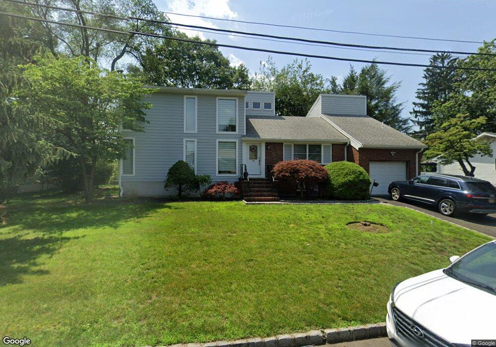
127 4th St Cresskill, NJ 07626
Estimated Value: $1,076,000 - $1,346,000
Studio
--
Bath
3,052
Sq Ft
$392/Sq Ft
Est. Value
About This Home
This home is located at 127 4th St, Cresskill, NJ 07626 and is currently estimated at $1,197,429, approximately $392 per square foot. 127 4th St is a home located in Bergen County with nearby schools including Cresskill High School and Spring School.
Ownership History
Date
Name
Owned For
Owner Type
Purchase Details
Closed on
Nov 7, 2002
Sold by
Kim In S
Bought by
Kim Calvin and Kim Yoon J
Current Estimated Value
Home Financials for this Owner
Home Financials are based on the most recent Mortgage that was taken out on this home.
Original Mortgage
$220,000
Interest Rate
6.02%
Purchase Details
Closed on
Jul 24, 1996
Sold by
Aida Hirotaka and Aida Myoung
Bought by
Kim In and Kim Bok
Home Financials for this Owner
Home Financials are based on the most recent Mortgage that was taken out on this home.
Original Mortgage
$200,000
Interest Rate
8.27%
Purchase Details
Closed on
Mar 1, 1994
Sold by
Ge Capital Mtg
Bought by
Aida Hirotaka and Aida Myong Cha
Home Financials for this Owner
Home Financials are based on the most recent Mortgage that was taken out on this home.
Original Mortgage
$120,000
Interest Rate
6.96%
Create a Home Valuation Report for This Property
The Home Valuation Report is an in-depth analysis detailing your home's value as well as a comparison with similar homes in the area
Home Values in the Area
Average Home Value in this Area
Purchase History
| Date | Buyer | Sale Price | Title Company |
|---|---|---|---|
| Kim Calvin | -- | -- | |
| Kim In | $294,000 | -- | |
| Aida Hirotaka | $200,000 | -- |
Source: Public Records
Mortgage History
| Date | Status | Borrower | Loan Amount |
|---|---|---|---|
| Previous Owner | Kim Calvin | $220,000 | |
| Previous Owner | Kim In | $200,000 | |
| Previous Owner | Aida Hirotaka | $120,000 |
Source: Public Records
Tax History
| Year | Tax Paid | Tax Assessment Tax Assessment Total Assessment is a certain percentage of the fair market value that is determined by local assessors to be the total taxable value of land and additions on the property. | Land | Improvement |
|---|---|---|---|---|
| 2025 | $17,521 | $816,600 | $367,500 | $449,100 |
| 2024 | $17,475 | $761,800 | $327,500 | $434,300 |
| 2023 | $16,810 | $752,900 | $297,500 | $455,400 |
| 2022 | $16,810 | $698,400 | $260,000 | $438,400 |
| 2021 | $16,281 | $666,700 | $240,000 | $426,700 |
| 2020 | $15,818 | $650,400 | $230,000 | $420,400 |
| 2019 | $15,441 | $641,500 | $227,500 | $414,000 |
| 2018 | $10,711 | $635,300 | $225,000 | $410,300 |
| 2017 | $15,140 | $556,200 | $210,000 | $346,200 |
| 2016 | $14,689 | $556,200 | $210,000 | $346,200 |
| 2015 | $14,233 | $556,200 | $210,000 | $346,200 |
| 2014 | $13,805 | $556,200 | $210,000 | $346,200 |
Source: Public Records
Map
Nearby Homes
- 137 6th St
- 81 5th St
- 40 5th St
- 23 Legion Dr Unit 202
- 177 Magnolia Ave
- 25 Allen St
- 26 Linwood Ave
- 126 Grant Ave
- 70 Linwood Ave Unit 24
- 21 Cedar St
- 5 Michele Ct
- 284 Madison Ave
- 225 12th St
- 36 Morningside Ave
- 37 New St
- 1314 The Plaza
- 1310 The Plaza
- 292 Magnolia Ave
- 61 Rose St
- 136 Stonegate Trail Unit 37
Your Personal Tour Guide
Ask me questions while you tour the home.