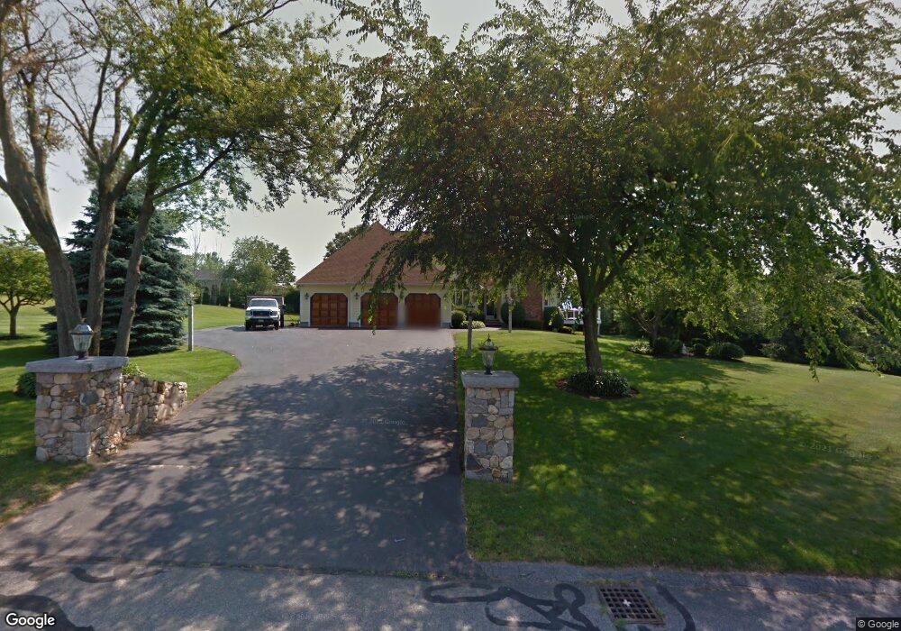
127 Betty Ann Ln Dracut, MA 01826
Estimated Value: $908,000 - $1,070,000
3
Beds
3
Baths
2,521
Sq Ft
$384/Sq Ft
Est. Value
About This Home
This home is located at 127 Betty Ann Ln, Dracut, MA 01826 and is currently estimated at $967,434, approximately $383 per square foot. 127 Betty Ann Ln is a home located in Middlesex County with nearby schools including Greenmont Avenue School, Richardson Middle School, and Dracut Senior High School.
Ownership History
Date
Name
Owned For
Owner Type
Purchase Details
Closed on
Oct 30, 2015
Sold by
Fotopoulos Charles P
Bought by
Fotopoulos John P and Fotopoulos Christie A
Current Estimated Value
Home Financials for this Owner
Home Financials are based on the most recent Mortgage that was taken out on this home.
Original Mortgage
$536,000
Outstanding Balance
$423,442
Interest Rate
3.92%
Mortgage Type
Purchase Money Mortgage
Estimated Equity
$543,992
Purchase Details
Closed on
Oct 31, 2002
Sold by
Tymowicz Mary A and Tymowicz Andrew
Bought by
Fotopoulos Charles P
Home Financials for this Owner
Home Financials are based on the most recent Mortgage that was taken out on this home.
Original Mortgage
$352,000
Interest Rate
6.09%
Mortgage Type
Purchase Money Mortgage
Purchase Details
Closed on
Mar 6, 1992
Sold by
Doney William H
Bought by
Tymowicz Andrew and Tymowicz Mary
Create a Home Valuation Report for This Property
The Home Valuation Report is an in-depth analysis detailing your home's value as well as a comparison with similar homes in the area
Home Values in the Area
Average Home Value in this Area
Purchase History
| Date | Buyer | Sale Price | Title Company |
|---|---|---|---|
| Fotopoulos John P | $700,000 | -- | |
| Fotopoulos Charles P | $440,000 | -- | |
| Tymowicz Andrew | $250,000 | -- |
Source: Public Records
Mortgage History
| Date | Status | Borrower | Loan Amount |
|---|---|---|---|
| Open | Fotopoulos John P | $536,000 | |
| Previous Owner | Tymowicz Andrew | $352,000 | |
| Previous Owner | Tymowicz Andrew | $116,670 | |
| Previous Owner | Tymowicz Andrew | $180,000 |
Source: Public Records
Tax History Compared to Growth
Tax History
| Year | Tax Paid | Tax Assessment Tax Assessment Total Assessment is a certain percentage of the fair market value that is determined by local assessors to be the total taxable value of land and additions on the property. | Land | Improvement |
|---|---|---|---|---|
| 2025 | $9,435 | $932,300 | $266,800 | $665,500 |
| 2024 | $9,136 | $874,300 | $254,300 | $620,000 |
| 2023 | $9,049 | $781,400 | $221,200 | $560,200 |
| 2022 | $9,677 | $787,400 | $201,200 | $586,200 |
| 2021 | $4,615 | $694,500 | $182,700 | $511,800 |
| 2020 | $9,198 | $689,000 | $177,200 | $511,800 |
| 2019 | $8,814 | $641,000 | $168,700 | $472,300 |
| 2018 | $4,100 | $590,400 | $176,000 | $414,400 |
| 2017 | $8,410 | $590,400 | $176,000 | $414,400 |
| 2016 | $7,920 | $533,700 | $169,200 | $364,500 |
| 2015 | $7,782 | $521,200 | $169,200 | $352,000 |
| 2014 | $7,132 | $492,200 | $169,200 | $323,000 |
Source: Public Records
Map
Nearby Homes
- 121 Old Marsh Hill Rd
- 167 Betty Ann Ln
- 321 Old Marsh Hill Rd
- 26 Frank St
- 1572 Bridge St
- 19 Esther Way Unit Lot 10
- 20 Esther Way Unit 11
- 67 Lincoln Ln
- 67 Foxhill Ln Unit 67
- 315 Broadway Rd Unit 7
- 241 Broadway Rd Unit 50
- 109 Meadow Creek Dr
- 81 Spring Park Ave
- 18 Stone St
- 190 Old Rd
- 35 Thissell Ave
- 174 Old Rd
- 675 Robbins Ave Unit 1
- 157 Old Rd
- 700 Robbins Ave Unit 6
- 135 Betty Ann Ln
- 119 Betty Ann Ln
- 55 Betty Ann Ln
- 142 Betty Ann Ln
- 47 Betty Ann Ln
- 63 Betty Ann Ln
- 152 Betty Ann Ln
- 134 Betty Ann Ln
- 111 Betty Ann Ln
- 158 Betty Ann Ln
- 39 Betty Ann Ln
- 71 Betty Ann Ln
- 123 Anywhere
- 10 Lots Liakas Way
- Lot 14 Burgess Farm Rd
- Lot 9 Burgess Farm Rd
- Lot 6 Burgess Farm Rd
- 13 Black Hawk Rd Unit 2-19
- 9 Black Hawk Rd Unit 2-17
- 155 Old Marsh Hill Rd