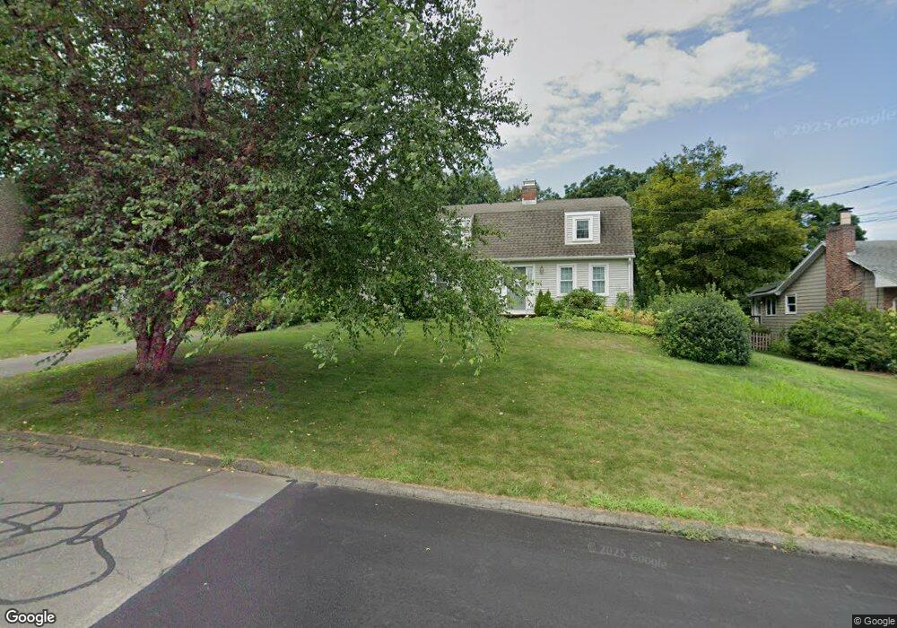
127 Boulter Rd Wethersfield, CT 06109
Estimated Value: $470,591 - $579,000
3
Beds
3
Baths
1,830
Sq Ft
$287/Sq Ft
Est. Value
About This Home
This home is located at 127 Boulter Rd, Wethersfield, CT 06109 and is currently estimated at $524,398, approximately $286 per square foot. 127 Boulter Rd is a home located in Hartford County with nearby schools including Highcrest School, Silas Deane Middle School, and Wethersfield High School.
Ownership History
Date
Name
Owned For
Owner Type
Purchase Details
Closed on
Aug 29, 2017
Sold by
Lukawicz Diane C
Bought by
Lukawicz Timothy P
Current Estimated Value
Home Financials for this Owner
Home Financials are based on the most recent Mortgage that was taken out on this home.
Original Mortgage
$227,065
Outstanding Balance
$190,274
Interest Rate
4.03%
Mortgage Type
Purchase Money Mortgage
Estimated Equity
$334,124
Purchase Details
Closed on
Sep 29, 1989
Sold by
Taute Robert G
Bought by
Lukawicz Robert P
Create a Home Valuation Report for This Property
The Home Valuation Report is an in-depth analysis detailing your home's value as well as a comparison with similar homes in the area
Home Values in the Area
Average Home Value in this Area
Purchase History
We collect this data history from publicly available records. To have your information removed, we recommend requesting removal directly through your county’s website.
| Date | Buyer | Sale Price | Title Company |
|---|---|---|---|
| Lukawicz Timothy P | $300,000 | -- | |
| Lukawicz Robert P | $264,000 | -- |
Source: Public Records
Mortgage History
We collect this data history from publicly available records. To have your information removed, we recommend requesting removal directly through your county’s website.
| Date | Status | Borrower | Loan Amount |
|---|---|---|---|
| Open | Lukawicz Robert P | $227,065 | |
| Previous Owner | Lukawicz Robert P | $100,000 | |
| Previous Owner | Lukawicz Robert P | $12,938 | |
| Previous Owner | Lukawicz Robert P | $97,600 |
Source: Public Records
Tax History
| Year | Tax Paid | Tax Assessment Tax Assessment Total Assessment is a certain percentage of the fair market value that is determined by local assessors to be the total taxable value of land and additions on the property. | Land | Improvement |
|---|---|---|---|---|
| 2025 | $12,559 | $304,680 | $104,540 | $200,140 |
| 2024 | $9,005 | $208,360 | $82,600 | $125,760 |
| 2023 | $8,705 | $208,360 | $82,600 | $125,760 |
| 2022 | $8,559 | $208,360 | $82,600 | $125,760 |
| 2021 | $8,474 | $208,360 | $82,600 | $125,760 |
| 2020 | $8,805 | $216,380 | $82,600 | $133,780 |
| 2019 | $8,489 | $208,360 | $82,600 | $125,760 |
| 2018 | $8,152 | $199,900 | $76,700 | $123,200 |
| 2017 | $7,950 | $199,900 | $76,700 | $123,200 |
| 2016 | $7,704 | $199,900 | $76,700 | $123,200 |
| 2015 | $7,634 | $199,900 | $76,700 | $123,200 |
| 2014 | $7,344 | $199,900 | $76,700 | $123,200 |
Source: Public Records
Map
Nearby Homes
- 492 Maple St
- 32 Meadowgate St
- 46 Kimball Rd
- 39 Mountain Laurel Dr
- 70 Mountain Laurel Dr Unit 70
- 149 Mill St
- 748 Maple St
- 152 Surrey Dr
- 75 Barry Place
- 80 Grist Mill Rd
- 19-21 Mill St
- 0 Middletown Ave
- 44 Beverly Rd
- 46 Stonegate Dr
- 50 Old Main St
- 86 Dudley Rd
- 146 Dudley Rd
- 129 Cloverdale Cir
- 107 Coleman Rd
- 268 Fox Hill Rd
- 140 Boulter Rd
- 134 Boulter Rd
- 146 Boulter Rd
- 128 Boulter Rd
- 152 Boulter Rd
- 133 Boulter Rd
- 141 Boulter Rd
- 122 Boulter Rd
- 156 Boulter Rd
- 121 Boulter Rd
- 149 Boulter Rd
- 115 Boulter Rd
- 82 Meadowgate St
- 155 Boulter Rd
- 92 Meadowgate St
- 102 Meadowgate St
- 118 Randy Ln
- 72 Meadowgate St
- 126 Randy Ln
- 108 Randy Ln
Your Personal Tour Guide
Ask me questions while you tour the home.