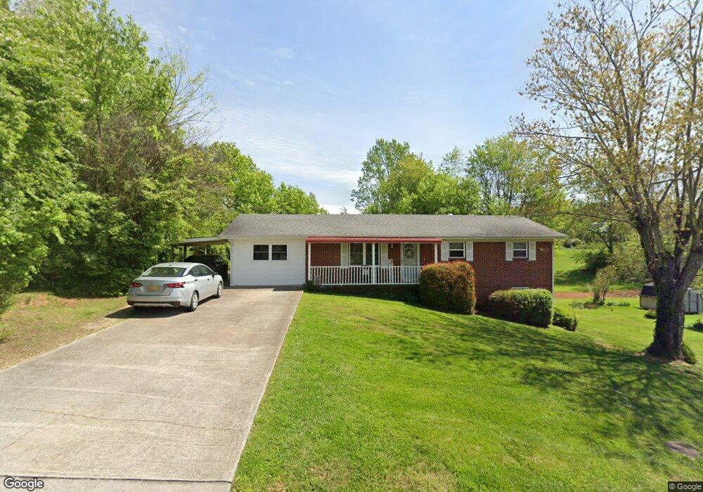
127 Britton Dr Talbott, TN 37877
Estimated Value: $225,000 - $342,000
Studio
3
Baths
1,400
Sq Ft
$192/Sq Ft
Est. Value
About This Home
This home is located at 127 Britton Dr, Talbott, TN 37877 and is currently estimated at $268,749, approximately $191 per square foot. 127 Britton Dr is a home located in Hamblen County with nearby schools including Alpha Elementary School, West View Middle School, and Morristown West High School.
Ownership History
Date
Name
Owned For
Owner Type
Purchase Details
Closed on
Sep 8, 2011
Sold by
Richardson Whitney Lee
Bought by
Richardson Michael Anthony
Current Estimated Value
Purchase Details
Closed on
Jul 8, 2011
Bought by
Richardson Michael Anthony
Purchase Details
Closed on
Apr 4, 2005
Sold by
Richardson Darrell G
Bought by
Richardson Michael A
Home Financials for this Owner
Home Financials are based on the most recent Mortgage that was taken out on this home.
Original Mortgage
$80,750
Interest Rate
5.74%
Purchase Details
Closed on
Jan 17, 1990
Bought by
Richardson Ruth L and Richardson E
Purchase Details
Closed on
May 8, 1985
Bought by
Richardson Ruth
Purchase Details
Closed on
Sep 22, 1978
Bought by
Deason Deason C and Deason Everee
Create a Home Valuation Report for This Property
The Home Valuation Report is an in-depth analysis detailing your home's value as well as a comparison with similar homes in the area
Purchase History
| Date | Buyer | Sale Price | Title Company |
|---|---|---|---|
| Richardson Michael Anthony | -- | -- | |
| Richardson Michael Anthony | -- | -- | |
| Richardson Michael A | $85,000 | -- | |
| Richardson Ruth L | $50,000 | -- | |
| Richardson Ruth | $46,000 | -- | |
| Deason Deason C | $31,000 | -- |
Source: Public Records
Mortgage History
| Date | Status | Borrower | Loan Amount |
|---|---|---|---|
| Previous Owner | Deason Deason C | $80,750 |
Source: Public Records
Tax History
| Year | Tax Paid | Tax Assessment Tax Assessment Total Assessment is a certain percentage of the fair market value that is determined by local assessors to be the total taxable value of land and additions on the property. | Land | Improvement |
|---|---|---|---|---|
| 2025 | $952 | $64,775 | $7,750 | $57,025 |
| 2024 | $563 | $28,600 | $5,150 | $23,450 |
| 2023 | $563 | $28,600 | $0 | $0 |
| 2022 | $563 | $28,600 | $5,150 | $23,450 |
| 2021 | $563 | $28,600 | $5,150 | $23,450 |
| 2020 | $563 | $28,600 | $5,150 | $23,450 |
| 2019 | $535 | $25,125 | $5,075 | $20,050 |
| 2018 | $535 | $25,125 | $5,075 | $20,050 |
| 2017 | $535 | $25,125 | $5,075 | $20,050 |
| 2016 | $500 | $25,125 | $5,075 | $20,050 |
| 2015 | $465 | $25,125 | $5,075 | $20,050 |
| 2014 | -- | $25,125 | $5,075 | $20,050 |
| 2013 | -- | $26,325 | $0 | $0 |
Source: Public Records
Map
Nearby Homes
- 7033 S Crest Ave
- 6987& 6989 W Andrew Johnson Hwy
- 566 Shaver Dr
- 7220 Briarwood Dr
- 7300 W Andrew Johnson Hwy
- 725 Ellencliff Cir
- 7350 W Andrew Johnson Hwy
- 230 Greenbriar Rd
- 6945 Westgate Cir
- 6640 Archer Cir
- 930 Shaver Dr
- 6 Talbott-Kansas Rd
- 7 Talbott-Kansas Rd
- 6864 Westgate Cir
- 6856 Hunter Rd
- Tract 2 Hunter Rd
- 234 Meek St
- 1050 Briar Ct
- 1015 Sherman Way
- Lot 1 & 2 Old Poplar Ridge Rd
- 137 Britton Dr
- 147 Britton Dr
- 128 Britton Dr
- 108 Britton Dr
- 118 Britton Dr
- 6997 W Andrew Johnson Hwy
- 138 Britton Dr
- 157 Britton Dr
- 158 Britton Dr
- 167 Britton Dr
- 168 Britton Dr
- 177 Britton Dr
- 178 Britton Dr
- 6960 W Andrew Johnson Hwy
- 187 Britton Dr
- 186 Britton Dr
- 197 Britton Dr
- 198 Britton Dr
- 6940 W Andrew Johnson Hwy
- 6984 Burke Ln
Your Personal Tour Guide
Ask me questions while you tour the home.