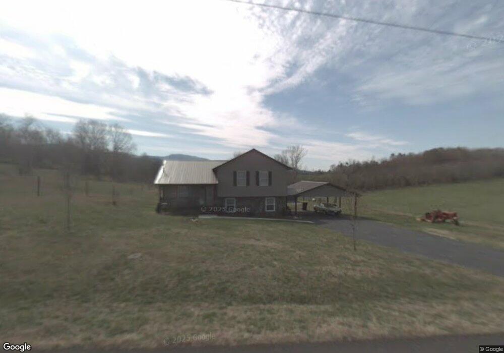
127 Brobeck Hill Rd Unit 1 Limestone, TN 37681
Estimated Value: $260,000 - $332,740
3
Beds
3
Baths
1,150
Sq Ft
$257/Sq Ft
Est. Value
About This Home
This home is located at 127 Brobeck Hill Rd Unit 1, Limestone, TN 37681 and is currently estimated at $295,935, approximately $257 per square foot. 127 Brobeck Hill Rd Unit 1 is a home located in Washington County with nearby schools including West View School and David Crockett High School.
Ownership History
Date
Name
Owned For
Owner Type
Purchase Details
Closed on
Oct 30, 2019
Sold by
Mauk Phil E and Mauk Kyleah G
Bought by
Tittle Danny L
Current Estimated Value
Home Financials for this Owner
Home Financials are based on the most recent Mortgage that was taken out on this home.
Original Mortgage
$163,975
Outstanding Balance
$146,464
Interest Rate
4.4%
Mortgage Type
FHA
Estimated Equity
$149,471
Purchase Details
Closed on
Mar 29, 2010
Sold by
Graham Kyle E
Bought by
Mauk Phil E
Home Financials for this Owner
Home Financials are based on the most recent Mortgage that was taken out on this home.
Original Mortgage
$134,000
Interest Rate
5.02%
Purchase Details
Closed on
Nov 7, 2003
Sold by
Warren Richard and Warren Kathern
Bought by
Graham Kyle E
Purchase Details
Closed on
Feb 28, 1991
Bought by
Warren Richard A and Warren Kathern M
Purchase Details
Closed on
Aug 27, 1990
Bought by
J & D Development Co Inc
Create a Home Valuation Report for This Property
The Home Valuation Report is an in-depth analysis detailing your home's value as well as a comparison with similar homes in the area
Home Values in the Area
Average Home Value in this Area
Purchase History
| Date | Buyer | Sale Price | Title Company |
|---|---|---|---|
| Tittle Danny L | $167,000 | None Available | |
| Mauk Phil E | $167,500 | -- | |
| Graham Kyle E | $73,000 | -- | |
| Warren Richard A | $58,700 | -- | |
| J & D Development Co Inc | $5,000 | -- |
Source: Public Records
Mortgage History
| Date | Status | Borrower | Loan Amount |
|---|---|---|---|
| Open | Tittle Danny L | $163,975 | |
| Previous Owner | J & D Development Co Inc | $134,000 |
Source: Public Records
Tax History Compared to Growth
Tax History
| Year | Tax Paid | Tax Assessment Tax Assessment Total Assessment is a certain percentage of the fair market value that is determined by local assessors to be the total taxable value of land and additions on the property. | Land | Improvement |
|---|---|---|---|---|
| 2024 | $1,085 | $63,425 | $7,475 | $55,950 |
| 2022 | $765 | $35,600 | $4,450 | $31,150 |
| 2021 | $765 | $35,600 | $4,450 | $31,150 |
| 2020 | $765 | $35,600 | $4,450 | $31,150 |
| 2019 | $844 | $35,600 | $4,450 | $31,150 |
| 2018 | $844 | $35,475 | $4,450 | $31,025 |
| 2017 | $844 | $35,475 | $4,450 | $31,025 |
| 2016 | $844 | $35,475 | $4,450 | $31,025 |
| 2015 | $702 | $35,475 | $4,450 | $31,025 |
| 2014 | $702 | $35,475 | $4,450 | $31,025 |
Source: Public Records
Map
Nearby Homes
- 236 Brobeck Hill Rd
- 151 Frank Stanton Rd
- 1942 Bailey Bridge Rd
- 324 Bill Mauk Rd
- 290 Bill Mauk Rd
- 290 Bill Mauk Rd
- 1851 Corby Bridge Rd
- 1761 Corby Bridge Rd
- Lot-4 Bailey Bridge Rd
- Lot-3 Bailey Bridge Rd
- 103 Lilly Painter Rd
- 438 Horace Dillow Rd
- 131 Brown Dr
- 185 Lester Snapp Rd
- 15.59 Ac Lester Snapp Rd
- 195 Cecil White Dr
- 269 Oklahoma Rd
- TBD Bill Gourley Rd
- Lot-5 Gravel Hill Rd
- 279 Donald Broyles Rd
- 127 Brobeck Hill Rd
- 119 Brobeck Hill Rd
- 1965 Conklin Rd
- 1959 Conklin Rd
- 1983 Conklin Rd
- 1984 Conklin Rd
- 1984 Conklin Rd
- 121 Brobeck Hill Rd
- 2005 Conklin Rd
- 1970 Conklin Rd
- 1992 Conklin Rd
- 1950 Conklin Rd
- 102 Paul Henley Rd
- 162 Brobeck Hill Rd
- 101 Charles Humphreys Rd
- 2014 Conklin Rd
- 2031 Conklin Rd
- 130 Paul Henley Rd
- 2020 Conklin Rd
- 121 Paul Henley Rd