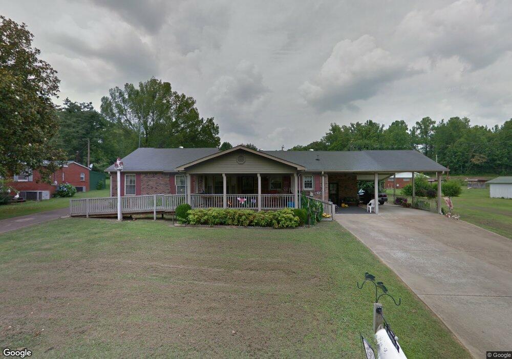
127 Brookside Dr Linden, TN 37096
Estimated Value: $174,680 - $282,000
Studio
2
Baths
1,380
Sq Ft
$161/Sq Ft
Est. Value
About This Home
This home is located at 127 Brookside Dr, Linden, TN 37096 and is currently estimated at $221,920, approximately $160 per square foot. 127 Brookside Dr is a home located in Perry County.
Ownership History
Date
Name
Owned For
Owner Type
Purchase Details
Closed on
Aug 3, 2020
Sold by
Pevahouse Katherine A and Phillips Joyce
Bought by
Mathis Johnny and Mathis Margie
Current Estimated Value
Purchase Details
Closed on
Nov 10, 2004
Bought by
Pevahouse Katherine A and Phillips Jo
Purchase Details
Closed on
Apr 16, 1995
Bought by
Bunch Curtis and Bunch Opal
Purchase Details
Closed on
Apr 14, 1982
Bought by
Bunch Curtis and Mcdaniel Freida B
Create a Home Valuation Report for This Property
The Home Valuation Report is an in-depth analysis detailing your home's value as well as a comparison with similar homes in the area
Purchase History
| Date | Buyer | Sale Price | Title Company |
|---|---|---|---|
| Mathis Johnny | $115,000 | None Available | |
| Pevahouse Katherine A | -- | -- | |
| Bunch Curtis | $12,500 | -- | |
| Bunch Curtis | -- | -- |
Source: Public Records
Tax History
| Year | Tax Paid | Tax Assessment Tax Assessment Total Assessment is a certain percentage of the fair market value that is determined by local assessors to be the total taxable value of land and additions on the property. | Land | Improvement |
|---|---|---|---|---|
| 2025 | -- | $29,300 | $1,375 | $27,925 |
| 2024 | $820 | $29,300 | $1,375 | $27,925 |
| 2023 | $673 | $29,300 | $1,375 | $27,925 |
| 2022 | $820 | $29,300 | $1,375 | $27,925 |
| 2021 | $820 | $29,300 | $1,375 | $27,925 |
| 2019 | $700 | $23,450 | $1,375 | $22,075 |
| 2018 | $700 | $23,450 | $1,375 | $22,075 |
| 2017 | $693 | $23,450 | $1,375 | $22,075 |
| 2016 | $693 | $23,450 | $1,375 | $22,075 |
| 2015 | $681 | $23,450 | $1,375 | $22,075 |
| 2014 | $681 | $23,450 | $1,375 | $22,075 |
| 2013 | $677 | $23,311 | $0 | $0 |
Source: Public Records
Map
Nearby Homes
- 122 Shelton St
- 239 Brooklyn Ave
- 141 Maple St
- 245 S Mill St
- 0 Church St
- 628 Starlight Dr Unit 176
- 8884 U S Highway 412
- 107 Possum Trot Ln
- Lot 5 Campers Ln
- Lot 7 Campers Ln
- Lot 9 Campers Ln
- Lot 15 Campers Ln
- Lot 4 Campers Ln
- Lot 11 Campers Ln
- Lot 8 Campers Ln
- Lot 10 Campers Ln
- Lot 6 Campers Ln
- Lot 17 Campers Ln
- Lot 13 Campers Ln
- Lot 14 Campers Ln
- 123 Brookside Dr
- 129 Brookside Dr
- 124 Brookside Dr
- 126 Flower St
- 0 New Era Rd Unit 3166863
- 0 New Era Rd Unit 1583681
- 27 Rainbow Rd
- 0 Deer Creek Unit RTC2579733
- 1490 Treadwell Prong Rd
- 0 Deer Creek Unit RTC2500624
- 2531 Hardin Bottom River Rd
- 116 Brookside Dr
- 127 Shelton St
- 113 Brookside Dr
- 112 Brookside Dr
- 135 Shelton St
- 107 Brookside Dr
- 115 Shelton St
- 214 Brooklyn Ave
- 121 Flower St
Your Personal Tour Guide
Ask me questions while you tour the home.