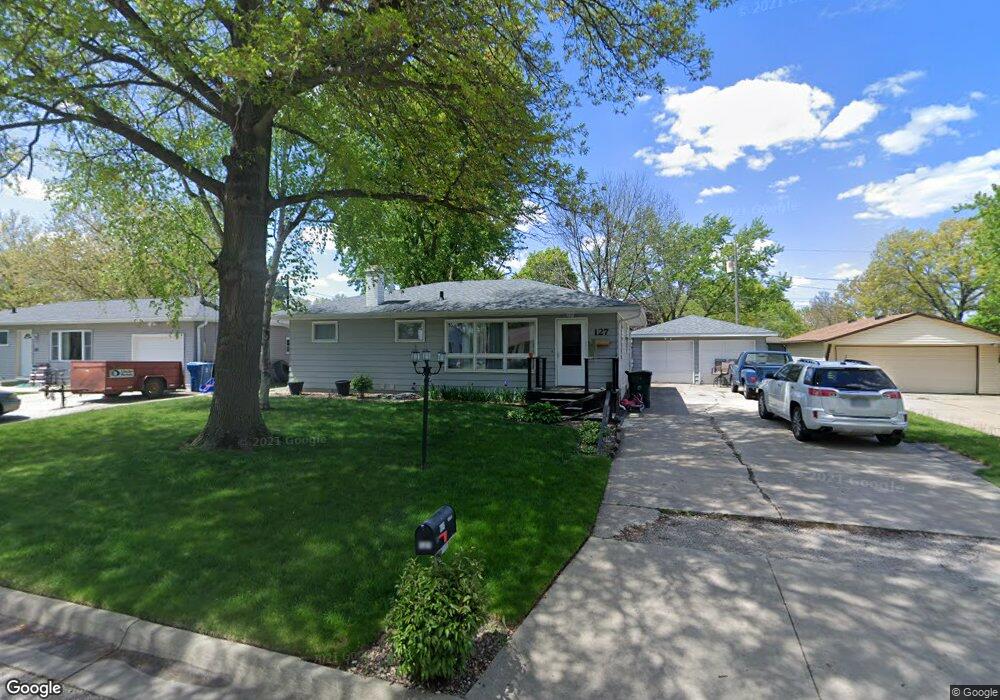
127 Desoto Ave Waterloo, IA 50701
Estimated Value: $174,000 - $190,313
3
Beds
2
Baths
1,438
Sq Ft
$128/Sq Ft
Est. Value
About This Home
This home is located at 127 Desoto Ave, Waterloo, IA 50701 and is currently estimated at $184,078, approximately $128 per square foot. 127 Desoto Ave is a home located in Black Hawk County with nearby schools including Becker Elementary School, Central Middle School, and East High School.
Ownership History
Date
Name
Owned For
Owner Type
Purchase Details
Closed on
Mar 6, 2015
Sold by
Surovy Robert D and Surovy Angela D
Bought by
Case Kelli J
Current Estimated Value
Home Financials for this Owner
Home Financials are based on the most recent Mortgage that was taken out on this home.
Original Mortgage
$107,670
Outstanding Balance
$81,307
Interest Rate
3.62%
Mortgage Type
Adjustable Rate Mortgage/ARM
Estimated Equity
$102,771
Purchase Details
Closed on
Nov 17, 2006
Sold by
Schmitt Gerald M and Schmitt Jean M
Bought by
Surovy Robert D and Surovy Angela D
Home Financials for this Owner
Home Financials are based on the most recent Mortgage that was taken out on this home.
Original Mortgage
$90,000
Interest Rate
6.4%
Mortgage Type
Purchase Money Mortgage
Create a Home Valuation Report for This Property
The Home Valuation Report is an in-depth analysis detailing your home's value as well as a comparison with similar homes in the area
Purchase History
| Date | Buyer | Sale Price | Title Company |
|---|---|---|---|
| Case Kelli J | $165,750 | None Available | |
| Surovy Robert D | $78,000 | Black Hawk County Abstract C |
Source: Public Records
Mortgage History
| Date | Status | Borrower | Loan Amount |
|---|---|---|---|
| Open | Case Kelli J | $107,670 | |
| Previous Owner | Surovy Robert D | $90,000 |
Source: Public Records
Tax History
| Year | Tax Paid | Tax Assessment Tax Assessment Total Assessment is a certain percentage of the fair market value that is determined by local assessors to be the total taxable value of land and additions on the property. | Land | Improvement |
|---|---|---|---|---|
| 2025 | $3,088 | $165,340 | $24,150 | $141,190 |
| 2024 | $3,088 | $152,540 | $24,150 | $128,390 |
| 2023 | $2,550 | $152,540 | $24,150 | $128,390 |
| 2022 | $2,482 | $125,020 | $24,150 | $100,870 |
| 2021 | $2,274 | $125,020 | $24,150 | $100,870 |
| 2020 | $2,232 | $108,970 | $17,710 | $91,260 |
| 2019 | $2,232 | $108,970 | $17,710 | $91,260 |
| 2018 | $2,156 | $108,970 | $17,710 | $91,260 |
| 2017 | $2,224 | $105,380 | $17,710 | $87,670 |
| 2016 | $2,192 | $105,380 | $17,710 | $87,670 |
| 2015 | $2,192 | $105,380 | $17,710 | $87,670 |
| 2014 | $2,236 | $105,380 | $17,710 | $87,670 |
Source: Public Records
Map
Nearby Homes
- 179 Letsch Rd
- 301 S Hackett Rd
- 313 Westbourne Rd
- 2117 Tilbury Rd
- 3709 Cadillac Dr
- 320 Valley Rd
- 2151 Grand Blvd
- 0 Bergen Dr
- 412 Hughes Dr
- 328 Drynan Dr
- 114 Hanna Blvd
- 211 Auburn St
- 456 Loma St
- 206 Loma St
- 2.29 Acres Ansborough Ave
- 2522 Sunset Blvd
- 819 Hanna Blvd
- 943 Progress Ave
- 712 Upton Ave
- 1811 Sager Ave
- 121 Desoto Ave
- 112 Cortez Cir
- 116 Cortez Cir
- 145 Desoto Ave
- 132 Desoto Ave
- 126 Desoto Ave
- 111 Desoto Ave
- 1614 Rainbow Dr
- 120 Desoto Ave
- 140 Desoto Ave
- 217 Desoto Ave
- 103 Desoto Ave
- 117 Cortez Cir
- 114 Desoto Ave
- 108 Cortez Cir
- 225 Desoto Ave
- 108 Desoto Ave
- 113 Cortez Cir
- 102 Desoto Ave
- 1704 Rainbow Dr