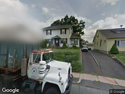
127 Division Ave Hasbrouck Heights, NJ 07604
Estimated Value: $558,201 - $631,000
--
Bed
--
Bath
1,279
Sq Ft
$465/Sq Ft
Est. Value
About This Home
This home is located at 127 Division Ave, Hasbrouck Heights, NJ 07604 and is currently estimated at $594,300, approximately $464 per square foot. 127 Division Ave is a home located in Bergen County with nearby schools including Hasbrouck Heights High School and Corpus Christi School.
Ownership History
Date
Name
Owned For
Owner Type
Purchase Details
Closed on
Mar 9, 2021
Sold by
Blanusa Dragan and Blanusa Mary K
Bought by
Blanusa Mary K
Current Estimated Value
Home Financials for this Owner
Home Financials are based on the most recent Mortgage that was taken out on this home.
Original Mortgage
$329,200
Interest Rate
3.02%
Purchase Details
Closed on
Jan 4, 2007
Sold by
Saccomano William J
Bought by
Blanusa Dragan and Blanusa Mary K
Home Financials for this Owner
Home Financials are based on the most recent Mortgage that was taken out on this home.
Original Mortgage
$374,000
Interest Rate
6.14%
Mortgage Type
Unknown
Create a Home Valuation Report for This Property
The Home Valuation Report is an in-depth analysis detailing your home's value as well as a comparison with similar homes in the area
Home Values in the Area
Average Home Value in this Area
Purchase History
| Date | Buyer | Sale Price | Title Company |
|---|---|---|---|
| Blanusa Mary K | -- | None Available | |
| Blanusa Dragan | -- | -- | |
| -- | $394,000 | -- |
Source: Public Records
Mortgage History
| Date | Status | Borrower | Loan Amount |
|---|---|---|---|
| Open | Blanusa Mary K | $455,840 | |
| Closed | Blanusa Mary K | $384,000 | |
| Closed | Blanusa Mary K | $328,200 | |
| Closed | Blanusa Mary K | $329,200 | |
| Closed | Blanusa Mary K | $31,176 | |
| Closed | Blanusa Mary K | $374,000 | |
| Closed | -- | $374,000 |
Source: Public Records
Tax History Compared to Growth
Tax History
| Year | Tax Paid | Tax Assessment Tax Assessment Total Assessment is a certain percentage of the fair market value that is determined by local assessors to be the total taxable value of land and additions on the property. | Land | Improvement |
|---|---|---|---|---|
| 2024 | $9,710 | $393,200 | $227,900 | $165,300 |
| 2023 | $9,449 | $376,800 | $217,900 | $158,900 |
| 2022 | $9,449 | $351,000 | $200,400 | $150,600 |
| 2021 | $9,192 | $325,500 | $187,900 | $137,600 |
| 2020 | $9,143 | $317,900 | $180,400 | $137,500 |
| 2019 | $8,893 | $312,600 | $177,900 | $134,700 |
| 2018 | $8,761 | $307,200 | $175,400 | $131,800 |
| 2017 | $8,622 | $301,900 | $172,900 | $129,000 |
| 2016 | $8,677 | $285,900 | $162,900 | $123,000 |
| 2015 | $8,537 | $285,900 | $162,900 | $123,000 |
| 2014 | $8,303 | $285,900 | $162,900 | $123,000 |
Source: Public Records
Map
Nearby Homes
- 39 Division Ave
- 38 Springfield Ave
- 262 Raymond St
- 100 Woodside Ave
- 14 Jefferson Ave Unit 16
- 7 Staal Ln
- 204 F Terhune Ave Unit F
- 204 Terhune Ave Unit F
- 110 Harrison Ave
- 5 Wesmont Dr
- 211 Harrison Ave
- 119 Eisenhower Ln Unit 2104
- 129 Eisenhower Ln Unit 2109
- 415 Jefferson Ave
- 11 Veterans Dr
- 65 Wesmont Dr
- 69 Wesmont Dr Unit 1809
- 145 Madison Ave
- 129 Roosevelt Dr
- 66 Terhune Ave Unit 13
- 127 Division Ave
- 131 Division Ave
- 123 Division Ave
- 135 Division Ave
- 126 Walter Ave
- 130 Walter Ave
- 122 Walter Ave
- 117 Division Ave
- 134 Walter Ave
- 139 Division Ave
- 118 Walter Ave
- 128 Division Ave
- 124 Division Ave
- 111 Division Ave
- 132 Division Ave
- 112 Walter Ave
- 120 Division Ave
- 140 Walter Ave
- 143 Division Ave
- 134 Division Ave