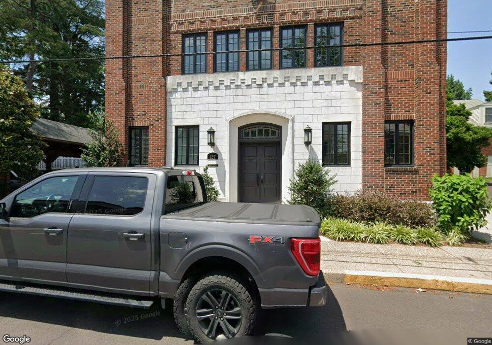
127 E State St Unit 2 Doylestown, PA 18901
Estimated Value: $1,462,000 - $2,020,000
3
Beds
4
Baths
4,165
Sq Ft
$419/Sq Ft
Est. Value
About This Home
This home is located at 127 E State St Unit 2, Doylestown, PA 18901 and is currently estimated at $1,745,116, approximately $418 per square foot. 127 E State St Unit 2 is a home located in Bucks County with nearby schools including Linden El School, Lenape Middle School, and Central Bucks High School-West.
Ownership History
Date
Name
Owned For
Owner Type
Purchase Details
Closed on
Oct 20, 2020
Sold by
Zellan Lester and Lowry Barbara
Bought by
Taylor Jacob E and Ernst Norman Timothy
Current Estimated Value
Home Financials for this Owner
Home Financials are based on the most recent Mortgage that was taken out on this home.
Original Mortgage
$1,250,000
Outstanding Balance
$1,118,745
Interest Rate
3.25%
Mortgage Type
Adjustable Rate Mortgage/ARM
Estimated Equity
$626,371
Purchase Details
Closed on
Jan 9, 2017
Sold by
Pump Investments Llc
Bought by
Lowry Barbara and Zellan Lester
Create a Home Valuation Report for This Property
The Home Valuation Report is an in-depth analysis detailing your home's value as well as a comparison with similar homes in the area
Home Values in the Area
Average Home Value in this Area
Purchase History
| Date | Buyer | Sale Price | Title Company |
|---|---|---|---|
| Taylor Jacob E | $1,400,000 | Tohickson Stlmt Svcs Inc | |
| Lowry Barbara | $1,750,000 | None Available |
Source: Public Records
Mortgage History
| Date | Status | Borrower | Loan Amount |
|---|---|---|---|
| Open | Taylor Jacob E | $1,250,000 |
Source: Public Records
Tax History
| Year | Tax Paid | Tax Assessment Tax Assessment Total Assessment is a certain percentage of the fair market value that is determined by local assessors to be the total taxable value of land and additions on the property. | Land | Improvement |
|---|---|---|---|---|
| 2025 | $26,664 | $148,010 | -- | $148,010 |
| 2024 | $26,664 | $148,010 | $0 | $148,010 |
| 2023 | $25,403 | $148,010 | $0 | $148,010 |
| 2022 | $25,051 | $148,010 | $0 | $148,010 |
| 2021 | $29,419 | $175,750 | $0 | $175,750 |
| 2020 | $29,095 | $175,750 | $0 | $175,750 |
| 2019 | $28,775 | $175,750 | $0 | $175,750 |
| 2018 | $28,423 | $175,750 | $0 | $175,750 |
| 2017 | $0 | $175,750 | $0 | $175,750 |
Source: Public Records
Map
Nearby Homes
- 146 E Court St
- 69 E Oakland Ave
- 110 E Ashland St
- 169 N Main St
- 150 Selner Ln
- 61 N Hamilton St
- 102 Clear Springs Ct
- 236 Green St
- 209 Harvey Ave
- 333 Lacey Ave Unit B9
- 190 Decatur St
- 109 S West St
- 180 N Clinton St
- 215 N Franklin St
- 195 Lafayette St
- 173 Washington St
- 45 Creek Dr
- 807 N Broad St
- 607 S Chubb Dr
- 2-7 Aspen Way Unit 27
- 127 E State St
- 127 E State St Unit 1
- 127 E State St Unit 2
- 5 Barnes Ct
- 10 Barnes Ct Unit 501
- 7 Barnes Ct Unit 304
- 4 Barnes Ct Unit 302
- 4 Barnes Ct Unit 301
- 5 Barnes Ct Unit 302
- 2 Barnes Ct
- 3 Barnes Ct Unit 201
- 1 Barnes Ct
- 128 E State St Unit GROUND
- 128 E State St
- 115 E State St Unit 501
- 29 S Broad St
- 100 Garden Aly Unit 201
- 100 Garden Aly
- 100 Garden Aly Unit 3
- 100 Garden Aly Unit 8
Your Personal Tour Guide
Ask me questions while you tour the home.