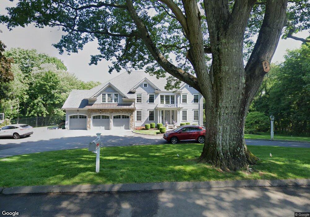
127 Field Rock Rd Southport, CT 06890
Estimated Value: $1,473,000 - $2,658,000
3
Beds
3
Baths
2,484
Sq Ft
$874/Sq Ft
Est. Value
About This Home
This home is located at 127 Field Rock Rd, Southport, CT 06890 and is currently estimated at $2,170,572, approximately $873 per square foot. 127 Field Rock Rd is a home located in Fairfield County with nearby schools including Mill Hill School, Roger Ludlowe Middle School, and Fairfield Ludlowe High School.
Ownership History
Date
Name
Owned For
Owner Type
Purchase Details
Closed on
Sep 21, 2010
Sold by
Flannery Roberta W
Bought by
Rosnick Michael P and Rosnick Emily P
Current Estimated Value
Home Financials for this Owner
Home Financials are based on the most recent Mortgage that was taken out on this home.
Original Mortgage
$900,000
Interest Rate
4.51%
Create a Home Valuation Report for This Property
The Home Valuation Report is an in-depth analysis detailing your home's value as well as a comparison with similar homes in the area
Home Values in the Area
Average Home Value in this Area
Purchase History
| Date | Buyer | Sale Price | Title Company |
|---|---|---|---|
| Rosnick Michael P | $730,000 | -- | |
| Rosnick Michael P | $730,000 | -- |
Source: Public Records
Mortgage History
| Date | Status | Borrower | Loan Amount |
|---|---|---|---|
| Open | Rosnick Michael P | $700,000 | |
| Closed | Rosnick Michael P | $900,000 |
Source: Public Records
Tax History Compared to Growth
Tax History
| Year | Tax Paid | Tax Assessment Tax Assessment Total Assessment is a certain percentage of the fair market value that is determined by local assessors to be the total taxable value of land and additions on the property. | Land | Improvement |
|---|---|---|---|---|
| 2025 | $32,767 | $1,154,160 | $516,390 | $637,770 |
| 2024 | $32,201 | $1,154,160 | $516,390 | $637,770 |
| 2023 | $31,751 | $1,154,160 | $516,390 | $637,770 |
| 2022 | $31,439 | $1,154,160 | $516,390 | $637,770 |
| 2021 | $31,139 | $1,154,160 | $516,390 | $637,770 |
| 2020 | $31,156 | $1,162,980 | $511,210 | $651,770 |
| 2019 | $31,156 | $1,162,980 | $511,210 | $651,770 |
| 2018 | $30,656 | $1,162,980 | $511,210 | $651,770 |
| 2017 | $30,028 | $1,162,980 | $511,210 | $651,770 |
| 2016 | $29,400 | $1,155,210 | $511,210 | $644,000 |
| 2015 | $25,162 | $1,015,000 | $511,000 | $504,000 |
| 2014 | $24,766 | $1,015,000 | $511,000 | $504,000 |
Source: Public Records
Map
Nearby Homes
- 11 Twin Brooks Ln
- 1135 Mill Hill Rd
- 254 Sherwood Farm Rd
- 232 Pell Meadow Dr
- 83 Pell Meadow Dr
- 476 Mill Hill Terrace
- 56 Drake Ln
- 647 Bronson Rd
- 2683 Bronson Rd
- 105 Charter Oak Rd
- 66 Adams Rd
- 688 Hulls Farm Rd
- 844 Mill Hill Terrace
- 33 Middlebrook Place
- 44 Deer Run Rd
- 53 Hilltop Dr
- 400 Bronson Rd
- 25 Millspaugh Dr
- 1001 Hulls Farm Rd
- 338 Orchard Hill Ln
- 92 Field Rock Rd
- 159 Field Rock Rd
- 93 Field Rock Rd
- 180 Field Rock Rd
- 45 Field Rock Rd
- 211 Warner Hill Rd
- 129 Cedar Rd
- 1785 Bronson Rd
- 32 Field Rock Rd
- 191 Field Rock Rd
- 1677 Bronson Rd
- 270 Warner Hill Rd
- 121 Cedar Rd
- 265 Warner Hill Rd
- 29 Cedar Rd
- 61 Cedar Rd
- 151 Cedar Rd
- 1731 Bronson Rd
- 1700 Bronson Rd
- 170 Warner Hill Rd