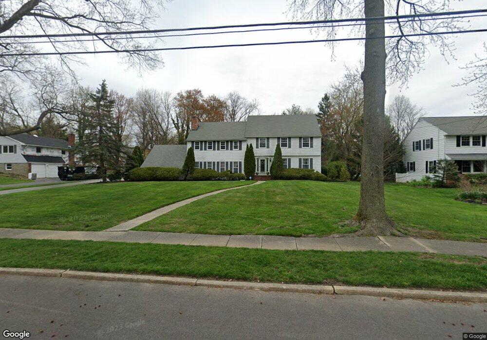
127 Forest Rd Moorestown, NJ 08057
Estimated Value: $920,000 - $1,107,000
--
Bed
--
Bath
3,698
Sq Ft
$274/Sq Ft
Est. Value
About This Home
This home is located at 127 Forest Rd, Moorestown, NJ 08057 and is currently estimated at $1,013,683, approximately $274 per square foot. 127 Forest Rd is a home located in Burlington County with nearby schools including Mary E. Roberts Elementary School, Moorestown Upper Elementary School, and William Allen Middle School.
Ownership History
Date
Name
Owned For
Owner Type
Purchase Details
Closed on
May 9, 2008
Sold by
Seddon Robert A and Moretti Seddon Joan
Bought by
Lopko Walter and Lopko Traci
Current Estimated Value
Home Financials for this Owner
Home Financials are based on the most recent Mortgage that was taken out on this home.
Original Mortgage
$370,000
Outstanding Balance
$235,053
Interest Rate
5.94%
Mortgage Type
Purchase Money Mortgage
Estimated Equity
$778,630
Create a Home Valuation Report for This Property
The Home Valuation Report is an in-depth analysis detailing your home's value as well as a comparison with similar homes in the area
Home Values in the Area
Average Home Value in this Area
Purchase History
| Date | Buyer | Sale Price | Title Company |
|---|---|---|---|
| Lopko Walter | $590,000 | Stewart Title Guaranty Co |
Source: Public Records
Mortgage History
| Date | Status | Borrower | Loan Amount |
|---|---|---|---|
| Open | Lopko Walter | $370,000 |
Source: Public Records
Tax History Compared to Growth
Tax History
| Year | Tax Paid | Tax Assessment Tax Assessment Total Assessment is a certain percentage of the fair market value that is determined by local assessors to be the total taxable value of land and additions on the property. | Land | Improvement |
|---|---|---|---|---|
| 2025 | $15,760 | $555,500 | $183,300 | $372,200 |
| 2024 | $15,282 | $555,500 | $183,300 | $372,200 |
| 2023 | $15,282 | $555,500 | $183,300 | $372,200 |
| 2022 | $15,126 | $555,500 | $183,300 | $372,200 |
| 2021 | $14,926 | $555,500 | $183,300 | $372,200 |
| 2020 | $14,832 | $555,500 | $183,300 | $372,200 |
| 2019 | $14,571 | $555,500 | $183,300 | $372,200 |
| 2018 | $13,730 | $538,000 | $183,300 | $354,700 |
| 2017 | $13,848 | $538,000 | $183,300 | $354,700 |
| 2016 | $13,800 | $538,000 | $183,300 | $354,700 |
| 2015 | $13,633 | $538,000 | $183,300 | $354,700 |
| 2014 | $12,944 | $538,000 | $183,300 | $354,700 |
Source: Public Records
Map
Nearby Homes
- 601 Stratford Dr
- 600 Stratford Dr
- 21 Foxwood Dr Unit 21
- 403 S Lenola Rd
- 531 Covington Terrace
- 801 E Camden Ave
- 308 Kenwood Dr
- 206 E Camden Ave
- 709 Manor Terrace
- 313 Fairview Ave
- 316 W 3rd St
- 423 Park Blvd
- 4 W Close
- 149 Chalkboard Ct
- 14 Vincent Way
- 316 Farmdale Rd
- 308 Farmdale Rd
- 21 N Lenola Rd
- 129 S Church St
- 310 S Washington Ave
- 123 Forest Rd
- 131 Forest Rd
- 132 Avon Terrace
- 119 Forest Rd
- 140 Avon Terrace
- 128 Avon Terrace
- 135 Forest Rd
- 124 Forest Rd
- 128 Forest Rd
- 124 Avon Terrace
- 120 Forest Rd
- 115 Forest Rd
- 146 Avon Terrace
- 132 Forest Rd
- 120 Avon Terrace
- 116 Forest Rd
- 139 Forest Rd
- 136 Forest Rd
- 137 Avon Terrace
- 617 Stratford Dr