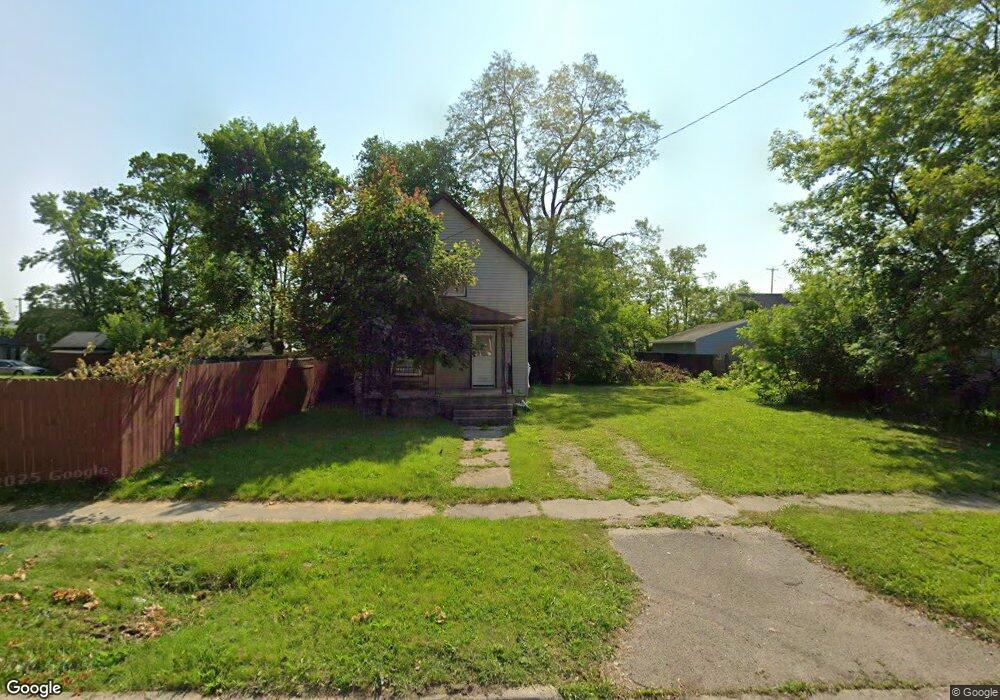
127 Grenville St Battle Creek, MI 49014
Post Franklin NeighborhoodEstimated Value: $20,570 - $52,000
2
Beds
1
Bath
1,000
Sq Ft
$33/Sq Ft
Est. Value
About This Home
This home is located at 127 Grenville St, Battle Creek, MI 49014 and is currently estimated at $33,190, approximately $33 per square foot. 127 Grenville St is a home located in Calhoun County with nearby schools including Post-Franklin Elementary School, Springfield Middle School, and Battle Creek Central High School.
Ownership History
Date
Name
Owned For
Owner Type
Purchase Details
Closed on
Nov 18, 2015
Sold by
Calhoun County Treasurer
Bought by
Calhoun County Land Bank Authority
Current Estimated Value
Purchase Details
Closed on
Nov 9, 2009
Sold by
Willavize Larry A
Bought by
Diggs Andre
Purchase Details
Closed on
Jul 6, 1999
Sold by
Hartman Darrell M
Bought by
Willavize
Purchase Details
Closed on
Apr 23, 1998
Bought by
Hartman
Purchase Details
Closed on
May 3, 1993
Sold by
Hartman Sandra G
Bought by
Hartman Darrell M
Create a Home Valuation Report for This Property
The Home Valuation Report is an in-depth analysis detailing your home's value as well as a comparison with similar homes in the area
Home Values in the Area
Average Home Value in this Area
Purchase History
| Date | Buyer | Sale Price | Title Company |
|---|---|---|---|
| Calhoun County Land Bank Authority | -- | None Available | |
| Diggs Andre | $7,500 | First American Title Ins Co | |
| Willavize | $15,000 | -- | |
| Hartman | -- | -- | |
| Hartman Darrell M | -- | -- |
Source: Public Records
Tax History Compared to Growth
Tax History
| Year | Tax Paid | Tax Assessment Tax Assessment Total Assessment is a certain percentage of the fair market value that is determined by local assessors to be the total taxable value of land and additions on the property. | Land | Improvement |
|---|---|---|---|---|
| 2025 | -- | $0 | $0 | $0 |
| 2024 | -- | $0 | $0 | $0 |
| 2023 | -- | $0 | $0 | $0 |
| 2022 | $0 | $0 | $0 | $0 |
| 2021 | $0 | $0 | $0 | $0 |
| 2020 | $0 | $0 | $0 | $0 |
| 2019 | $0 | $0 | $0 | $0 |
| 2018 | $0 | $0 | $0 | $0 |
| 2017 | -- | $0 | $0 | $0 |
| 2016 | -- | $0 | $0 | $0 |
| 2015 | $1,297 | $16,747 | $1,801 | $14,946 |
| 2014 | $1,297 | $12,635 | $1,801 | $10,834 |
Source: Public Records
Map
Nearby Homes
- 125 Grenville St
- 123 Grenville St
- 151 Post Ave
- 119 Grenville St
- 159 Post Ave
- 116 Nelson St
- 163 Post Ave
- 145 Post Ave
- 178 Lathrop Ave
- 128 Grenville St
- 126 Grenville St
- 165 Post Ave
- 165 Post Ave Unit 2
- 114 Nelson St
- 169 Post Ave
- 141 Post Ave
- 170 Lathrop Ave
- 120 Grenville St
- 184 Lathrop Ave
- 166 Lathrop Ave