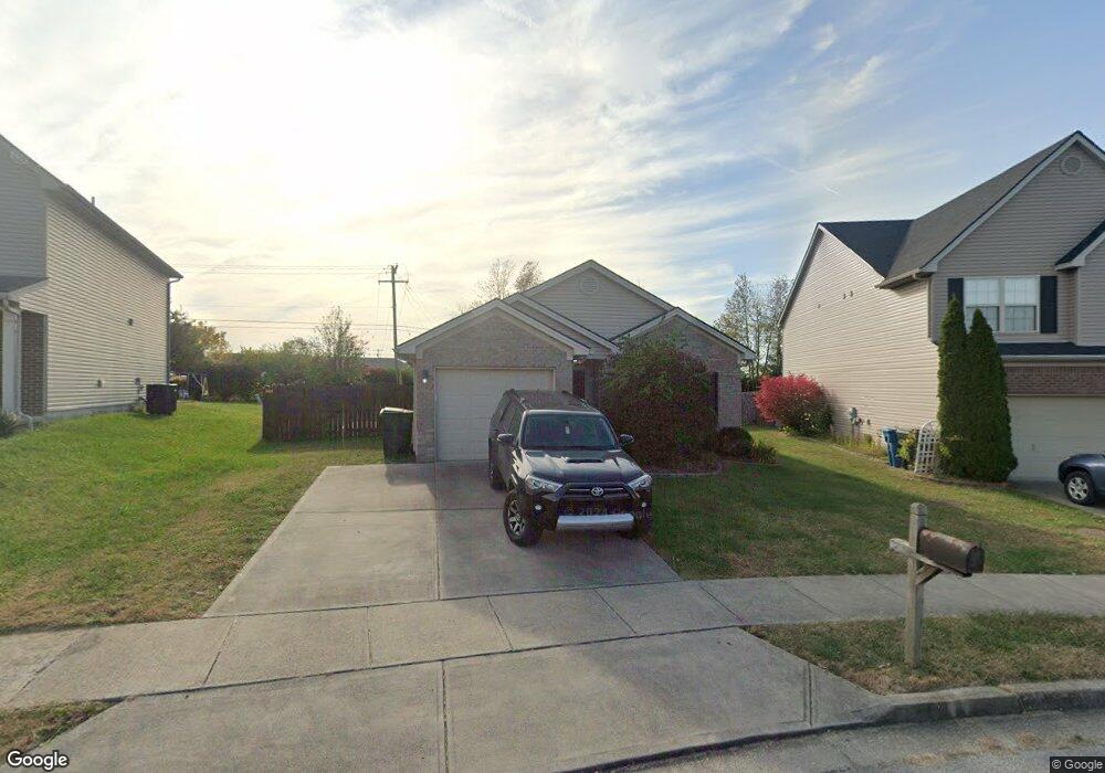
127 Grisham Dr Georgetown, KY 40324
Bradford Place NeighborhoodEstimated Value: $247,000 - $280,000
3
Beds
2
Baths
1,208
Sq Ft
$221/Sq Ft
Est. Value
About This Home
This home is located at 127 Grisham Dr, Georgetown, KY 40324 and is currently estimated at $266,408, approximately $220 per square foot. 127 Grisham Dr is a home located in Scott County with nearby schools including Southern Elementary School, Georgetown Middle School, and Scott County High School.
Ownership History
Date
Name
Owned For
Owner Type
Purchase Details
Closed on
Nov 8, 2011
Sold by
Meece Michael W and Meece Ashley D
Bought by
Hardesty Pamela S
Current Estimated Value
Home Financials for this Owner
Home Financials are based on the most recent Mortgage that was taken out on this home.
Original Mortgage
$124,440
Outstanding Balance
$83,894
Interest Rate
4.09%
Mortgage Type
New Conventional
Estimated Equity
$182,514
Purchase Details
Closed on
Jul 31, 2007
Sold by
Ball Homes Llc
Bought by
Meece Michael W and Meece Ashley D
Home Financials for this Owner
Home Financials are based on the most recent Mortgage that was taken out on this home.
Original Mortgage
$120,273
Interest Rate
6.62%
Mortgage Type
New Conventional
Create a Home Valuation Report for This Property
The Home Valuation Report is an in-depth analysis detailing your home's value as well as a comparison with similar homes in the area
Home Values in the Area
Average Home Value in this Area
Purchase History
| Date | Buyer | Sale Price | Title Company |
|---|---|---|---|
| Hardesty Pamela S | $122,000 | None Available | |
| Meece Michael W | $120,273 | Multiple |
Source: Public Records
Mortgage History
| Date | Status | Borrower | Loan Amount |
|---|---|---|---|
| Open | Hardesty Pamela S | $124,440 | |
| Previous Owner | Meece Michael W | $120,273 |
Source: Public Records
Tax History
| Year | Tax Paid | Tax Assessment Tax Assessment Total Assessment is a certain percentage of the fair market value that is determined by local assessors to be the total taxable value of land and additions on the property. | Land | Improvement |
|---|---|---|---|---|
| 2025 | $1,768 | $198,500 | $0 | $0 |
| 2024 | $17 | $198,500 | $0 | $0 |
| 2023 | $1,695 | $186,900 | $42,000 | $144,900 |
| 2022 | $1,427 | $167,800 | $35,000 | $132,800 |
| 2021 | $1,456 | $154,600 | $35,000 | $119,600 |
| 2020 | $1,224 | $142,500 | $35,000 | $107,500 |
| 2019 | $1,157 | $132,600 | $0 | $0 |
| 2018 | $1,088 | $125,392 | $0 | $0 |
| 2017 | $1,093 | $125,392 | $0 | $0 |
| 2016 | $982 | $122,000 | $0 | $0 |
| 2015 | $976 | $122,000 | $0 | $0 |
| 2014 | $1,012 | $122,000 | $0 | $0 |
| 2011 | $75 | $120,273 | $0 | $0 |
Source: Public Records
Map
Nearby Homes
- 118 Chamberlain Dr
- 109 Crescent Way
- 107 Crescent Way
- 103 Crescent Way
- 101 Crescent Way
- 116 Crescent Way
- 105 Crescent Way
- 120 Crescent Way
- 111 Crescent Way
- 113 Crescent Way
- 117 Crescent Way
- 119 Crescent Way
- 121 Crescent Way
- 129 Compass Trail
- 106 Ransom Trace
- 138 Magellan Ln
- 140 Magellan Ln
- 144 Magellan Ln
- 152 Magellan Ln
- 109 Corsali Way
- 129 Grisham Dr
- 125 Grisham Dr
- 131 Grisham Dr
- 123 Grisham Dr
- 133 Grisham Dr
- 126 Grisham Dr
- 121 Grisham Dr
- 135 Grisham Dr
- 117 Cabot Place
- 120 Grisham Dr
- 119 Grisham Dr
- 145 Chamberlain Dr
- 137 Grisham Dr
- 143 Chamberlain Dr
- 118 Grisham Dr
- 115 Cabot Place
- 117 Grisham Dr Unit 4B
- 141 Chamberlain Dr
- 113 Cabot Place
- 139 Grisham Dr
Your Personal Tour Guide
Ask me questions while you tour the home.