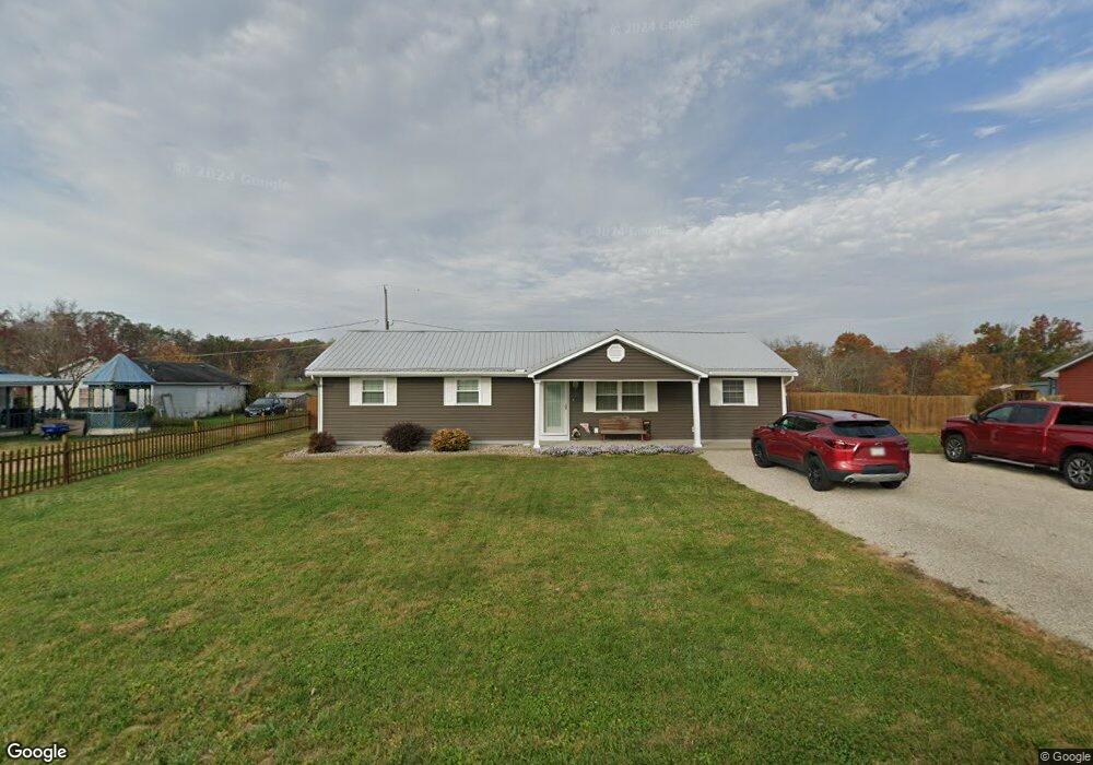
127 Hale Dr West Union, OH 45693
Estimated Value: $108,000 - $166,000
3
Beds
1
Bath
1,416
Sq Ft
$92/Sq Ft
Est. Value
About This Home
This home is located at 127 Hale Dr, West Union, OH 45693 and is currently estimated at $130,641, approximately $92 per square foot. 127 Hale Dr is a home located in Adams County with nearby schools including West Union Elementary School, West Union High School, and Adams County Christian School.
Ownership History
Date
Name
Owned For
Owner Type
Purchase Details
Closed on
Apr 8, 2022
Sold by
Tumbleson Jeffrey W
Bought by
Jeffrey W Tumbleson and Melissa A Tumbleson
Current Estimated Value
Purchase Details
Closed on
Apr 7, 2022
Sold by
Tumbleson Jeffrey W
Bought by
Tumbleson Jeffrey W and Tumbleson Melissa A
Purchase Details
Closed on
Jan 12, 1998
Sold by
Whalen John P
Bought by
Tumbleson Jeffrey W
Purchase Details
Closed on
Mar 18, 1991
Bought by
Whalen John P
Create a Home Valuation Report for This Property
The Home Valuation Report is an in-depth analysis detailing your home's value as well as a comparison with similar homes in the area
Purchase History
| Date | Buyer | Sale Price | Title Company |
|---|---|---|---|
| Jeffrey W Tumbleson | -- | -- | |
| Tumbleson Jeffrey W | -- | None Listed On Document | |
| Tumbleson Jeffrey W | $45,000 | -- | |
| Whalen John P | $17,500 | -- |
Source: Public Records
Tax History
| Year | Tax Paid | Tax Assessment Tax Assessment Total Assessment is a certain percentage of the fair market value that is determined by local assessors to be the total taxable value of land and additions on the property. | Land | Improvement |
|---|---|---|---|---|
| 2025 | $951 | $28,390 | $4,380 | $24,010 |
| 2024 | $476 | $28,390 | $4,380 | $24,010 |
| 2023 | $479 | $28,390 | $4,380 | $24,010 |
| 2022 | $974 | $25,770 | $3,330 | $22,440 |
| 2021 | $959 | $25,770 | $3,330 | $22,440 |
| 2020 | $981 | $25,770 | $3,330 | $22,440 |
| 2019 | $981 | $25,770 | $3,330 | $22,440 |
| 2018 | $823 | $22,020 | $3,330 | $18,690 |
| 2017 | $809 | $22,020 | $3,330 | $18,690 |
| 2016 | $808 | $22,020 | $3,330 | $18,690 |
| 2015 | $750 | $21,150 | $3,750 | $17,400 |
| 2014 | $750 | $21,150 | $3,750 | $17,400 |
Source: Public Records
Map
Nearby Homes
- 9598 State Route 41
- 40 Greenwood Ave
- 81 Evergreen St
- 230 Hope Ln
- 1070 Eagle Creek Rd
- 7925 St Rt 41
- 144 ac Pumpkin Ridge Rd
- 286 & 290 S Market St
- 408 W South St
- 305 W Walnut St
- 700 Tony Rd
- 186 S Market St
- 80 Madonna Dr
- 0.8ac State Route 41
- 12196 State Route 41
- 537 1st St
- 5768 State Route 125
- 104 N Washington St
- 419 E Main St
- Lot 5 Mark Dr
Your Personal Tour Guide
Ask me questions while you tour the home.