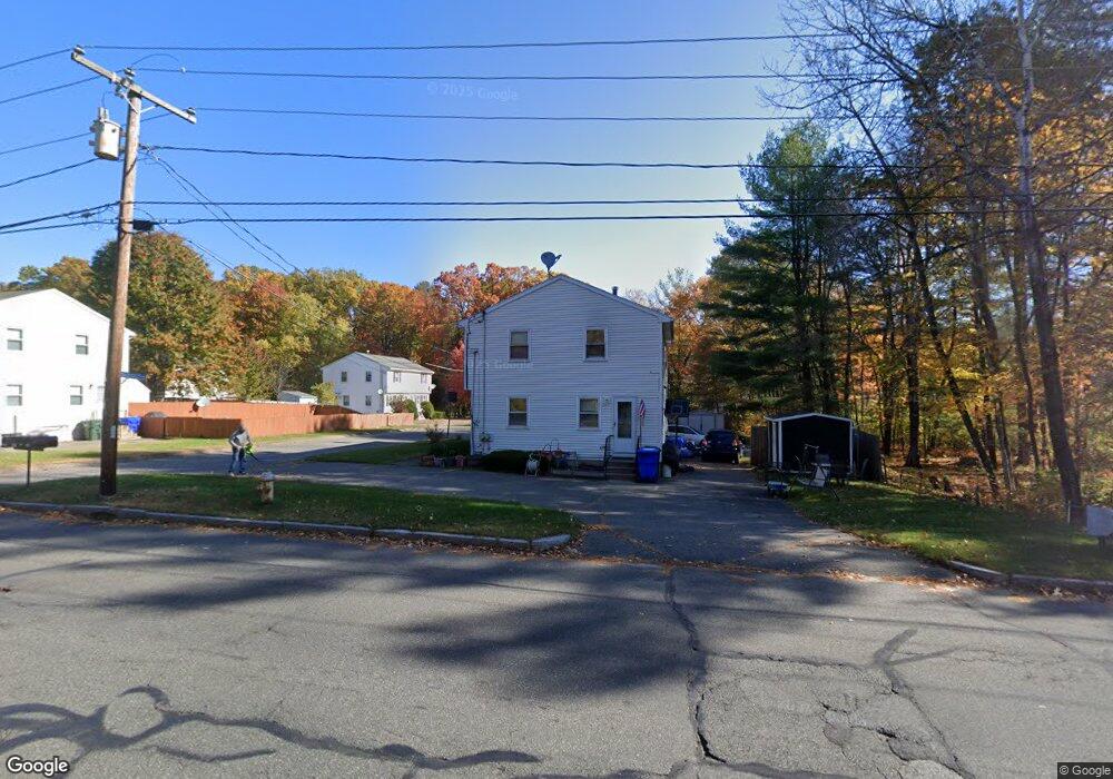
127 Kent Rd Unit 129 Springfield, MA 01129
Boston Road NeighborhoodEstimated Value: $348,013 - $453,000
4
Beds
2
Baths
1,764
Sq Ft
$224/Sq Ft
Est. Value
About This Home
This home is located at 127 Kent Rd Unit 129, Springfield, MA 01129 and is currently estimated at $395,753, approximately $224 per square foot. 127 Kent Rd Unit 129 is a home located in Hampden County with nearby schools including Warner, M Marcus Kiley Middle, and Springfield Central High School.
Ownership History
Date
Name
Owned For
Owner Type
Purchase Details
Closed on
Feb 28, 2005
Sold by
Lamon Michelle M and Lamon Scott C
Bought by
Erricolo Marc J
Current Estimated Value
Home Financials for this Owner
Home Financials are based on the most recent Mortgage that was taken out on this home.
Original Mortgage
$166,725
Outstanding Balance
$85,196
Interest Rate
5.73%
Mortgage Type
Purchase Money Mortgage
Estimated Equity
$310,557
Purchase Details
Closed on
Apr 23, 2003
Sold by
Boszko Stanley A
Bought by
Lamon Michele M and Lamon Scott C
Home Financials for this Owner
Home Financials are based on the most recent Mortgage that was taken out on this home.
Original Mortgage
$105,600
Interest Rate
5.64%
Mortgage Type
Purchase Money Mortgage
Purchase Details
Closed on
Jan 25, 1994
Sold by
H&F Prop and Horner Gordon
Bought by
Boszko Stanley A
Home Financials for this Owner
Home Financials are based on the most recent Mortgage that was taken out on this home.
Original Mortgage
$73,500
Interest Rate
7.08%
Mortgage Type
Purchase Money Mortgage
Create a Home Valuation Report for This Property
The Home Valuation Report is an in-depth analysis detailing your home's value as well as a comparison with similar homes in the area
Home Values in the Area
Average Home Value in this Area
Purchase History
| Date | Buyer | Sale Price | Title Company |
|---|---|---|---|
| Erricolo Marc J | $175,500 | -- | |
| Lamon Michele M | $132,000 | -- | |
| Boszko Stanley A | $105,000 | -- |
Source: Public Records
Mortgage History
| Date | Status | Borrower | Loan Amount |
|---|---|---|---|
| Open | Erricolo Marc J | $166,725 | |
| Previous Owner | Lamon Michele M | $105,600 | |
| Previous Owner | Boszko Stanley A | $73,500 |
Source: Public Records
Tax History Compared to Growth
Tax History
| Year | Tax Paid | Tax Assessment Tax Assessment Total Assessment is a certain percentage of the fair market value that is determined by local assessors to be the total taxable value of land and additions on the property. | Land | Improvement |
|---|---|---|---|---|
| 2025 | $4,680 | $298,500 | $57,700 | $240,800 |
| 2024 | $4,812 | $299,600 | $57,700 | $241,900 |
| 2023 | $4,300 | $252,200 | $54,900 | $197,300 |
| 2022 | $4,317 | $229,400 | $54,900 | $174,500 |
| 2021 | $4,149 | $219,500 | $49,900 | $169,600 |
| 2020 | $3,648 | $186,800 | $37,100 | $149,700 |
| 2019 | $3,483 | $177,000 | $37,100 | $139,900 |
| 2018 | $3,292 | $167,300 | $37,100 | $130,200 |
| 2017 | $3,212 | $163,400 | $37,100 | $126,300 |
| 2016 | $3,067 | $156,000 | $37,100 | $118,900 |
| 2015 | $2,797 | $142,200 | $37,100 | $105,100 |
Source: Public Records
Map
Nearby Homes
- 115 Kent Rd Unit 117
- 123 Kent Rd Unit 125
- 123-125 Kent Rd
- 119 Kent Rd Unit 121
- 107 Kent Rd Unit 109
- 107-109 Kent Rd
- 103 Kent Rd Unit 105
- 103-105 Kent Rd
- 95 Kent Rd Unit 97
- 99 Kent Rd Unit 101
- 99-101 Kent Rd
- 3 Radner St
- 35 Radner St
- 9 Radner St Unit 11
- 35 Eastwood Dr
- 12 Waterford Cir Unit 14
- 46 Waterford Cir
- 4-6 Waterford Cir
- 21 Radner St
- 20 Waterford Cir Unit 22