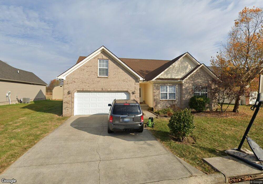
127 Lost Tree Dr Georgetown, KY 40324
Estimated Value: $357,000 - $373,000
3
Beds
2
Baths
1,550
Sq Ft
$235/Sq Ft
Est. Value
About This Home
This home is located at 127 Lost Tree Dr, Georgetown, KY 40324 and is currently estimated at $364,753, approximately $235 per square foot. 127 Lost Tree Dr is a home located in Scott County with nearby schools including Stamping Ground Elementary School, Royal Spring Middle School, and Scott County High School.
Create a Home Valuation Report for This Property
The Home Valuation Report is an in-depth analysis detailing your home's value as well as a comparison with similar homes in the area
Tax History
| Year | Tax Paid | Tax Assessment Tax Assessment Total Assessment is a certain percentage of the fair market value that is determined by local assessors to be the total taxable value of land and additions on the property. | Land | Improvement |
|---|---|---|---|---|
| 2025 | $2,576 | $289,200 | $0 | $0 |
| 2024 | $2,340 | $260,200 | $0 | $0 |
| 2023 | $2,232 | $246,200 | $30,000 | $216,200 |
| 2022 | $1,890 | $222,300 | $30,000 | $192,300 |
| 2021 | $1,853 | $211,300 | $30,000 | $181,300 |
| 2020 | $1,705 | $198,400 | $28,000 | $170,400 |
| 2019 | $1,679 | $192,400 | $0 | $0 |
| 2018 | $1,638 | $188,800 | $0 | $0 |
| 2017 | $1,646 | $188,800 | $0 | $0 |
| 2016 | $1,520 | $188,800 | $0 | $0 |
| 2015 | $1,511 | $188,800 | $0 | $0 |
| 2014 | $1,443 | $188,800 | $0 | $0 |
| 2011 | $1,385 | $190,500 | $0 | $0 |
Source: Public Records
Map
Nearby Homes
- 112 Lost Tree Dr
- 117 Windsong Way
- 128 Thomas Ln
- 200 Victoria Way
- 169 Muir Ln
- 208 Craig Ln
- 162 Hidden Creek Dr
- 120 Creekside Dr
- 103 Locust Grove Dr
- 140 Seahawk Trail
- 106 Sand Piper Ct
- 3200 Fishers Mill Rd
- 133 Treetop Ct
- 3612 Ironworks Rd
- 635A Lot A White Oak Rd
- 3669 Ironworks Rd Unit B-1
- 3669 Ironworks Rd Unit B-2
- 3669 Ironworks Rd Unit B-3
- 104 Lloyd Rd
- 108 Parker Place
- 129 Lost Tree Dr
- 125 Lost Tree Dr
- 123 Lost Tree Dr
- 120 Raccoon Run
- 131 Lost Tree Dr
- 122 Lost Tree Dr
- 130 Lost Tree Dr
- 130 Lost Tree Dr Unit 198
- 132 Lost Tree Dr
- 121 Lost Tree Dr
- 118 Raccoon Run
- 119 Raccoon Run
- 121 Raccoon Run
- 119 Lost Tree Dr
- 116 Lost Tree Dr
- 116 Raccoon Run
- 117 Raccoon Run
- 117 Raccoon Run Unit 208
- 117 Raccoon Run Unit 190
- 117 Lost Tree Dr
Your Personal Tour Guide
Ask me questions while you tour the home.