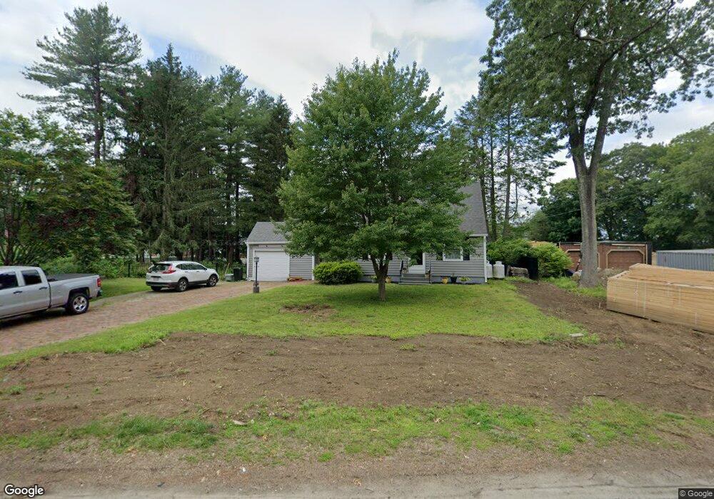
127 Macarthur Dr Millbury, MA 01527
Estimated Value: $388,000 - $443,000
2
Beds
2
Baths
1,176
Sq Ft
$354/Sq Ft
Est. Value
About This Home
This home is located at 127 Macarthur Dr, Millbury, MA 01527 and is currently estimated at $416,585, approximately $354 per square foot. 127 Macarthur Dr is a home located in Worcester County with nearby schools including Elmwood Street Elementary School, Raymond E. Shaw Elementary School, and Millbury Junior/Senior High School.
Ownership History
Date
Name
Owned For
Owner Type
Purchase Details
Closed on
Sep 29, 2017
Sold by
Mclaughlin Edward H Es and Mclaughlin Larosee
Bought by
Skamarock Kristen A
Current Estimated Value
Home Financials for this Owner
Home Financials are based on the most recent Mortgage that was taken out on this home.
Original Mortgage
$252,500
Outstanding Balance
$213,687
Interest Rate
4.5%
Mortgage Type
New Conventional
Estimated Equity
$202,898
Create a Home Valuation Report for This Property
The Home Valuation Report is an in-depth analysis detailing your home's value as well as a comparison with similar homes in the area
Home Values in the Area
Average Home Value in this Area
Purchase History
| Date | Buyer | Sale Price | Title Company |
|---|---|---|---|
| Skamarock Kristen A | $125,000 | -- | |
| Skamarock Kristen A | $125,000 | -- |
Source: Public Records
Mortgage History
| Date | Status | Borrower | Loan Amount |
|---|---|---|---|
| Open | Skamarock Kristen A | $252,500 | |
| Closed | Skamarock Kristen A | $252,500 |
Source: Public Records
Tax History
| Year | Tax Paid | Tax Assessment Tax Assessment Total Assessment is a certain percentage of the fair market value that is determined by local assessors to be the total taxable value of land and additions on the property. | Land | Improvement |
|---|---|---|---|---|
| 2025 | $4,826 | $360,400 | $114,400 | $246,000 |
| 2024 | $4,428 | $334,700 | $105,900 | $228,800 |
| 2023 | $3,912 | $270,700 | $74,300 | $196,400 |
| 2022 | $3,908 | $260,500 | $74,300 | $186,200 |
| 2021 | $3,899 | $252,700 | $74,300 | $178,400 |
| 2020 | $3,779 | $246,500 | $74,300 | $172,200 |
| 2019 | $3,774 | $238,100 | $67,500 | $170,600 |
| 2018 | $13,328 | $216,200 | $67,500 | $148,700 |
| 2017 | $3,178 | $193,400 | $67,500 | $125,900 |
| 2016 | $2,933 | $178,200 | $67,500 | $110,700 |
| 2015 | $2,956 | $179,600 | $71,800 | $107,800 |
| 2014 | $2,813 | $164,500 | $71,800 | $92,700 |
Source: Public Records
Map
Nearby Homes
- 48 Macarthur Dr
- 2 Diane St
- 2 Wilson Rd Unit B
- 2 Wilson Rd Unit A
- 2 Riverlin Pkwy
- 12 Irene Ct
- 8 Nightview Place
- 300 Millbury Ave
- 5 Ann Dr Unit 5
- 5 Lincoln Ln Unit 5
- 7 Barbara St
- 20 Woodridge Rd
- 11 Maplewood Rd
- 1459 Grafton Rd
- 46 Lexington Rd
- 8 Lincoln Ave
- 17 Lincoln Ave
- 16 Amherst St
- 6 Nathaniel St
- 7 Canal St
- 131 Macarthur Dr
- 117 Macarthur Dr
- 77 Macarthur Dr
- 85 Macarthur Dr
- 135 Macarthur Dr
- 75 Macarthur Dr
- 126 Macarthur Dr
- 132 Macarthur Dr
- 124 Macarthur Dr
- 87 Macarthur Dr
- 120 Macarthur Dr
- 111 Macarthur Dr
- 69 Macarthur Dr
- 118 Macarthur Dr
- 128 Macarthur Dr
- 116 Macarthur Dr
- 67 Macarthur Dr
- 137 Macarthur Dr
- 91 Macarthur Dr
- 82 Macarthur Dr
Your Personal Tour Guide
Ask me questions while you tour the home.