Estimated Value: $215,000 - $293,000
--
Bed
2
Baths
1,344
Sq Ft
$201/Sq Ft
Est. Value
About This Home
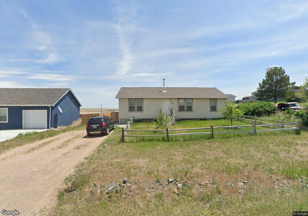
This home is located at 127 Main St, Burns, WY 82053 and is currently estimated at $270,188, approximately $201 per square foot. 127 Main St is a home located in Laramie County.
Ownership History
Date
Name
Owned For
Owner Type
Purchase Details
Closed on
Dec 2, 2016
Sold by
Jpmorgan Chase Bank N A
Bought by
Burkett Richard L and Burkett Wanda J
Current Estimated Value
Purchase Details
Closed on
Jul 8, 2016
Sold by
Wieneke Mark
Bought by
Jpmorgan Chase Bank Na
Purchase Details
Closed on
Dec 12, 2013
Sold by
Cmh Homes Inc
Bought by
Wieneke Mark
Home Financials for this Owner
Home Financials are based on the most recent Mortgage that was taken out on this home.
Original Mortgage
$153,061
Interest Rate
4.14%
Mortgage Type
New Conventional
Purchase Details
Closed on
May 31, 2013
Sold by
Pauli Harry P
Bought by
Cmh Homes Inc
Create a Home Valuation Report for This Property
The Home Valuation Report is an in-depth analysis detailing your home's value as well as a comparison with similar homes in the area
Home Values in the Area
Average Home Value in this Area
Purchase History
| Date | Buyer | Sale Price | Title Company |
|---|---|---|---|
| Burkett Richard L | -- | None Available | |
| Jpmorgan Chase Bank Na | $124,410 | None Available | |
| Wieneke Mark | -- | None Available | |
| Cmh Homes Inc | -- | None Available |
Source: Public Records
Mortgage History
| Date | Status | Borrower | Loan Amount |
|---|---|---|---|
| Previous Owner | Wieneke Mark | $153,061 |
Source: Public Records
Tax History Compared to Growth
Tax History
| Year | Tax Paid | Tax Assessment Tax Assessment Total Assessment is a certain percentage of the fair market value that is determined by local assessors to be the total taxable value of land and additions on the property. | Land | Improvement |
|---|---|---|---|---|
| 2025 | $1,615 | $17,081 | $770 | $16,311 |
| 2024 | $1,615 | $21,915 | $1,026 | $20,889 |
| 2023 | $1,557 | $21,125 | $1,026 | $20,099 |
| 2022 | $1,357 | $18,054 | $1,026 | $17,028 |
| 2021 | $1,227 | $16,290 | $936 | $15,354 |
| 2020 | $1,059 | $14,098 | $698 | $13,400 |
| 2019 | $1,006 | $13,383 | $698 | $12,685 |
| 2018 | $916 | $12,290 | $698 | $11,592 |
| 2017 | $899 | $11,966 | $698 | $11,268 |
| 2016 | $894 | $11,882 | $698 | $11,184 |
| 2015 | $857 | $11,392 | $698 | $10,694 |
| 2014 | $842 | $11,121 | $698 | $10,423 |
Source: Public Records
Map
Nearby Homes
- 133 N Main St
- TBD Burns Ave
- 512 Horseshoe Rd
- 4866 Rising Sun Way
- Lot 1 Rising Sun Way
- 4537 Iron Horse Rd
- TBD Willow Brook Ln
- 1778 County Road 146
- Tract 9 Jake Spoon Trail
- Tract 7 Blue Duck Trail
- Tract 21 Lonesome Dove Trail
- Tract 23 Lonesome Dove Trail
- Tract 18 Lonesome Dove Trail
- Tract 20 Lonesome Dove Trail
- Tract 2 Jake Spoon Trail
- Tract 5 Jake Spoon Trail
- Tract 19 Lonesome Dove Trail
- 1019 Blue Duck Trail
- Tract 16 Blue Duck Trail
- Tract 4 Road 143