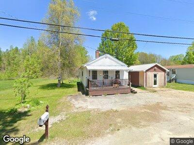
127 Main St New Sharon, ME 04955
Estimated Value: $93,609 - $163,000
1
Bed
1
Bath
700
Sq Ft
$177/Sq Ft
Est. Value
About This Home
This home is located at 127 Main St, New Sharon, ME 04955 and is currently estimated at $123,652, approximately $176 per square foot. 127 Main St is a home located in Franklin County with nearby schools including Mt. Blue High School.
Ownership History
Date
Name
Owned For
Owner Type
Purchase Details
Closed on
Oct 1, 2021
Sold by
Webster Prop Rentals Llc
Bought by
Gordon Kimberly
Current Estimated Value
Home Financials for this Owner
Home Financials are based on the most recent Mortgage that was taken out on this home.
Original Mortgage
$70,000
Outstanding Balance
$64,522
Interest Rate
2.8%
Mortgage Type
Purchase Money Mortgage
Estimated Equity
$66,796
Purchase Details
Closed on
Jun 20, 2016
Sold by
Webster Charles M and Webster Vicki C
Bought by
Webster Property Rentals
Purchase Details
Closed on
Mar 11, 2016
Sold by
Webster Charles M and Webster Vicki C
Bought by
Butterfield Kirk and Butterfield Susan
Home Financials for this Owner
Home Financials are based on the most recent Mortgage that was taken out on this home.
Original Mortgage
$112,000
Interest Rate
3.79%
Mortgage Type
New Conventional
Purchase Details
Closed on
Nov 29, 2010
Sold by
Mcpherson Joyce L
Bought by
Webster Charles M and Webster Vicki C
Create a Home Valuation Report for This Property
The Home Valuation Report is an in-depth analysis detailing your home's value as well as a comparison with similar homes in the area
Home Values in the Area
Average Home Value in this Area
Purchase History
| Date | Buyer | Sale Price | Title Company |
|---|---|---|---|
| Gordon Kimberly | -- | None Available | |
| Webster Property Rentals | -- | -- | |
| Butterfield Kirk | -- | -- | |
| Webster Charles M | -- | -- |
Source: Public Records
Mortgage History
| Date | Status | Borrower | Loan Amount |
|---|---|---|---|
| Open | Gordon Kimberly | $70,000 | |
| Previous Owner | Webster Property Rentals | $40,000 | |
| Previous Owner | Butterfield Kirk | $112,000 | |
| Previous Owner | Mcpherson Joyce L | $30,000 | |
| Previous Owner | Mcpherson Joyce L | $7,201 |
Source: Public Records
Tax History Compared to Growth
Tax History
| Year | Tax Paid | Tax Assessment Tax Assessment Total Assessment is a certain percentage of the fair market value that is determined by local assessors to be the total taxable value of land and additions on the property. | Land | Improvement |
|---|---|---|---|---|
| 2024 | $1,063 | $97,560 | $18,680 | $78,880 |
| 2023 | $931 | $53,180 | $13,800 | $39,380 |
| 2022 | $850 | $53,180 | $13,800 | $39,380 |
| 2021 | $914 | $53,180 | $13,800 | $39,380 |
| 2020 | $3,372 | $53,180 | $13,800 | $39,380 |
| 2019 | $3,516 | $53,180 | $13,800 | $39,380 |
| 2018 | $851 | $53,180 | $13,800 | $39,380 |
| 2017 | $856 | $53,180 | $13,800 | $39,380 |
| 2016 | $898 | $53,130 | $13,750 | $39,380 |
| 2014 | $808 | $53,130 | $13,750 | $39,380 |
Source: Public Records
Map
Nearby Homes
- 5 Nadeau Ln
- 35 Industry Rd
- 48 Starks Rd
- 20 Webster Rd
- Lot 74 Flagg Rd
- 59 Chandler Rd
- 82 Lane Rd
- 64 Mile Hill Rd
- Lot 9 & 12 Smith Rd
- Lot #33 Cape Cod Hill Rd
- 05 Farmington Falls Rd
- 33 Kimball Pond
- R-01-031 Mason Rd
- 335 Swan Rd
- 1092 Farmington Falls Rd
- 129 Philbrick St
- 203 Beans Corner Rd
- 490 Mile Hill Rd
- Lot 33-4 Industry Rd
- Lot 33-3 Industry Rd