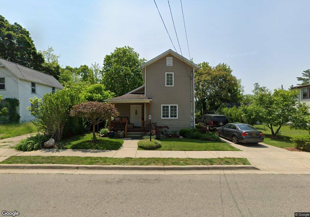
127 Manchester St W Battle Creek, MI 49037
North Central NeighborhoodEstimated Value: $74,000 - $154,000
3
Beds
1
Bath
1,444
Sq Ft
$75/Sq Ft
Est. Value
About This Home
This home is located at 127 Manchester St W, Battle Creek, MI 49037 and is currently estimated at $108,277, approximately $74 per square foot. 127 Manchester St W is a home located in Calhoun County with nearby schools including Ann J. Kellogg School, Northwestern Middle School, and Battle Creek Central High School.
Ownership History
Date
Name
Owned For
Owner Type
Purchase Details
Closed on
Aug 23, 2005
Sold by
Battle Creek Area Habitat For Humanity
Bought by
Cortes Maria Brenda
Current Estimated Value
Home Financials for this Owner
Home Financials are based on the most recent Mortgage that was taken out on this home.
Original Mortgage
$52,000
Interest Rate
5.82%
Mortgage Type
Seller Take Back
Purchase Details
Closed on
Aug 17, 2004
Sold by
Boyd Greg
Bought by
Battle Creek Area Habitat For Humanity
Purchase Details
Closed on
Jan 3, 2000
Sold by
Boyd Mamie L
Purchase Details
Closed on
Aug 22, 1995
Sold by
Boyd Mamie L
Bought by
Boyd Mamie L and Boyd Gregory R
Create a Home Valuation Report for This Property
The Home Valuation Report is an in-depth analysis detailing your home's value as well as a comparison with similar homes in the area
Home Values in the Area
Average Home Value in this Area
Purchase History
| Date | Buyer | Sale Price | Title Company |
|---|---|---|---|
| Cortes Maria Brenda | $52,000 | Chicago Title | |
| Battle Creek Area Habitat For Humanity | -- | First American Title Ins Co | |
| -- | -- | -- | |
| Boyd Mamie L | -- | -- |
Source: Public Records
Mortgage History
| Date | Status | Borrower | Loan Amount |
|---|---|---|---|
| Closed | Cortes Maria Brenda | $52,000 |
Source: Public Records
Tax History Compared to Growth
Tax History
| Year | Tax Paid | Tax Assessment Tax Assessment Total Assessment is a certain percentage of the fair market value that is determined by local assessors to be the total taxable value of land and additions on the property. | Land | Improvement |
|---|---|---|---|---|
| 2025 | -- | $37,600 | $0 | $0 |
| 2024 | $699 | $31,370 | $0 | $0 |
| 2023 | $799 | $27,099 | $0 | $0 |
| 2022 | $631 | $22,330 | $0 | $0 |
| 2021 | $753 | $21,250 | $0 | $0 |
| 2020 | $746 | $16,151 | $0 | $0 |
| 2019 | $759 | $15,610 | $0 | $0 |
| 2018 | $759 | $16,136 | $420 | $15,716 |
| 2017 | $825 | $17,109 | $0 | $0 |
| 2016 | $834 | $19,529 | $0 | $0 |
| 2015 | $817 | $20,809 | $2,129 | $18,680 |
| 2014 | $817 | $17,730 | $2,129 | $15,601 |
Source: Public Records
Map
Nearby Homes
- 125 Oaklawn Ave
- V/L W Michigan 055 Ave
- 35 Hubbard St
- 0 W Vanburen 032 St Unit 22040288
- 16 Wood St S
- 216 Kendall St N
- 562 Van Buren St W
- 0 W Michigan 005 Ave Unit 22040281
- 0 W Vanburen 025 St Unit 22040286
- 0 W Vanburen 027 St Unit 22040287
- 0 W Michigan 010 Ave Unit 22040284
- 0 W Ave Unit 22040282
- 0 W Michigan 011 Ave Unit 22040285
- 9 Thorne St
- 253 Greenwood Ave
- 60 Graves Ave
- 69 Jordan St
- 46 Walter Ave
- 224 Hubbard St
- 0 W Jackson 061 St Unit 22040291
- 135 Manchester St W
- 4712 Kendall St N
- 82 Kendall St N
- 123 Manchester St W
- 0 W Manchester St Unit 55021102293
- 0 W Manchester St Unit M20041653
- 0 W Manchester St Unit M20040878
- 0 W Manchester St Unit 21102293
- 0 W Manchester St
- W W Manchester St
- 124 Manchester St W
- 130 Manchester St W
- 93 Kendall St N
- 118 Manchester St W
- 72 Kendall St N
- 111 W West Manchester St
- 111 Manchester St W
- 108 Manchester St W
- 66 Kendall St N
- 146 Manchester St W