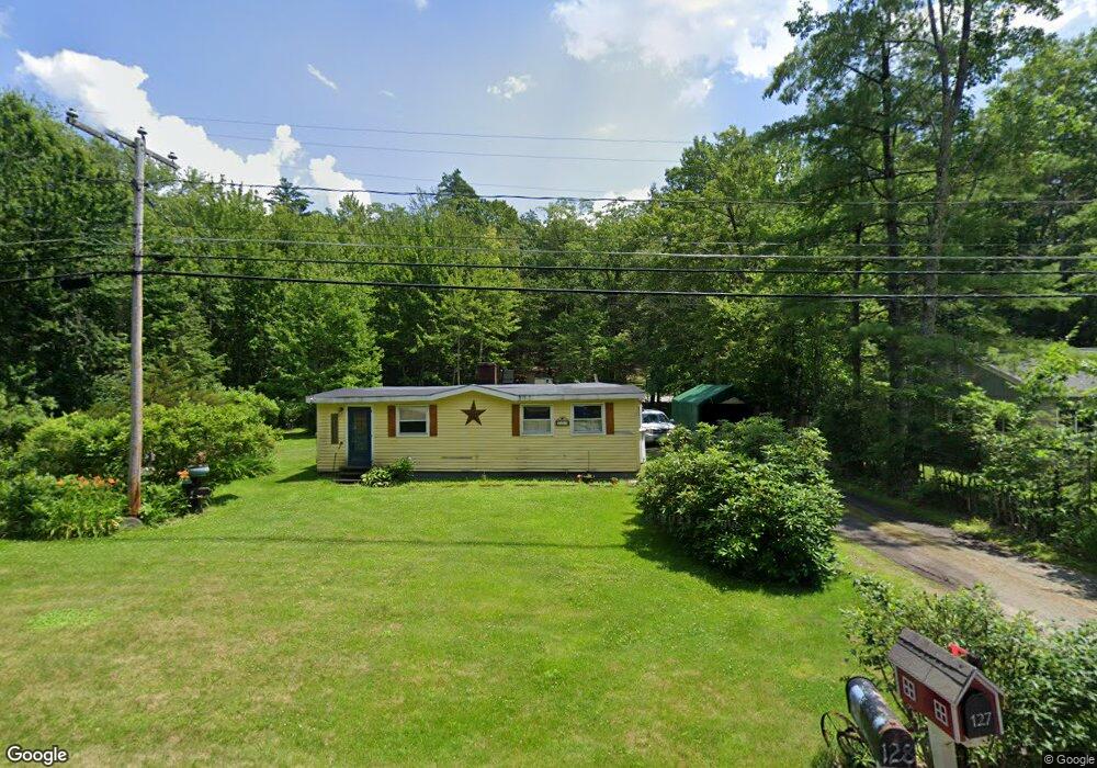
127 Mountain Base Rd Goffstown, NH 03045
Estimated Value: $335,000 - $364,000
1
Bed
1
Bath
1,143
Sq Ft
$304/Sq Ft
Est. Value
About This Home
This home is located at 127 Mountain Base Rd, Goffstown, NH 03045 and is currently estimated at $347,334, approximately $303 per square foot. 127 Mountain Base Rd is a home with nearby schools including Mountain View Middle School and Goffstown High School.
Ownership History
Date
Name
Owned For
Owner Type
Purchase Details
Closed on
Mar 19, 2025
Sold by
Wilson Robert D and Wilson Dianne
Bought by
Wilson
Current Estimated Value
Purchase Details
Closed on
Apr 19, 1999
Sold by
Pegnam John E and Pegnam Margaret M
Bought by
Wilson Robert D and Wilson Dianne
Home Financials for this Owner
Home Financials are based on the most recent Mortgage that was taken out on this home.
Original Mortgage
$48,750
Interest Rate
7.04%
Create a Home Valuation Report for This Property
The Home Valuation Report is an in-depth analysis detailing your home's value as well as a comparison with similar homes in the area
Home Values in the Area
Average Home Value in this Area
Purchase History
| Date | Buyer | Sale Price | Title Company |
|---|---|---|---|
| Wilson | -- | None Available | |
| Wilson | -- | None Available | |
| Wilson Robert D | $65,000 | -- | |
| Wilson Robert D | $65,000 | -- |
Source: Public Records
Mortgage History
| Date | Status | Borrower | Loan Amount |
|---|---|---|---|
| Previous Owner | Wilson Robert D | $48,750 |
Source: Public Records
Tax History Compared to Growth
Tax History
| Year | Tax Paid | Tax Assessment Tax Assessment Total Assessment is a certain percentage of the fair market value that is determined by local assessors to be the total taxable value of land and additions on the property. | Land | Improvement |
|---|---|---|---|---|
| 2024 | $5,196 | $254,200 | $163,700 | $90,500 |
| 2023 | $4,794 | $254,200 | $163,700 | $90,500 |
| 2022 | $4,186 | $159,100 | $99,500 | $59,600 |
| 2021 | $3,949 | $159,100 | $99,500 | $59,600 |
| 2020 | $3,949 | $159,100 | $99,500 | $59,600 |
| 2019 | $3,849 | $156,600 | $99,500 | $57,100 |
| 2018 | $2,913 | $156,600 | $99,500 | $57,100 |
| 2017 | $3,746 | $136,600 | $82,300 | $54,300 |
| 2016 | $3,610 | $136,600 | $82,300 | $54,300 |
| 2015 | $3,433 | $121,900 | $69,500 | $52,400 |
| 2014 | $3,291 | $121,900 | $69,500 | $52,400 |
Source: Public Records
Map
Nearby Homes
- 914 Back Mountain Rd
- 99 Cambridge Rd
- 21A Apple Tree Dr
- 27 Birkdale Rd Unit LOTS 170/171
- 9 Cherry Ln
- 120 S Mast St
- 152 S Mast St
- 39 S Mast St
- 28 Olde Lantern Rd
- 12 S Mast St
- 12 Maplewood Ave
- 25 Pleasant St
- 137 Elm St
- 2 Larch St Unit 1
- 99 Elm St
- 0 Mast Rd Unit 49 5054665
- 22 Winter Hill Rd
- 16 Palmer Rd
- 14 Angel Point Cir Unit B
- 718 Bedford Rd
- 129 Mountain Base Rd
- 128 Mountain Base Rd
- 16 Incline Ave
- 25 Incline Ave
- 118 Mountain Base
- 14 Incline Ave
- 39 Incline Ave
- 3 Forest Ave
- 116 Mountain Base Rd
- 35 Incline Ave
- 12 Incline Ave
- 146 Mountain Base Rd
- 37 Incline Ave
- 346 Worthley Hill Rd
- 155 Mountain Base Rd
- 4 Mc Farland Rd Unit A
- 4 Mc Farland Rd Unit B
- 161 Mountain Base Rd
- 356 Worthley Hill Rd
- 43 Incline Ave