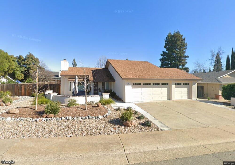
127 Placer Mine Rd Folsom, CA 95630
Estimated Value: $250,000 - $584,000
2
Beds
2
Baths
1,075
Sq Ft
$430/Sq Ft
Est. Value
About This Home
This home is located at 127 Placer Mine Rd, Folsom, CA 95630 and is currently estimated at $462,282, approximately $430 per square foot. 127 Placer Mine Rd is a home located in Sacramento County with nearby schools including Ottomon Way Elementary School, Louis Pasteur Fundamental Middle School, and Casa Roble Fundamental High School.
Ownership History
Date
Name
Owned For
Owner Type
Purchase Details
Closed on
Jan 11, 2014
Sold by
Freij Nicholas J and Freij Nawal M
Bought by
Saca Muna
Current Estimated Value
Purchase Details
Closed on
Dec 12, 2011
Sold by
Searles Jaime and Searles Gabriel
Bought by
Freij Nicholas J and Freij Nawal M
Purchase Details
Closed on
Sep 23, 2004
Sold by
Deaquair Donna
Bought by
Searles Gabriel and Searles Jamie
Home Financials for this Owner
Home Financials are based on the most recent Mortgage that was taken out on this home.
Original Mortgage
$276,000
Interest Rate
5.76%
Mortgage Type
Purchase Money Mortgage
Purchase Details
Closed on
Sep 17, 2002
Sold by
Mazloom Mohammad Taghi and Mazloom Zahra
Bought by
Deaquair Donna
Home Financials for this Owner
Home Financials are based on the most recent Mortgage that was taken out on this home.
Original Mortgage
$166,000
Interest Rate
6.16%
Purchase Details
Closed on
Mar 22, 2000
Sold by
Mazloom Mohammad T and Mazloom Zahra
Bought by
Mazloom Mohammad Taghi and Mazloom Zahra
Create a Home Valuation Report for This Property
The Home Valuation Report is an in-depth analysis detailing your home's value as well as a comparison with similar homes in the area
Home Values in the Area
Average Home Value in this Area
Purchase History
| Date | Buyer | Sale Price | Title Company |
|---|---|---|---|
| Saca Muna | -- | None Available | |
| Freij Nicholas J | $171,000 | Placer Title Company | |
| Searles Gabriel | $345,000 | North American Title Co | |
| Deaquair Donna | $241,000 | North American Title Co | |
| Mazloom Mohammad Taghi | -- | -- |
Source: Public Records
Mortgage History
| Date | Status | Borrower | Loan Amount |
|---|---|---|---|
| Previous Owner | Searles Gabriel | $276,000 | |
| Previous Owner | Deaquair Donna | $166,000 | |
| Closed | Searles Gabriel | $34,500 |
Source: Public Records
Tax History Compared to Growth
Tax History
| Year | Tax Paid | Tax Assessment Tax Assessment Total Assessment is a certain percentage of the fair market value that is determined by local assessors to be the total taxable value of land and additions on the property. | Land | Improvement |
|---|---|---|---|---|
| 2025 | $3,232 | $281,939 | $122,581 | $159,358 |
| 2024 | $3,232 | $276,412 | $120,178 | $156,234 |
| 2023 | $3,148 | $270,993 | $117,822 | $153,171 |
| 2022 | $3,130 | $265,680 | $115,512 | $150,168 |
| 2021 | $3,076 | $260,472 | $113,248 | $147,224 |
| 2020 | $3,018 | $257,802 | $112,087 | $145,715 |
| 2019 | $2,955 | $252,748 | $109,890 | $142,858 |
| 2018 | $2,919 | $247,793 | $107,736 | $140,057 |
| 2017 | $2,889 | $242,935 | $105,624 | $137,311 |
| 2016 | $2,713 | $238,172 | $103,553 | $134,619 |
| 2015 | $2,677 | $234,595 | $101,998 | $132,597 |
| 2014 | $2,054 | $174,744 | $81,970 | $92,774 |
Source: Public Records
Map
Nearby Homes
- 1122 River Rock Dr
- 116 Raeanne Ln
- 254 Winding Canyon Ln Unit L
- 140 Boulder Canyon Way
- 6412 Benning St Unit 12B
- 6412 Benning St Unit 4A
- 6412 Benning St Unit 5B
- 203 Crow Canyon Dr
- 6132 Main Ave Unit 28
- 9340 Orangevale Ave Unit 36
- 9340 Orangevale Ave Unit 19
- 9340 Orangevale Ave Unit 25
- 103 S Fork Way
- 224 Oak Canyon Way
- 5943 Main Ave Unit D
- 9487 Dalton Way
- 5948 Sirl Way
- 5947 Main Ave Unit A
- 5930 Sirl Way
- 9324 Rolling Acres Ct
- 123 Placer Mine Rd
- 108 Prospector Ct
- 131 Placer Mine Rd
- 112 Prospector Ct
- 104 Prospector Ct
- 128 Placer Mine Rd
- 116 Prospector Ct
- 132 Placer Mine Rd
- 124 Placer Mine Rd
- 101 Paydirt Ct
- 105 Paydirt Ct
- 100 Prospector Ct
- 113 Prospector Ct
- 127 Ore St
- 109 Prospector Ct
- 120 Prospector Ct
- 131 Ore St
- 104 Jedediah Rd
- 123 Ore St