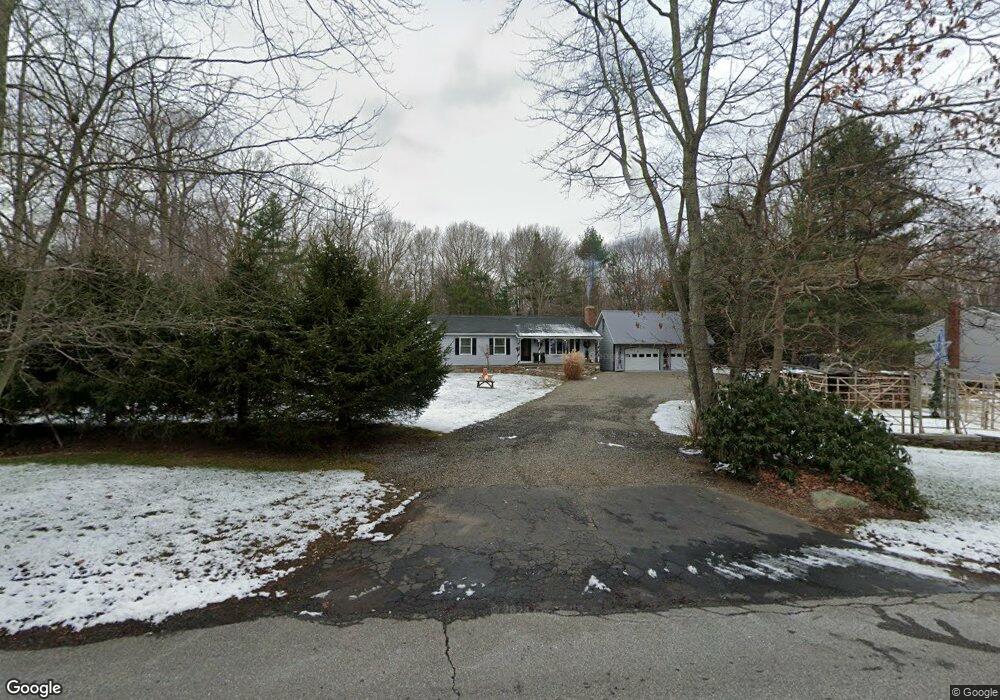
127 Plains Rd Tolland, CT 06084
Estimated Value: $379,000 - $402,000
3
Beds
2
Baths
1,352
Sq Ft
$289/Sq Ft
Est. Value
About This Home
This home is located at 127 Plains Rd, Tolland, CT 06084 and is currently estimated at $390,668, approximately $288 per square foot. 127 Plains Rd is a home located in Tolland County with nearby schools including Tolland High School.
Create a Home Valuation Report for This Property
The Home Valuation Report is an in-depth analysis detailing your home's value as well as a comparison with similar homes in the area
Home Values in the Area
Average Home Value in this Area
Tax History
| Year | Tax Paid | Tax Assessment Tax Assessment Total Assessment is a certain percentage of the fair market value that is determined by local assessors to be the total taxable value of land and additions on the property. | Land | Improvement |
|---|---|---|---|---|
| 2025 | $6,112 | $224,800 | $65,300 | $159,500 |
| 2024 | $5,707 | $151,100 | $62,200 | $88,900 |
| 2023 | $5,641 | $151,100 | $62,200 | $88,900 |
| 2022 | $5,527 | $151,100 | $62,200 | $88,900 |
| 2021 | $5,607 | $151,100 | $62,200 | $88,900 |
| 2020 | $5,447 | $151,100 | $62,200 | $88,900 |
| 2019 | $5,436 | $150,800 | $64,100 | $86,700 |
| 2018 | $5,278 | $150,800 | $64,100 | $86,700 |
| 2017 | $5,156 | $150,800 | $64,100 | $86,700 |
| 2016 | $5,156 | $150,800 | $64,100 | $86,700 |
| 2015 | $5,031 | $150,800 | $64,100 | $86,700 |
| 2014 | $5,098 | $164,200 | $71,300 | $92,900 |
Source: Public Records
Map
Nearby Homes
- 45 Mountain Laurel Dr
- 8 Neff Hill Rd
- 41 Neff Hill Rd
- 15 Usher Ridge
- 68 Usher Ridge
- 36 Usher Ridge
- 110 Neff Hill Rd
- 105 Neff Hill Rd
- 137 Neff Hill Rd
- 77 Neff Hill Rd
- 100 Neff Hill Rd
- 84 Neff Hill Rd
- 71 Neff Hill Rd
- 0 Tolland Turnpike
- 38 Schofield Rd
- 50 Cook Rd
- 50 Buff Cap Rd
- 51 Sandy Beach Rd
- 0 River Rd Unit 24120753
- 109 Tolland Ave
Your Personal Tour Guide
Ask me questions while you tour the home.