Estimated Value: $219,000 - $270,000
3
Beds
2
Baths
2,156
Sq Ft
$115/Sq Ft
Est. Value
About This Home
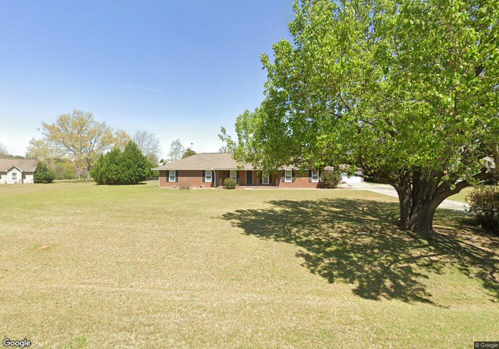
This home is located at 127 Robbie Dr, Byron, GA 31008 and is currently estimated at $247,678, approximately $114 per square foot. 127 Robbie Dr is a home located in Peach County with nearby schools including Kay Road Elementary School, Fort Valley Middle School, and Peach County High School.
Ownership History
Date
Name
Owned For
Owner Type
Purchase Details
Closed on
Nov 8, 2012
Sold by
Sando Kermit A
Bought by
Mangrum Maxwell
Current Estimated Value
Home Financials for this Owner
Home Financials are based on the most recent Mortgage that was taken out on this home.
Original Mortgage
$133,429
Outstanding Balance
$23,576
Interest Rate
3.3%
Mortgage Type
FHA
Estimated Equity
$224,102
Purchase Details
Closed on
Apr 3, 2012
Sold by
Clawson Guy L
Bought by
Sando Kermit A
Purchase Details
Closed on
Mar 18, 1996
Bought by
Clawson Guy L and Clawson Irene L
Purchase Details
Closed on
Aug 26, 1988
Bought by
Hale Gordon L and Hale Jacque L
Purchase Details
Closed on
May 17, 1988
Bought by
R B & B Construction Inc
Purchase Details
Closed on
Dec 16, 1986
Bought by
Mccord Timothy A
Create a Home Valuation Report for This Property
The Home Valuation Report is an in-depth analysis detailing your home's value as well as a comparison with similar homes in the area
Home Values in the Area
Average Home Value in this Area
Purchase History
| Date | Buyer | Sale Price | Title Company |
|---|---|---|---|
| Mangrum Maxwell | $136,900 | -- | |
| Sando Kermit A | $84,164 | -- | |
| Clawson Guy L | $121,500 | -- | |
| Hale Gordon L | $87,400 | -- | |
| R B & B Construction Inc | -- | -- | |
| Mccord Timothy A | -- | -- |
Source: Public Records
Mortgage History
| Date | Status | Borrower | Loan Amount |
|---|---|---|---|
| Open | Mangrum Maxwell | $133,429 |
Source: Public Records
Tax History Compared to Growth
Tax History
| Year | Tax Paid | Tax Assessment Tax Assessment Total Assessment is a certain percentage of the fair market value that is determined by local assessors to be the total taxable value of land and additions on the property. | Land | Improvement |
|---|---|---|---|---|
| 2024 | $2,305 | $64,600 | $6,800 | $57,800 |
| 2023 | $2,306 | $64,200 | $6,800 | $57,400 |
| 2022 | $1,514 | $56,240 | $6,800 | $49,440 |
| 2021 | $1,499 | $48,000 | $6,800 | $41,200 |
| 2020 | $1,615 | $51,720 | $6,800 | $44,920 |
| 2019 | $1,585 | $50,520 | $6,800 | $43,720 |
| 2018 | $1,593 | $50,520 | $6,800 | $43,720 |
| 2017 | $1,601 | $50,520 | $6,800 | $43,720 |
| 2016 | $1,594 | $50,520 | $6,800 | $43,720 |
| 2015 | $1,597 | $50,520 | $6,800 | $43,720 |
| 2014 | $1,599 | $50,520 | $6,800 | $43,720 |
| 2013 | -- | $50,520 | $6,800 | $43,720 |
Source: Public Records
Map
Nearby Homes
- 127 Erin Ct
- 53.91 Acres Anna Marie Circle (Autumn Cove Subdivision)
- 0 Housers Mill Rd Unit 5515996
- 1046 Walker Rd
- 0 Peavy Rd
- 199 Red Tail Cir
- 152 Hawks Ridge Trace
- 109 Red Tail Cir
- 107 Red Tail Cir
- 248 Shantz Way
- 248 Shantz Way Unit (LOT A41)
- 120 Hawks Ridge Trace
- 127 Hawks Ridge Trace
- 206 Christopher Dr
- 120 Hawks Place
- 305 Shantz Way
- The McGinnis Plan at Bryson Farms
- The Lawson Plan at Bryson Farms
- The Coleman Plan at Bryson Farms
- 131 Robbie Dr
- 123 Robbie Dr
- 0 Robbie Dr Unit 8770872
- Lot 15 Robbie Dr
- 0 Robbie Dr Unit 8356807
- 0 Robbie Dr Unit LOt 15 8651974
- 0 Robbie Dr Unit LOt 15 8515484
- 0 Robbie Dr Unit Lot 15
- 135 Robbie Dr
- 5029 Housers Mill Rd
- 122 Robbie Dr
- 130 Robbie Dr
- 119 Robbie Dr
- 118 Robbie Dr
- 115 Robbie Dr
- 114 Robbie Dr
- 5155 Housers Mill Rd
- 109 Robbie Dr
- 5035 Housers Mill Rd
- 115 Erin Ct