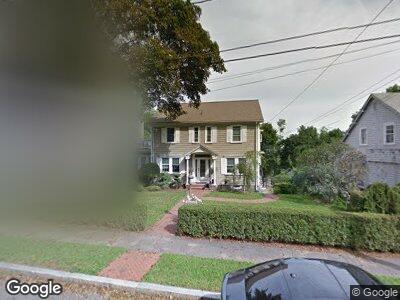
127 Summit Ave Quincy, MA 02170
West Quincy NeighborhoodEstimated Value: $884,000 - $1,288,344
4
Beds
3
Baths
2,136
Sq Ft
$526/Sq Ft
Est. Value
About This Home
This home is located at 127 Summit Ave, Quincy, MA 02170 and is currently estimated at $1,124,086, approximately $526 per square foot. 127 Summit Ave is a home located in Norfolk County with nearby schools including Wollaston School, Central Middle School, and North Quincy High School.
Ownership History
Date
Name
Owned For
Owner Type
Purchase Details
Closed on
Feb 4, 2014
Sold by
Bowes Michael J and Bowes Katherine
Bought by
Bowes Katherine
Current Estimated Value
Purchase Details
Closed on
Oct 26, 2001
Sold by
Flate George W and Flate Eda A
Bought by
Bowes Michael J and Bowes Katherine
Home Financials for this Owner
Home Financials are based on the most recent Mortgage that was taken out on this home.
Original Mortgage
$408,000
Interest Rate
6.86%
Mortgage Type
Purchase Money Mortgage
Create a Home Valuation Report for This Property
The Home Valuation Report is an in-depth analysis detailing your home's value as well as a comparison with similar homes in the area
Home Values in the Area
Average Home Value in this Area
Purchase History
| Date | Buyer | Sale Price | Title Company |
|---|---|---|---|
| Bowes Katherine | -- | -- | |
| Bowes Michael J | $510,000 | -- |
Source: Public Records
Mortgage History
| Date | Status | Borrower | Loan Amount |
|---|---|---|---|
| Open | Bowes Katherine | $175,000 | |
| Open | Bowes Katherine | $450,000 | |
| Closed | Bowes Katherine | $463,000 | |
| Previous Owner | Bowes Katherine | $455,100 | |
| Previous Owner | Bowes Katherine | $100,000 | |
| Previous Owner | Bowes Katherine | $500,000 | |
| Previous Owner | Bowes Michael J | $408,000 | |
| Previous Owner | Flate George W | $90,000 | |
| Previous Owner | Flate George W | $92,500 |
Source: Public Records
Tax History Compared to Growth
Tax History
| Year | Tax Paid | Tax Assessment Tax Assessment Total Assessment is a certain percentage of the fair market value that is determined by local assessors to be the total taxable value of land and additions on the property. | Land | Improvement |
|---|---|---|---|---|
| 2025 | $13,040 | $1,131,000 | $490,700 | $640,300 |
| 2024 | $12,602 | $1,118,200 | $490,700 | $627,500 |
| 2023 | $11,705 | $1,051,700 | $467,700 | $584,000 |
| 2022 | $11,175 | $932,800 | $360,500 | $572,300 |
| 2021 | $11,123 | $916,200 | $360,500 | $555,700 |
| 2020 | $11,100 | $893,000 | $360,500 | $532,500 |
| 2019 | $10,788 | $859,600 | $352,400 | $507,200 |
| 2018 | $10,517 | $788,400 | $319,500 | $468,900 |
| 2017 | $10,768 | $759,900 | $334,700 | $425,200 |
| 2016 | $9,954 | $693,200 | $299,400 | $393,800 |
| 2015 | $9,302 | $637,100 | $261,700 | $375,400 |
| 2014 | $8,949 | $602,200 | $254,200 | $348,000 |
Source: Public Records
Map
Nearby Homes
- 100 Summit Ave
- 8 Stoney Brae Rd
- 209 Milton St
- 23 Summit Ave
- 162 Milton St
- 9 Granger St
- 37 Connell St
- 41 Connell St
- 70 Sherman St
- 53 Kimball St
- 18 Kimball St
- 176 N Central Ave
- 407 Highland Ave
- 32 Grogan Ave
- 74 Churchill Rd
- 72 Taylor St
- 100 Grandview Ave Unit 14B
- 15 Lincoln Ave
- 39 Bassett St
- 111 Warren Ave Unit 4E
- 127 Summit Ave
- 121 Summit Ave
- 133 Summit Ave
- 114 Hillside Ave
- 115 Summit Ave
- 126 Summit Ave
- 139 Summit Ave
- 120 Hillside Ave
- 124 Summit Ave
- 128 Hillside Ave
- 100 Hillside Ave
- 120 Summit Ave
- 109 Summit Ave
- 140 Summit Ave
- 96 Hillside Ave
- 114 Summit Ave
- 103 Summit Ave
- 92 Hillside Ave
- 161 Summit Ave
- 108 Summit Ave