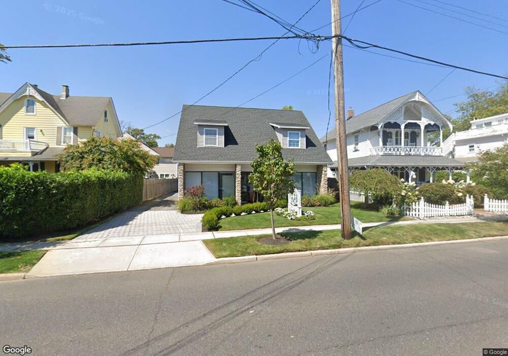
127 Union Ave Unit Floor 1 Manasquan, NJ 08736
Estimated Value: $1,059,339
--
Bed
--
Bath
2,312
Sq Ft
$458/Sq Ft
Est. Value
About This Home
This home is located at 127 Union Ave Unit Floor 1, Manasquan, NJ 08736 and is currently estimated at $1,059,339, approximately $458 per square foot. 127 Union Ave Unit Floor 1 is a home located in Monmouth County with nearby schools including Manasquan Elementary School, Manasquan High School, and The Brookside School.
Ownership History
Date
Name
Owned For
Owner Type
Purchase Details
Closed on
Jun 15, 2018
Sold by
127 Union Ave Enterprises Llc
Bought by
127 Union Ave Squan Llc
Current Estimated Value
Purchase Details
Closed on
Mar 31, 2017
Sold by
Wood Richard I and Wood Nancy
Bought by
127 Union Avenue Enterprises Llc
Home Financials for this Owner
Home Financials are based on the most recent Mortgage that was taken out on this home.
Original Mortgage
$215,500
Interest Rate
4.1%
Mortgage Type
Credit Line Revolving
Create a Home Valuation Report for This Property
The Home Valuation Report is an in-depth analysis detailing your home's value as well as a comparison with similar homes in the area
Home Values in the Area
Average Home Value in this Area
Purchase History
| Date | Buyer | Sale Price | Title Company |
|---|---|---|---|
| 127 Union Ave Squan Llc | $550,000 | Commonwealth Title Agency | |
| 127 Union Avenue Enterprises Llc | $287,500 | None Available |
Source: Public Records
Mortgage History
| Date | Status | Borrower | Loan Amount |
|---|---|---|---|
| Previous Owner | 127 Union Avenue Enterprises Llc | $215,500 |
Source: Public Records
Tax History Compared to Growth
Tax History
| Year | Tax Paid | Tax Assessment Tax Assessment Total Assessment is a certain percentage of the fair market value that is determined by local assessors to be the total taxable value of land and additions on the property. | Land | Improvement |
|---|---|---|---|---|
| 2025 | $8,810 | $495,500 | $150,500 | $345,000 |
| 2024 | $8,478 | $495,500 | $150,500 | $345,000 |
| 2023 | $8,478 | $495,500 | $150,500 | $345,000 |
| 2022 | $8,161 | $495,500 | $150,500 | $345,000 |
| 2021 | $8,161 | $495,500 | $150,500 | $345,000 |
| 2020 | $8,047 | $495,500 | $150,500 | $345,000 |
| 2019 | $7,745 | $495,500 | $150,500 | $345,000 |
| 2018 | $4,761 | $311,600 | $150,500 | $161,100 |
| 2017 | $4,581 | $311,600 | $150,500 | $161,100 |
| 2016 | $4,459 | $311,600 | $150,500 | $161,100 |
| 2015 | $6,163 | $360,600 | $201,400 | $159,200 |
| 2014 | $6,336 | $371,200 | $212,000 | $159,200 |
Source: Public Records
Map
Nearby Homes
- 85 Virginia Ave
- 610 Agnes Ave
- 105 Mount Ln Unit 3
- 116 Curtis Ave
- 633 Agnes Ave
- 507 Magnolia Ave
- 10 Acpoan Place
- 504 Fisk Ave
- 300 Union Ave
- 549 Woodland Ave
- 323-325 Fisk Ave
- 320 Cedar Ave
- 329 Fisk Ave
- 508 Harris Ave
- 308 South St
- 34 Broad St Unit 306
- 386 Perrine Blvd
- 34 Wigwam Path
- 22 Woodland Ave
- 3 Central Ave
- 127 Union Ave Unit 127 Union Ave Floor
- 127 Union Ave Unit 1
- 127 Union Ave
- 127 Union Ave
- 123 Union Ave
- 131 Union Ave
- 92 Morris Ave
- 117 Marcellus Ave
- 91 Marcellus Ave
- 88 Morris Ave
- 122 Union Ave
- 87 Marcellus Ave
- 114 Union Ave
- 84 Morris Ave
- 95 Morris Ave
- 85 Marcellus Ave
- 93 Morris Ave
- 115 Marcellus Ave
- 139 Union Ave
- 80 Morris Ave