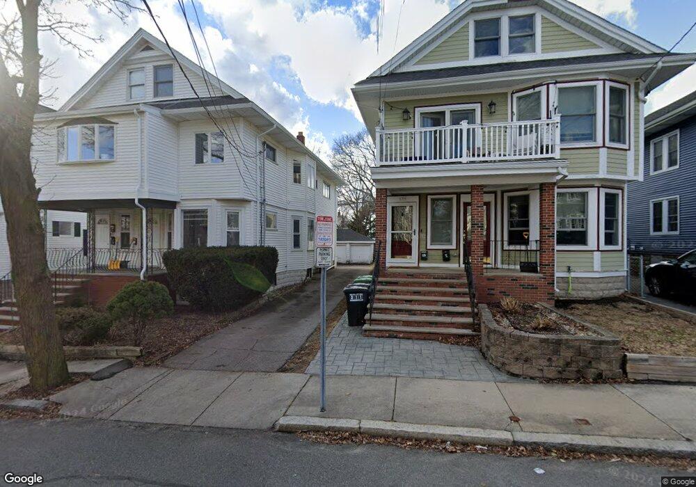
127 W Adams St Somerville, MA 02144
West Somerville NeighborhoodEstimated Value: $1,183,000 - $1,505,596
3
Beds
3
Baths
1,000
Sq Ft
$1,380/Sq Ft
Est. Value
About This Home
Located in the Tufts area of Somerville. 3 bedroom on the 1st floor of a 3-family with 2 parking spots included. Coin operated laundry is on site. (Reference #179281)
Ownership History
Date
Name
Owned For
Owner Type
Purchase Details
Closed on
Jul 25, 1990
Sold by
Durham Bruce
Bought by
Kamio Michael Y
Current Estimated Value
Home Financials for this Owner
Home Financials are based on the most recent Mortgage that was taken out on this home.
Original Mortgage
$184,000
Interest Rate
10.01%
Mortgage Type
Purchase Money Mortgage
Create a Home Valuation Report for This Property
The Home Valuation Report is an in-depth analysis detailing your home's value as well as a comparison with similar homes in the area
Home Values in the Area
Average Home Value in this Area
Purchase History
| Date | Buyer | Sale Price | Title Company |
|---|---|---|---|
| Kamio Michael Y | $230,000 | -- |
Source: Public Records
Mortgage History
| Date | Status | Borrower | Loan Amount |
|---|---|---|---|
| Open | Kamio Michael Y | $385,000 | |
| Closed | Kamio Michael Y | $184,000 |
Source: Public Records
Property History
| Date | Event | Price | List to Sale | Price per Sq Ft |
|---|---|---|---|---|
| 10/08/2024 10/08/24 | Off Market | $3,000 | -- | -- |
| 09/01/2024 09/01/24 | For Rent | $3,000 | -- | -- |
Tax History Compared to Growth
Tax History
| Year | Tax Paid | Tax Assessment Tax Assessment Total Assessment is a certain percentage of the fair market value that is determined by local assessors to be the total taxable value of land and additions on the property. | Land | Improvement |
|---|---|---|---|---|
| 2025 | $12,799 | $1,173,100 | $613,700 | $559,400 |
| 2024 | $12,038 | $1,144,300 | $613,700 | $530,600 |
| 2023 | $11,743 | $1,135,700 | $613,700 | $522,000 |
| 2022 | $10,824 | $1,063,300 | $584,400 | $478,900 |
| 2021 | $10,528 | $1,033,200 | $580,200 | $453,000 |
| 2020 | $10,342 | $1,025,000 | $580,600 | $444,400 |
| 2019 | $9,696 | $901,100 | $528,500 | $372,600 |
| 2018 | $9,283 | $820,800 | $480,500 | $340,300 |
| 2017 | $8,936 | $765,700 | $453,300 | $312,400 |
| 2016 | $9,183 | $732,900 | $404,700 | $328,200 |
| 2015 | $8,782 | $696,400 | $373,800 | $322,600 |
Source: Public Records
Map
Nearby Homes
- 16 High St Unit 2
- 21 High St
- 33 Conwell Ave
- 235 Powder House Blvd
- 9 Woods Ave
- 31 Fairfax St
- 327 Alewife Brook Pkwy Unit A
- 202 Powder House Blvd Unit 2
- 6 Hamilton Rd Unit 6
- 44 Woods Ave Unit 44
- 69 Sterling St
- 34 Belknap St
- 16 Hamilton Rd
- 11 Watson St Unit 1
- 11 Watson St Unit 2
- 395 Alewife Brook Pkwy Unit 2C
- 395 Alewife Brook Pkwy Unit PH E
- 12 Arizona Terrace Unit 2
- 55 Packard Ave Unit 1
- 57 Garrison Ave
- 127 W Adams St
- 127 W Adams St Unit 1
- 8 Bailey St
- 6 Bailey St
- 12 Bailey St
- 12 Bailey St
- 12 Bailey St Unit 2
- 14 Bailey St
- 23 College Hill Rd
- 123 W Adams St
- 125 W Adams St Unit 2
- 131 W Adams St Unit 2
- 131 W Adams St
- 131 W Adams St Unit 131
- 133 W Adams St Unit 133
- 16 Bailey St Unit 2
- 16 Bailey St
- 16 Bailey St
- 119 W Adams St
- 119 W Adams St Unit 119