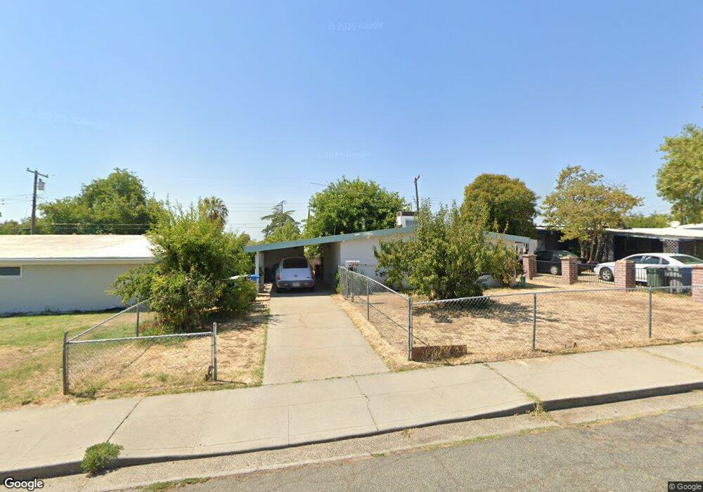
127 Worthy Ave Oroville, CA 95965
Estimated Value: $226,805 - $255,000
3
Beds
1
Bath
1,029
Sq Ft
$230/Sq Ft
Est. Value
About This Home
This home is located at 127 Worthy Ave, Oroville, CA 95965 and is currently estimated at $236,201, approximately $229 per square foot. 127 Worthy Ave is a home located in Butte County with nearby schools including Sierra Avenue Elementary School, Nelson Avenue Middle School, and Oroville High School.
Ownership History
Date
Name
Owned For
Owner Type
Purchase Details
Closed on
Oct 3, 2017
Sold by
Grogan William C
Bought by
Grogan William C and Willam C Grogan Revocable Trust
Current Estimated Value
Purchase Details
Closed on
Nov 28, 2000
Sold by
Brown Marijane
Bought by
Grogan William C
Home Financials for this Owner
Home Financials are based on the most recent Mortgage that was taken out on this home.
Original Mortgage
$55,215
Outstanding Balance
$20,289
Interest Rate
7.66%
Mortgage Type
FHA
Estimated Equity
$215,912
Create a Home Valuation Report for This Property
The Home Valuation Report is an in-depth analysis detailing your home's value as well as a comparison with similar homes in the area
Home Values in the Area
Average Home Value in this Area
Purchase History
| Date | Buyer | Sale Price | Title Company |
|---|---|---|---|
| Grogan William C | -- | None Available | |
| Grogan William C | $67,500 | Mid Valley Title & Escrow Co |
Source: Public Records
Mortgage History
| Date | Status | Borrower | Loan Amount |
|---|---|---|---|
| Open | Grogan William C | $55,215 | |
| Closed | Grogan William C | $16,875 |
Source: Public Records
Tax History Compared to Growth
Tax History
| Year | Tax Paid | Tax Assessment Tax Assessment Total Assessment is a certain percentage of the fair market value that is determined by local assessors to be the total taxable value of land and additions on the property. | Land | Improvement |
|---|---|---|---|---|
| 2025 | $1,672 | $101,685 | $27,109 | $74,576 |
| 2024 | $1,672 | $99,692 | $26,578 | $73,114 |
| 2023 | $1,618 | $97,738 | $26,057 | $71,681 |
| 2022 | $1,534 | $95,823 | $25,547 | $70,276 |
| 2021 | $1,499 | $93,946 | $25,047 | $68,899 |
| 2020 | $1,446 | $92,984 | $24,791 | $68,193 |
| 2019 | $1,431 | $91,161 | $24,305 | $66,856 |
| 2018 | $1,369 | $89,375 | $23,829 | $65,546 |
| 2017 | $1,334 | $87,623 | $23,362 | $64,261 |
| 2016 | $1,318 | $85,905 | $22,904 | $63,001 |
| 2015 | $1,256 | $84,615 | $22,560 | $62,055 |
| 2014 | $1,211 | $82,959 | $22,119 | $60,840 |
Source: Public Records
Map
Nearby Homes
- 135 Morningstar Ave
- 4 La Palma Dr
- 0 Grand Ave
- 60 La Cresenta Dr
- 0 Nelson Ave Unit OR25168133
- 0 Cherokee Rd Unit PA24106650
- 59 Flying Cloud Dr
- 0 Mono Ave
- 77 Paula Ct
- 55 Grand Ave
- 82 Nelson Ave
- 0 Paula Ct Unit OR25099943
- 70 Grand Ave
- 0 Oroview Dr Unit 225096018
- 1401 Norton St
- 2255 Bird St
- 2175 Robinson St
- 1685 Washington Ave
- 1240 Long Bar Rd
- 1220 Long Bar Rd
- 131 Worthy Ave
- 123 Worthy Ave
- 126 Morningstar Ave
- 119 Worthy Ave
- 135 Worthy Ave
- 130 Morningstar Ave
- 122 Morningstar Ave
- 126 Worthy Ave
- 122 Worthy Ave
- 130 Worthy Ave
- 134 Morningstar Ave
- 139 Worthy Ave
- 115 Worthy Ave
- 118 Worthy Ave
- 134 Worthy Ave
- 114 Morningstar Ave
- 138 Worthy Ave
- 114 Worthy Ave
- 111 Worthy Ave
- 110 Morningstar Ave