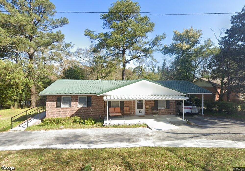
1270 Davis St E Macon, GA 31211
Estimated Value: $81,000 - $126,000
3
Beds
2
Baths
1,075
Sq Ft
$97/Sq Ft
Est. Value
About This Home
This home is located at 1270 Davis St E, Macon, GA 31211 and is currently estimated at $104,374, approximately $97 per square foot. 1270 Davis St E is a home located in Bibb County with nearby schools including Burdell Elementary School, Appling Middle School, and Northeast High School.
Ownership History
Date
Name
Owned For
Owner Type
Purchase Details
Closed on
Mar 13, 2024
Sold by
Booker Gwendolyn S
Bought by
Booker Lewis Natalie and Booke Williams Megan
Current Estimated Value
Purchase Details
Closed on
Sep 14, 2015
Sold by
Booker Gwendolyn Stroud
Bought by
Booker Gwendolyn Stroud
Purchase Details
Closed on
Nov 4, 2009
Sold by
Booker Gwendolyn Stroud
Bought by
Booker William Decker
Create a Home Valuation Report for This Property
The Home Valuation Report is an in-depth analysis detailing your home's value as well as a comparison with similar homes in the area
Purchase History
| Date | Buyer | Sale Price | Title Company |
|---|---|---|---|
| Booker Lewis Natalie | -- | None Listed On Document | |
| Booker Gwendolyn Stroud | $54,400 | Attorney | |
| Booker William Decker | -- | None Available |
Source: Public Records
Tax History
| Year | Tax Paid | Tax Assessment Tax Assessment Total Assessment is a certain percentage of the fair market value that is determined by local assessors to be the total taxable value of land and additions on the property. | Land | Improvement |
|---|---|---|---|---|
| 2025 | $752 | $30,603 | $6,000 | $24,603 |
| 2024 | $777 | $30,603 | $6,000 | $24,603 |
| 2023 | $0 | $30,603 | $6,000 | $24,603 |
| 2022 | $855 | $22,496 | $3,206 | $19,290 |
| 2021 | $855 | $22,496 | $3,206 | $19,290 |
| 2020 | $899 | $22,496 | $3,206 | $19,290 |
| 2019 | $733 | $22,496 | $3,206 | $19,290 |
| 2018 | $120 | $22,496 | $3,206 | $19,290 |
| 2017 | $0 | $22,496 | $3,206 | $19,290 |
| 2016 | $778 | $22,496 | $3,206 | $19,290 |
| 2015 | -- | $21,797 | $3,206 | $18,591 |
| 2014 | -- | $21,797 | $3,206 | $18,591 |
Source: Public Records
Map
Nearby Homes
- 1174 Davis St E
- 1154 Davis Cir
- 1036 Clay Ave
- 1020 Clay Ave
- 1006 Clay Ave Unit 1008,1020,1022
- 980 Curry Place
- 1049 Boulevard
- 965 North Ave
- 1392 Fort Hill St
- 990 Center St
- 970 Center St
- 1059 Fort Hill St
- 784 North Ave
- 722 Mitchell St
- 856 Center St
- 940 Curry Dr
- 378 Cowan St
- 390 Cowan St
- 1158 Jackson Springs Rd
- 751 Mitchell St
- 1278 Davis St E
- 1288 Davis St E
- 1258 Davis St E
- 1490 Clinton Rd
- 1255 Boulevard Terrace
- 1260 Clinton Rd
- 1249 Highland Ave
- 1186 Davis St E
- 1260 Highland Ave
- 1131 Davis Cir
- 1153 Davis Cir
- 1226 Clinton Rd
- 1235 Highland Ave
- 1159 Davis Cir
- 1510 Clinton Rd
- 1246 Highland Ave
- 1236 Highland Ave
- 1160 Davis Cir
- 1141 Clinton Rd
- 1952 Clinton Rd
Your Personal Tour Guide
Ask me questions while you tour the home.