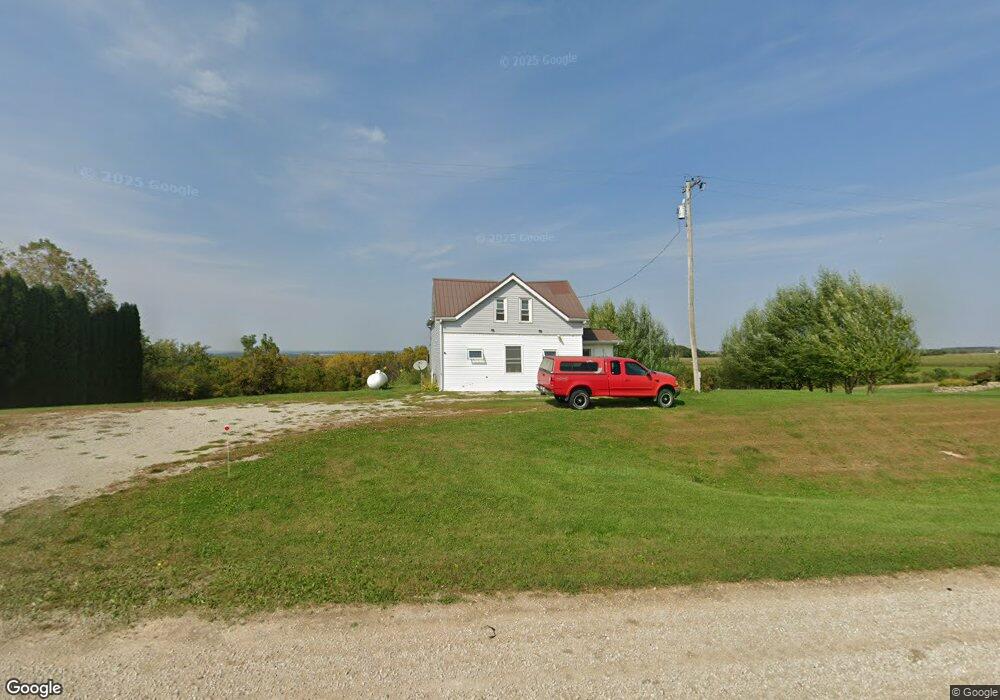
1270 Highway 9 Lansing, IA 52151
Estimated Value: $165,000 - $257,000
2
Beds
4
Baths
1,266
Sq Ft
$152/Sq Ft
Est. Value
About This Home
This home is located at 1270 Highway 9, Lansing, IA 52151 and is currently estimated at $192,619, approximately $152 per square foot. 1270 Highway 9 is a home located in Allamakee County with nearby schools including West Campus Elementary School, East Campus Elementary School, and Waukon Middle School.
Ownership History
Date
Name
Owned For
Owner Type
Purchase Details
Closed on
Mar 5, 2024
Sold by
Srf Properties Llc
Bought by
Schellhammer Larry L and Schellhammer Cindy S
Current Estimated Value
Purchase Details
Closed on
May 15, 2020
Sold by
Brink Jason C
Bought by
Waddell Makeniza
Home Financials for this Owner
Home Financials are based on the most recent Mortgage that was taken out on this home.
Original Mortgage
$97,500
Interest Rate
3.3%
Mortgage Type
Construction
Create a Home Valuation Report for This Property
The Home Valuation Report is an in-depth analysis detailing your home's value as well as a comparison with similar homes in the area
Home Values in the Area
Average Home Value in this Area
Purchase History
| Date | Buyer | Sale Price | Title Company |
|---|---|---|---|
| Schellhammer Larry L | -- | None Listed On Document | |
| Waddell Makeniza | $98,000 | None Available |
Source: Public Records
Mortgage History
| Date | Status | Borrower | Loan Amount |
|---|---|---|---|
| Previous Owner | Waddell Makeniza | $97,500 |
Source: Public Records
Tax History Compared to Growth
Tax History
| Year | Tax Paid | Tax Assessment Tax Assessment Total Assessment is a certain percentage of the fair market value that is determined by local assessors to be the total taxable value of land and additions on the property. | Land | Improvement |
|---|---|---|---|---|
| 2025 | $1,436 | $136,200 | $41,700 | $94,500 |
| 2024 | $1,436 | $124,200 | $41,700 | $82,500 |
| 2023 | $1,370 | $124,400 | $41,700 | $82,700 |
| 2022 | $1,024 | $84,800 | $31,200 | $53,600 |
| 2021 | $974 | $84,800 | $31,200 | $53,600 |
| 2020 | $974 | $76,900 | $28,400 | $48,500 |
| 2019 | $776 | $72,300 | $0 | $0 |
| 2018 | $756 | $72,300 | $0 | $0 |
| 2017 | $756 | $65,900 | $0 | $0 |
| 2016 | $676 | $65,900 | $0 | $0 |
| 2015 | $676 | $65,900 | $0 | $0 |
| 2014 | $668 | $65,900 | $0 | $0 |
Source: Public Records
Map
Nearby Homes
- 1464 Iowa 9
- 1511 Scenic Valley Rd
- 000 Tbd Lycurgus Rd
- 2307 Mays Prairie Rd
- 2162 Lycurgus Rd
- 1862 Village Creek Dr
- 210 Northgate Ave NW
- 821 4th St NW
- 820 4th St NW
- 933 Iowa River Dr
- 602 2nd St NW
- 1930 Hideaway Hills Ln Unit 29
- 0 Parcel Id#1031351007 Unit 20211899
- 0 Parcel Id#1506100051 Unit 20211897
- 0 Parcel Id#1031376012 Unit 20211905
- 0 Parcel Id#1031376013 Unit 20211902
- 0 Parcel Id#1031351004 Unit 20211906
- 0 Parcel Id#1031376005 Unit 20211907
- 0 Parcel Id#1031351006 Unit 20211900
- 525 4th St SE
- 1274 Highway 9
- 1287 Highway 9
- 1911 Hawk View Rd
- 1903 Hawk View Rd
- 1231 Highway 9
- 1939 Hawk View Rd
- 1315 Highway 9
- 1829 Hilltop Rd
- 1818 Village Creek Rd
- 1822 Village Creek Rd
- 1909 Bluebell Rd
- 1911 Gun Tower Rd
- 1866 Bluebell Rd
- 1807 Village Creek Rd
- 1186 Highway 9
- 1248 Kedary Ridge Dr
- 1182 Highway 9
- 1949 Gun Tower Rd
- 1176 Highway 9
- 1172 Highway 9