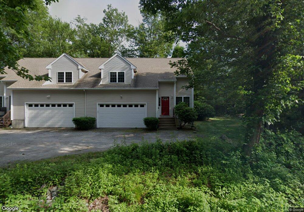
1270 Saugatucket Rd Wakefield, RI 02879
Estimated Value: $454,000 - $502,000
3
Beds
2
Baths
1,248
Sq Ft
$378/Sq Ft
Est. Value
About This Home
This home is located at 1270 Saugatucket Rd, Wakefield, RI 02879 and is currently estimated at $471,983, approximately $378 per square foot. 1270 Saugatucket Rd is a home located in Washington County with nearby schools including South Kingstown High School, The Compass School, and South Shore School.
Ownership History
Date
Name
Owned For
Owner Type
Purchase Details
Closed on
Oct 10, 2013
Sold by
Moster Mark L and Moster Marlene R
Bought by
Sheehan David J and Sheehan Susan L
Current Estimated Value
Home Financials for this Owner
Home Financials are based on the most recent Mortgage that was taken out on this home.
Original Mortgage
$153,750
Outstanding Balance
$40,626
Interest Rate
4.53%
Estimated Equity
$431,357
Purchase Details
Closed on
Aug 15, 2007
Sold by
Corpenna Dev Grp Llc
Bought by
Moster Mark L and Moster Marlene R
Home Financials for this Owner
Home Financials are based on the most recent Mortgage that was taken out on this home.
Original Mortgage
$232,000
Interest Rate
6.67%
Mortgage Type
Purchase Money Mortgage
Create a Home Valuation Report for This Property
The Home Valuation Report is an in-depth analysis detailing your home's value as well as a comparison with similar homes in the area
Home Values in the Area
Average Home Value in this Area
Purchase History
| Date | Buyer | Sale Price | Title Company |
|---|---|---|---|
| Sheehan David J | $205,000 | -- | |
| Moster Mark L | $290,000 | -- |
Source: Public Records
Mortgage History
| Date | Status | Borrower | Loan Amount |
|---|---|---|---|
| Open | Moster Mark L | $153,750 | |
| Previous Owner | Moster Mark L | $232,000 |
Source: Public Records
Tax History Compared to Growth
Tax History
| Year | Tax Paid | Tax Assessment Tax Assessment Total Assessment is a certain percentage of the fair market value that is determined by local assessors to be the total taxable value of land and additions on the property. | Land | Improvement |
|---|---|---|---|---|
| 2025 | $3,354 | $375,200 | $0 | $375,200 |
| 2024 | $3,361 | $304,200 | $0 | $304,200 |
| 2023 | $3,361 | $304,200 | $0 | $304,200 |
| 2022 | $3,331 | $304,200 | $0 | $304,200 |
| 2021 | $3,711 | $256,800 | $0 | $256,800 |
| 2020 | $3,711 | $256,800 | $0 | $256,800 |
| 2019 | $3,711 | $256,800 | $0 | $256,800 |
| 2018 | $4,163 | $265,500 | $0 | $265,500 |
| 2017 | $4,065 | $265,500 | $0 | $265,500 |
| 2016 | $4,006 | $265,500 | $0 | $265,500 |
| 2015 | $4,108 | $264,700 | $0 | $264,700 |
| 2014 | $4,098 | $264,700 | $0 | $264,700 |
Source: Public Records
Map
Nearby Homes
- 1810 Kingstown Rd
- 14 Vespia Ln Unit B
- 0 Vespia Dr Unit 1317499
- 42 Vespia Ln
- 50 Vespia Ln
- 54 Vespia Ln
- 58 Vespia Ln
- 53 Rocky Brook Way
- 957 Saugatucket Rd
- 918 Saugatucket Rd
- 228 Rodman St
- 17 Celestial Heights Dr
- 128 North Rd
- 222 Windmill Dr
- 128 Rodman St
- 3 Larkin St
- 23 Conant Ln
- 507 Curtis Corner Rd
- 294 Rose Hill Rd
- 0 South Rd Unit 1400966
- 1270 Saugatucket Rd Unit B
- 1268 Saugatucket Rd
- 1268 Saugatucket Rd Unit A
- 1743 Kingstown Rd
- 6 Curtis Corner Rd
- 1735 Kingstown Rd
- 1744 Kingstown Rd
- 27 Birchwood Dr
- 33 Birchwood Dr
- 29 Birchwood Dr
- 16 Curtis Corner Rd
- 1732 Kingstown Rd
- 1725 Kingstown Rd
- 41 Birchwood Dr
- 23 Birchwood Dr
- 1738 Kingstown Rd
- 1789 Kingstown Rd
- 1724 Kingstown Rd
- 17 Birchwood Dr
- 47 Birchwood Dr