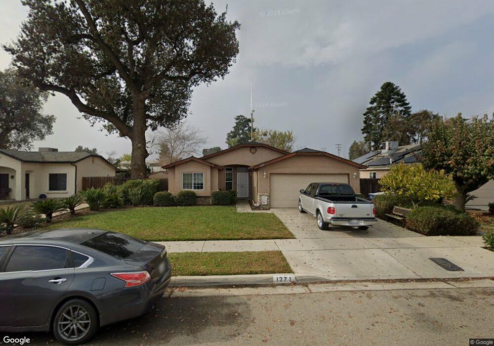
1271 Mathias St Tulare, CA 93274
Tulare Northwest NeighborhoodEstimated Value: $307,000 - $336,000
4
Beds
2
Baths
1,338
Sq Ft
$241/Sq Ft
Est. Value
About This Home
This home is located at 1271 Mathias St, Tulare, CA 93274 and is currently estimated at $322,686, approximately $241 per square foot. 1271 Mathias St is a home located in Tulare County with nearby schools including Heritage Elementary School, Los Tules Middle School, and Tulare Western High School.
Ownership History
Date
Name
Owned For
Owner Type
Purchase Details
Closed on
Jan 14, 2002
Sold by
Ennis Homes Inc
Bought by
Carrasco Henry and Carrasco Andrea
Current Estimated Value
Home Financials for this Owner
Home Financials are based on the most recent Mortgage that was taken out on this home.
Original Mortgage
$113,677
Interest Rate
6.78%
Mortgage Type
FHA
Create a Home Valuation Report for This Property
The Home Valuation Report is an in-depth analysis detailing your home's value as well as a comparison with similar homes in the area
Home Values in the Area
Average Home Value in this Area
Purchase History
| Date | Buyer | Sale Price | Title Company |
|---|---|---|---|
| Carrasco Henry | $115,500 | Chicago Title Co |
Source: Public Records
Mortgage History
| Date | Status | Borrower | Loan Amount |
|---|---|---|---|
| Previous Owner | Carrasco Henry | $113,677 |
Source: Public Records
Tax History
| Year | Tax Paid | Tax Assessment Tax Assessment Total Assessment is a certain percentage of the fair market value that is determined by local assessors to be the total taxable value of land and additions on the property. | Land | Improvement |
|---|---|---|---|---|
| 2025 | $1,771 | $169,893 | $36,932 | $132,961 |
| 2024 | $1,771 | $166,562 | $36,208 | $130,354 |
| 2023 | $1,725 | $163,298 | $35,499 | $127,799 |
| 2022 | $1,673 | $160,097 | $34,803 | $125,294 |
| 2021 | $1,650 | $156,958 | $34,121 | $122,837 |
| 2020 | $1,677 | $155,348 | $33,771 | $121,577 |
| 2019 | $1,718 | $152,302 | $33,109 | $119,193 |
| 2018 | $1,688 | $149,316 | $32,460 | $116,856 |
| 2017 | $1,671 | $146,389 | $31,824 | $114,565 |
| 2016 | $1,596 | $143,519 | $31,200 | $112,319 |
| 2015 | $1,521 | $141,363 | $30,731 | $110,632 |
| 2014 | $1,521 | $137,000 | $34,000 | $103,000 |
Source: Public Records
Map
Nearby Homes
- 2622 W Prosperity Ave
- 1695 Cochran Ave
- 2157 Country View Ave
- 1440 Cottage Grove Ave
- 1924 Scarlet Oak Ct Unit 16 Wo
- 1983 Scarlet Oak Ct Unit 19 Wo
- 1971 Scarlet Oak Ct Unit 20 Wo
- 1919 Oak Falls Ct Unit 11 Wo
- 653 Alpha St
- 1400 W Oakland Ave
- 1521 W Juliet Ave
- 501 Alpha St
- 150-O Blue Ridge St
- 151-O Blue Ridge St
- 1922 Oak Falls Ct Unit 5 Wo
- 1982 Oak Falls Ct Unit 1 Wo
- 1975 Oak Falls Ct Unit 8 Wo
- 1969 Oak Falls Ct Unit 9 Wo
- 1989 Oak Falls Ct Unit 7 Wo
- 920 Maricopa St
- 1257 Mathias St
- 1295 Mathias St
- 1233 Mathias St
- 2187 W Prosperity Ave
- 2110 Bering Ct
- 2113 Bering Ct
- 2154 Berryhill Ave
- 2120 Berryhill Ave
- 2088 Bering Ct
- 2091 Bering Ct
- 2180 Berryhill Ave
- 2207 W Prosperity Ave
- 2073 Bering Ct
- 2064 Bering Ct
- 2094 Berryhill Ave
- 2100 Berryhill Ave
- 1217 La Dawna St
- 2160 W Prosperity Ave
- 2068 Berryhill Ave
- 2057 Bering Ct
Your Personal Tour Guide
Ask me questions while you tour the home.