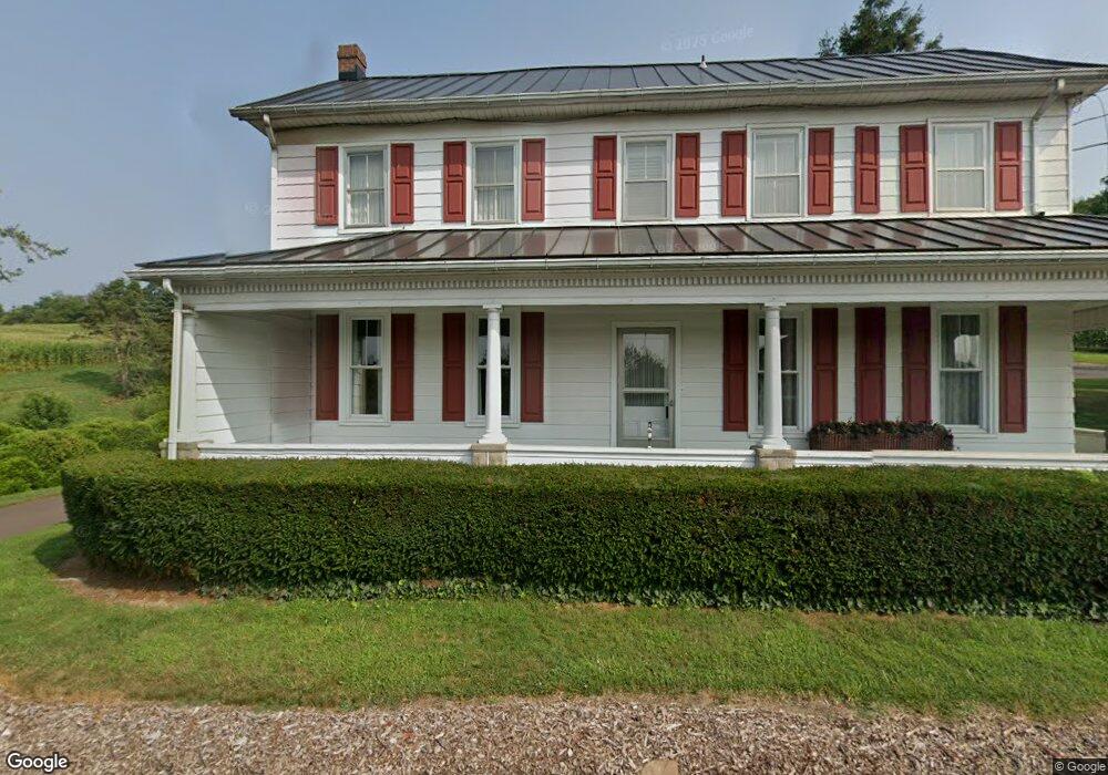
1271 State Route 93 Berwick, PA 18603
Estimated Value: $111,000 - $489,000
--
Bed
--
Bath
2,780
Sq Ft
$116/Sq Ft
Est. Value
About This Home
This home is located at 1271 State Route 93, Berwick, PA 18603 and is currently estimated at $322,662, approximately $116 per square foot. 1271 State Route 93 is a home located in Columbia County with nearby schools including Central Columbia Elementary School, Central Columbia Middle School, and Central Columbia Senior High School.
Ownership History
Date
Name
Owned For
Owner Type
Purchase Details
Closed on
Aug 26, 2010
Sold by
Yost Jack C and Yost Dorothy Lea
Bought by
The Jack C & Dorothy Lea Yost Revocable
Current Estimated Value
Purchase Details
Closed on
Apr 28, 2010
Sold by
Yost Jack C and Yost Dorothy Lea
Bought by
The Jack C & Dorothy Lea Yost Revocable
Create a Home Valuation Report for This Property
The Home Valuation Report is an in-depth analysis detailing your home's value as well as a comparison with similar homes in the area
Home Values in the Area
Average Home Value in this Area
Purchase History
| Date | Buyer | Sale Price | Title Company |
|---|---|---|---|
| The Jack C & Dorothy Lea Yost Revocable | $358 | None Available | |
| The Jack C & Dorothy Lea Yost Revocable | -- | None Available | |
| The Jack C & Dorothy Lea Yost Revocable | $4,856 | None Available | |
| The Jack C & Dorothy Lea Yost Revocable | $620 | None Available |
Source: Public Records
Tax History Compared to Growth
Tax History
| Year | Tax Paid | Tax Assessment Tax Assessment Total Assessment is a certain percentage of the fair market value that is determined by local assessors to be the total taxable value of land and additions on the property. | Land | Improvement |
|---|---|---|---|---|
| 2025 | $4,375 | $59,830 | $0 | $0 |
| 2024 | $4,272 | $59,830 | $34,173 | $25,657 |
| 2023 | $4,093 | $59,830 | $34,173 | $25,657 |
| 2022 | $2,465 | $59,830 | $34,173 | $25,657 |
| 2021 | $2,465 | $59,830 | $34,173 | $25,657 |
| 2020 | $2,386 | $59,830 | $34,173 | $25,657 |
| 2019 | $2,340 | $59,830 | $34,173 | $25,657 |
| 2018 | $2,340 | $59,830 | $34,173 | $25,657 |
| 2017 | $2,303 | $59,830 | $34,173 | $25,657 |
| 2016 | -- | $59,830 | $34,173 | $25,657 |
| 2015 | -- | $59,830 | $34,173 | $25,657 |
| 2014 | -- | $59,830 | $34,173 | $25,657 |
Source: Public Records
Map
Nearby Homes
- 4 Nursery Rd
- LOT 10 Lake Rd
- LOT 6 Highland Garden Dr
- LOT 11 Highland Garden Dr
- LOT 1 Highland Garden Dr
- LOT 4 Highland Garden Dr
- LOT 10 Highland Garden Dr
- LOT 2 Highland Garden Dr
- LOT 3 Highland Garden Dr
- LOT 7 Highland Garden Dr
- LOT 8 Highland Garden Dr
- LOT 5 Highland Garden Dr
- LOT 9 Highland Garden Dr
- 467 Mountain Rd
- 45 Amron Dr
- 7270 School House Rd
- 0 Columbia Blvd Unit 20-98472
- 0 Columbia Blvd Unit 20-94407
- 7035 Scenic Dr
- 6970 Scenic Dr
- 1244 State Route 93
- 1240 State Route 93
- 31 Dennis Mill Rd
- 1249 State Route 93
- 36 Dennis Mill Rd
- 1227 State Route 93
- 18 Dennis Mill Rd
- 1096 Fowlersville Rd Extension
- 1213 State Route 93
- 57 Dennis Mill Rd
- 1091 Fowlersville Rd Extension
- 84 Edwards Rd
- 1090 Fowlersville Rd Extension
- 1211 State Route 93
- 142 Slowick Rd
- 126 Slowick Rd
- 145 Slowick Rd
- 1197 State Route 93
- 133 Slowick Rd
- 118 Slowick Rd