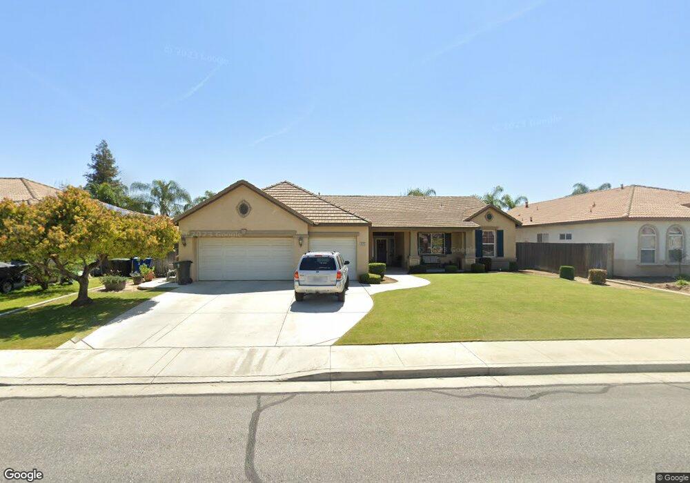
12715 Monterey Beach Dr Unit 2 Bakersfield, CA 93311
River Oaks NeighborhoodEstimated Value: $591,000 - $667,000
3
Beds
2
Baths
2,979
Sq Ft
$213/Sq Ft
Est. Value
About This Home
This home is located at 12715 Monterey Beach Dr Unit 2, Bakersfield, CA 93311 and is currently estimated at $633,743, approximately $212 per square foot. 12715 Monterey Beach Dr Unit 2 is a home located in Kern County with nearby schools including Ronald Reagan Elementary School, Earl Warren Junior High School, and Stockdale High School.
Ownership History
Date
Name
Owned For
Owner Type
Purchase Details
Closed on
Aug 5, 2004
Sold by
Smith James P
Bought by
Dong Christopher
Current Estimated Value
Home Financials for this Owner
Home Financials are based on the most recent Mortgage that was taken out on this home.
Original Mortgage
$419,500
Outstanding Balance
$208,025
Interest Rate
6%
Mortgage Type
Purchase Money Mortgage
Estimated Equity
$425,718
Purchase Details
Closed on
Apr 28, 2004
Sold by
Lennar Bakersfield Inc
Bought by
Smith James P
Home Financials for this Owner
Home Financials are based on the most recent Mortgage that was taken out on this home.
Original Mortgage
$229,800
Interest Rate
5.62%
Mortgage Type
Purchase Money Mortgage
Purchase Details
Closed on
Apr 26, 2003
Sold by
Communities At River Oaks Llc
Bought by
Lennar Bakersfield Inc
Create a Home Valuation Report for This Property
The Home Valuation Report is an in-depth analysis detailing your home's value as well as a comparison with similar homes in the area
Home Values in the Area
Average Home Value in this Area
Purchase History
| Date | Buyer | Sale Price | Title Company |
|---|---|---|---|
| Dong Christopher | $419,500 | Chicago Title | |
| Smith James P | $288,500 | Chicago Title | |
| Lennar Bakersfield Inc | -- | First American Title |
Source: Public Records
Mortgage History
| Date | Status | Borrower | Loan Amount |
|---|---|---|---|
| Open | Dong Christopher | $419,500 | |
| Previous Owner | Smith James P | $229,800 | |
| Closed | Smith James P | $43,250 |
Source: Public Records
Tax History Compared to Growth
Tax History
| Year | Tax Paid | Tax Assessment Tax Assessment Total Assessment is a certain percentage of the fair market value that is determined by local assessors to be the total taxable value of land and additions on the property. | Land | Improvement |
|---|---|---|---|---|
| 2025 | $7,677 | $584,727 | $118,474 | $466,253 |
| 2024 | $7,583 | $573,262 | $116,151 | $457,111 |
| 2023 | $7,583 | $562,023 | $113,874 | $448,149 |
| 2022 | $6,205 | $460,000 | $115,000 | $345,000 |
| 2021 | $5,924 | $440,000 | $110,000 | $330,000 |
| 2020 | $5,491 | $406,000 | $102,000 | $304,000 |
| 2019 | $5,701 | $395,000 | $99,000 | $296,000 |
| 2018 | $5,523 | $393,000 | $98,000 | $295,000 |
| 2017 | $5,444 | $380,000 | $95,000 | $285,000 |
| 2016 | $5,269 | $388,000 | $97,000 | $291,000 |
| 2015 | $5,327 | $390,000 | $98,000 | $292,000 |
| 2014 | $5,293 | $390,000 | $98,000 | $292,000 |
Source: Public Records
Map
Nearby Homes
- 12811 Woodson Bridge Dr
- 1513 Sugarleaf Ridge Dr
- 12411 Riverfront Park Dr
- 12607 Schooner Beach Dr
- 1525 Sugarleaf Ridge Dr
- 12504 Crown Crest Dr
- 12200 White Rapids Way
- 12012 Tulane Park Place
- 13301 Birkenfeld Ave
- 12416 Locksley Dr
- 12001 Bedfordshire Dr
- 12117 Clegg Dr
- 11814 Grecian Laurel Dr
- 11902 Bedfordshire Dr
- 1709 Apsley Ct
- 1214 Deschules Creek Ln
- 11805 Crescent Creek Ct
- 501 Reed St
- 15829 Cole Brook Ct
- 13408 Frenchglen Ave
- 12711 Monterey Beach Dr
- 12719 Monterey Beach Dr
- 12704 Woodson Bridge Dr
- 12708 Woodson Bridge Dr
- 12700 Woodson Bridge Dr
- 12712 Woodson Bridge Dr
- 12707 Monterey Beach Dr Unit 2
- 12723 Monterey Beach Dr
- 12614 Woodson Bridge Dr
- 12714 Monterey Beach Dr Unit 2
- 12710 Monterey Beach Dr
- 12716 Woodson Bridge Dr
- 12718 Monterey Beach Dr Unit 2
- 12706 Monterey Beach Dr Unit 2
- 12610 Woodson Bridge Dr
- 12703 Monterey Beach Dr
- 12801 Monterey Beach Dr
- 12720 Woodson Bridge Dr
- 12800 Monterey Beach Dr Unit 2
- 12702 Monterey Beach Dr